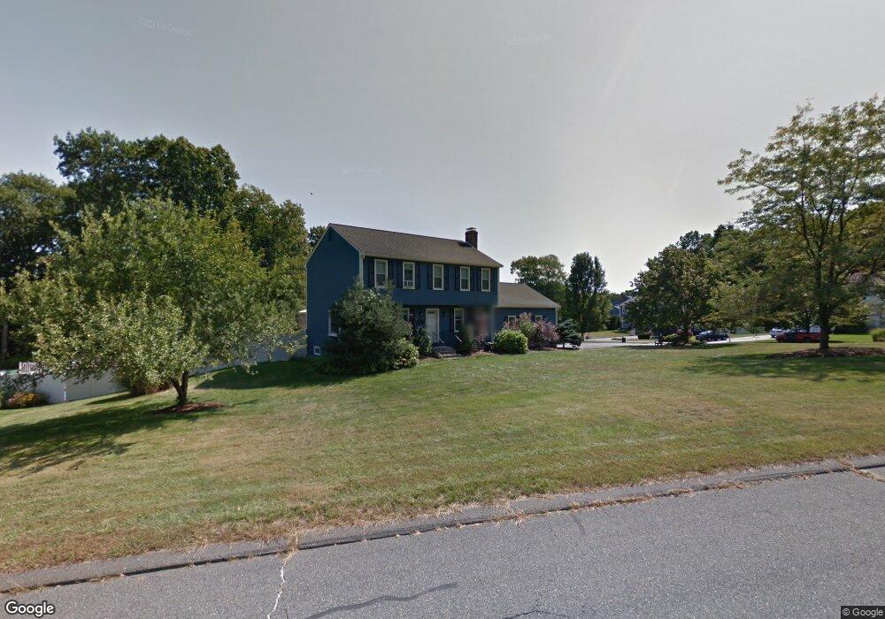
12 Whitney Rd Hopedale, MA 01747
Estimated Value: $623,000 - $754,000
3
Beds
2
Baths
2,200
Sq Ft
$306/Sq Ft
Est. Value
About This Home
This home is located at 12 Whitney Rd, Hopedale, MA 01747 and is currently estimated at $672,692, approximately $305 per square foot. 12 Whitney Rd is a home located in Worcester County with nearby schools including Memorial Elementary School and Hopedale Jr Sr High School.
Ownership History
Date
Name
Owned For
Owner Type
Purchase Details
Closed on
Feb 15, 2002
Sold by
Morris Sean M and Morris Tammy C
Bought by
Whiting Sameul P and Whiting Colleen C
Current Estimated Value
Purchase Details
Closed on
Aug 16, 1999
Sold by
Arsenis Nikolaos A and Arsenis Claudine C
Bought by
Morris Sean M and Morris Tammy C
Purchase Details
Closed on
Apr 29, 1988
Sold by
W G B Constr
Bought by
Arsenis N A
Create a Home Valuation Report for This Property
The Home Valuation Report is an in-depth analysis detailing your home's value as well as a comparison with similar homes in the area
Home Values in the Area
Average Home Value in this Area
Purchase History
| Date | Buyer | Sale Price | Title Company |
|---|---|---|---|
| Whiting Sameul P | $310,100 | -- | |
| Morris Sean M | $229,000 | -- | |
| Arsenis N A | $184,900 | -- |
Source: Public Records
Mortgage History
| Date | Status | Borrower | Loan Amount |
|---|---|---|---|
| Open | Arsenis N A | $50,000 | |
| Open | Arsenis N A | $221,000 |
Source: Public Records
Tax History Compared to Growth
Tax History
| Year | Tax Paid | Tax Assessment Tax Assessment Total Assessment is a certain percentage of the fair market value that is determined by local assessors to be the total taxable value of land and additions on the property. | Land | Improvement |
|---|---|---|---|---|
| 2025 | $9,013 | $542,600 | $208,200 | $334,400 |
| 2024 | $8,591 | $517,500 | $198,200 | $319,300 |
| 2023 | $7,854 | $486,300 | $195,100 | $291,200 |
| 2022 | $7,664 | $447,900 | $178,900 | $269,000 |
| 2021 | $7,346 | $411,100 | $162,600 | $248,500 |
| 2020 | $7,157 | $411,100 | $162,600 | $248,500 |
| 2019 | $2,054 | $385,200 | $162,600 | $222,600 |
| 2018 | $1,961 | $371,800 | $155,000 | $216,800 |
| 2017 | $4,863 | $352,000 | $147,800 | $204,200 |
| 2016 | $5,859 | $348,100 | $147,800 | $200,300 |
| 2015 | $5,435 | $327,800 | $137,800 | $190,000 |
Source: Public Records
Map
Nearby Homes
- 130 Dutcher St
- 15 Tammie Rd
- 8 Union St Unit 8
- 11 Miscoe Rd
- 76 Jones Rd
- 0 West St
- 104 Jones Rd
- 26 Brookview Ln Unit 26
- 8 Country Club Ln Unit B
- 29 Miscoe Rd
- 175 West St
- 14 Country Club Ln Unit C
- 7 Highland St
- 33 Country Club Ln Unit D
- 14 C Country Club Ln
- 106 Adin St
- 59 Lawrence St
- 116 Adin St
- 7 Madden Ave
- 6 Correia Cir Unit B