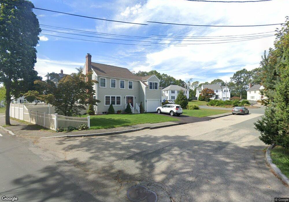
12 Wickford Ln Quincy, MA 02169
Estimated Value: $628,709 - $736,000
3
Beds
1
Bath
1,554
Sq Ft
$441/Sq Ft
Est. Value
About This Home
This home is located at 12 Wickford Ln, Quincy, MA 02169 and is currently estimated at $685,177, approximately $440 per square foot. 12 Wickford Ln is a home located in Norfolk County with nearby schools including South West Middle School, Lincoln-Hancock Community School, and Quincy High School.
Ownership History
Date
Name
Owned For
Owner Type
Purchase Details
Closed on
Apr 28, 2004
Sold by
Vo Khanh O
Bought by
Maderos Matthew B and Lee Maureen E
Current Estimated Value
Home Financials for this Owner
Home Financials are based on the most recent Mortgage that was taken out on this home.
Original Mortgage
$292,000
Interest Rate
5.36%
Mortgage Type
Purchase Money Mortgage
Purchase Details
Closed on
Nov 4, 2002
Sold by
Securities Trend Ltd
Bought by
Abbott Rt
Purchase Details
Closed on
Jul 31, 1996
Sold by
Ab Kahane & Assoc Inc
Bought by
Quinn Timothy J and Quinn Debra A
Home Financials for this Owner
Home Financials are based on the most recent Mortgage that was taken out on this home.
Original Mortgage
$101,350
Interest Rate
8.27%
Mortgage Type
Purchase Money Mortgage
Create a Home Valuation Report for This Property
The Home Valuation Report is an in-depth analysis detailing your home's value as well as a comparison with similar homes in the area
Home Values in the Area
Average Home Value in this Area
Purchase History
| Date | Buyer | Sale Price | Title Company |
|---|---|---|---|
| Maderos Matthew B | $365,000 | -- | |
| Abbott Rt | $141,500 | -- | |
| Quinn Timothy J | $119,350 | -- |
Source: Public Records
Mortgage History
| Date | Status | Borrower | Loan Amount |
|---|---|---|---|
| Open | Quinn Timothy J | $398,912 | |
| Closed | Maderos Matthew B | $292,000 | |
| Previous Owner | Quinn Timothy J | $101,350 | |
| Closed | Quinn Timothy J | $12,000 |
Source: Public Records
Tax History Compared to Growth
Tax History
| Year | Tax Paid | Tax Assessment Tax Assessment Total Assessment is a certain percentage of the fair market value that is determined by local assessors to be the total taxable value of land and additions on the property. | Land | Improvement |
|---|---|---|---|---|
| 2025 | $5,923 | $513,700 | $299,200 | $214,500 |
| 2024 | $5,536 | $491,200 | $285,000 | $206,200 |
| 2023 | $5,191 | $466,400 | $271,400 | $195,000 |
| 2022 | $4,896 | $408,700 | $217,100 | $191,600 |
| 2021 | $4,709 | $387,900 | $217,100 | $170,800 |
| 2020 | $4,725 | $380,100 | $217,100 | $163,000 |
| 2019 | $4,660 | $371,300 | $210,800 | $160,500 |
| 2018 | $4,530 | $339,600 | $195,200 | $144,400 |
| 2017 | $4,529 | $319,600 | $185,900 | $133,700 |
| 2016 | $4,258 | $296,500 | $169,000 | $127,500 |
| 2015 | $4,028 | $275,900 | $159,400 | $116,500 |
| 2014 | $3,932 | $264,600 | $159,400 | $105,200 |
Source: Public Records
Map
Nearby Homes
- 211 West St Unit 12B
- 63 Adele Rd
- 52 Bunker Hill Ln
- 55 Station St Unit 1
- 36 Greystone St Unit 36
- 42 West St
- 57A West St
- 2 Ricciuti Dr Unit 8
- 28 Miller St Unit 8
- 808 Willard St Unit F11
- 72 Centre St Unit J
- 211 Copeland St
- 203 Centre St
- 328 Copeland St Unit 3E
- 57 Buckley St
- 14 Arthur Ave
- 145 Suomi Rd Unit C7
- 21 Arthur St
- 12 Arthur Ave
- 21 Totman St Unit 204
- 6 Wickford Ln
- 227 West St
- 18 Wickford Ln
- 166 Bunker Hill Ln
- 233 West St
- 17 Wickford Ln
- 15 Wickford Ln
- 211 West St Unit 10A
- 211 West St Unit 9B
- 211 West St Unit 8B
- 211 West St Unit 8A
- 211 West St Unit 7B
- 211 West St Unit 7A
- 211 West St Unit 6B
- 211 West St Unit 6A
- 211 West St Unit 5B
- 211 West St Unit 5A
- 211 West St Unit 4B
- 211 West St Unit 4A
- 211 West St Unit 3B