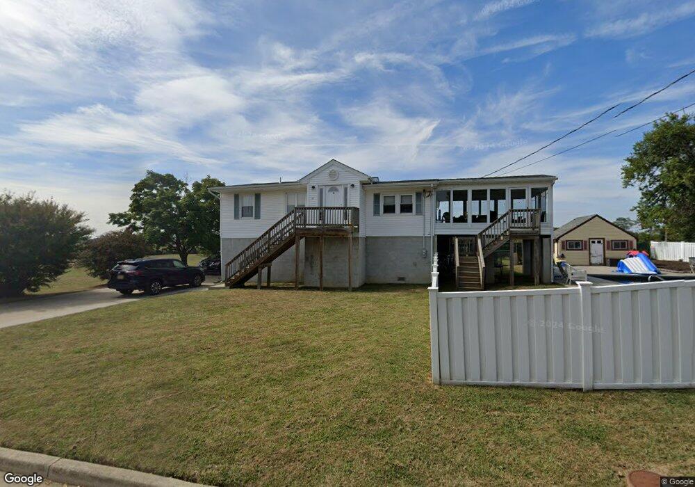
12 Wilson Ave Port Monmouth, NJ 07758
Estimated Value: $504,225 - $546,000
3
Beds
2
Baths
1,146
Sq Ft
$460/Sq Ft
Est. Value
About This Home
This home is located at 12 Wilson Ave, Port Monmouth, NJ 07758 and is currently estimated at $527,056, approximately $459 per square foot. 12 Wilson Ave is a home located in Monmouth County with nearby schools including Port Monmouth Elementary School, Thorne Middle School, and Middletown High School North.
Ownership History
Date
Name
Owned For
Owner Type
Purchase Details
Closed on
Apr 4, 2011
Sold by
Zamrzycki Patricia Ann
Bought by
Simon Michael and Simon Wendy
Current Estimated Value
Home Financials for this Owner
Home Financials are based on the most recent Mortgage that was taken out on this home.
Original Mortgage
$243,662
Outstanding Balance
$173,495
Interest Rate
5.5%
Mortgage Type
FHA
Estimated Equity
$353,561
Create a Home Valuation Report for This Property
The Home Valuation Report is an in-depth analysis detailing your home's value as well as a comparison with similar homes in the area
Home Values in the Area
Average Home Value in this Area
Purchase History
| Date | Buyer | Sale Price | Title Company |
|---|---|---|---|
| Simon Michael | $250,000 | Red Bank Title Agency Inc |
Source: Public Records
Mortgage History
| Date | Status | Borrower | Loan Amount |
|---|---|---|---|
| Open | Simon Michael | $243,662 |
Source: Public Records
Tax History Compared to Growth
Tax History
| Year | Tax Paid | Tax Assessment Tax Assessment Total Assessment is a certain percentage of the fair market value that is determined by local assessors to be the total taxable value of land and additions on the property. | Land | Improvement |
|---|---|---|---|---|
| 2025 | $7,149 | $509,000 | $306,000 | $203,000 |
| 2024 | $6,408 | $434,600 | $235,300 | $199,300 |
| 2023 | $6,408 | $368,700 | $209,300 | $159,400 |
| 2022 | $5,489 | $318,200 | $164,300 | $153,900 |
| 2021 | $5,489 | $263,900 | $135,000 | $128,900 |
| 2020 | $5,052 | $236,300 | $110,300 | $126,000 |
| 2019 | $5,134 | $243,100 | $110,300 | $132,800 |
| 2018 | $4,978 | $229,700 | $103,100 | $126,600 |
| 2017 | $4,691 | $214,300 | $110,300 | $104,000 |
| 2016 | $4,501 | $211,200 | $110,300 | $100,900 |
| 2015 | $4,646 | $210,500 | $110,300 | $100,200 |
| 2014 | $5,180 | $228,900 | $137,300 | $91,600 |
Source: Public Records
Map
Nearby Homes
- 11 Brainard Ave
- 19 Brainard Ave
- 620 Park Ave
- 36 Main St
- 62 Brainard Ave
- 602 Park Ave Unit 7C
- 78 Wilson Ave
- 2 Lydia Place
- 37 Golden Eye Ln
- 36 Golden Eye Ln
- 43 Skimmer Ln
- 19 Walada Ave
- 617 Carter Ave
- 443 Port Monmouth Rd E
- 147 Church St
- 79 Compton St Unit A & B
- 0 Clinton St Unit 22238196
- 92 Compton St
- 35 Willow St
- 0 S End Ave Unit 22420779
- 12 Wilson Ave
- 6 Wilson Ave
- 11 Wilson Ave
- 15 Wilson Ave Unit AH
- 9 Wilson Ave
- 5 Wilson Ave
- 614 Monmouth Ave
- 612 Monmouth Ave
- 616 Monmouth Ave
- 608 Monmouth Ave
- 606 Monmouth Ave
- 618 Monmouth Ave
- 604 Monmouth Ave
- 720 Port Monmouth Rd
- 23 Wilson Ave
- 622 Monmouth Ave
- 0 Wilson Ave
- 611 Monmouth Ave
- 615 Monmouth Ave
- 609 Monmouth Ave