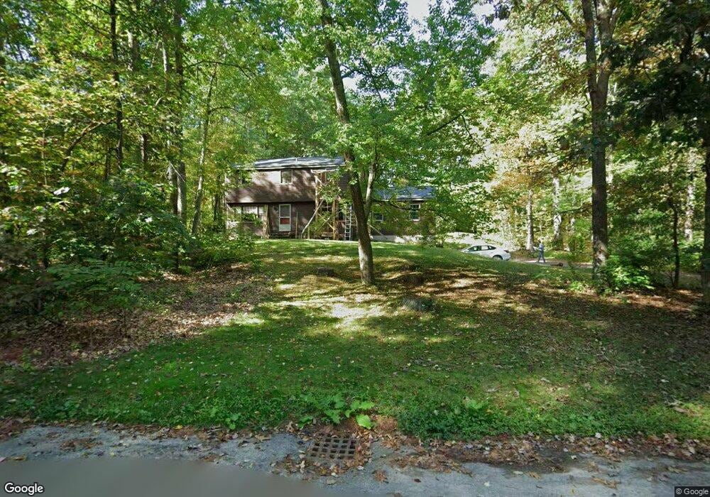
12 Withington Ln Harvard, MA 01451
Estimated Value: $709,999 - $870,000
4
Beds
3
Baths
2,084
Sq Ft
$375/Sq Ft
Est. Value
About This Home
This home is located at 12 Withington Ln, Harvard, MA 01451 and is currently estimated at $781,500, approximately $375 per square foot. 12 Withington Ln is a home located in Worcester County.
Ownership History
Date
Name
Owned For
Owner Type
Purchase Details
Closed on
Jan 11, 2002
Sold by
Linder Axel W and Linder Jeannette
Bought by
Smitha James D and Lawson Victoria A
Current Estimated Value
Home Financials for this Owner
Home Financials are based on the most recent Mortgage that was taken out on this home.
Original Mortgage
$200,000
Interest Rate
7.04%
Mortgage Type
Purchase Money Mortgage
Create a Home Valuation Report for This Property
The Home Valuation Report is an in-depth analysis detailing your home's value as well as a comparison with similar homes in the area
Home Values in the Area
Average Home Value in this Area
Purchase History
| Date | Buyer | Sale Price | Title Company |
|---|---|---|---|
| Smitha James D | $367,500 | -- |
Source: Public Records
Mortgage History
| Date | Status | Borrower | Loan Amount |
|---|---|---|---|
| Open | Smitha James D | $139,500 | |
| Closed | Smitha James D | $195,000 | |
| Closed | Smitha James D | $200,000 |
Source: Public Records
Tax History Compared to Growth
Tax History
| Year | Tax Paid | Tax Assessment Tax Assessment Total Assessment is a certain percentage of the fair market value that is determined by local assessors to be the total taxable value of land and additions on the property. | Land | Improvement |
|---|---|---|---|---|
| 2025 | $8,894 | $568,300 | $243,500 | $324,800 |
| 2024 | $8,538 | $573,000 | $243,500 | $329,500 |
| 2023 | $8,606 | $518,100 | $225,500 | $292,600 |
| 2022 | $8,047 | $449,300 | $210,500 | $238,800 |
| 2021 | $7,921 | $421,800 | $210,500 | $211,300 |
| 2020 | $7,270 | $393,600 | $210,500 | $183,100 |
| 2019 | $6,834 | $392,300 | $210,500 | $181,800 |
| 2018 | $6,464 | $376,900 | $210,500 | $166,400 |
| 2017 | $6,668 | $368,400 | $189,000 | $179,400 |
| 2016 | $6,650 | $368,400 | $189,000 | $179,400 |
| 2015 | $6,943 | $390,300 | $185,100 | $205,200 |
| 2014 | $6,670 | $390,300 | $185,100 | $205,200 |
Source: Public Records
Map
Nearby Homes
- 13 Pine Hill Way
- 14 Pine Hill Way
- 16 A Pine Hill Way Unit 16AA
- 18 B Pine Hill Way Unit BB
- 184 Old Bolton Rd
- 76 Bolton Woods Way
- 90 Corn Rd
- 310 Codman Hill Rd Unit 35D
- 19 Partridge Hill Rd
- 9 Cortland Dr Unit 9
- 1155 Burroughs Rd
- 98 Meadow Rd
- 51 Heather Ln Unit 51
- 28 Mcintosh Dr Unit 22
- 207 Boxboro Rd
- 19 Barton Rd
- 68 Hudson Rd
- 124 Meadow Rd
- 21 Woodside Rd
- 94 Hudson Rd
- 16 Withington Ln
- 10 Withington Ln
- 11 Withington Ln
- 5 Withington Ln
- 8 Withington Ln
- 22 Withington Ln
- 17 Withington Ln
- 6 Withington Ln
- 19 Withington Ln
- 3 Withington Ln
- 24 Withington Ln
- 58 Finn Rd
- 301 Stow Rd
- 23 Withington Ln
- 30 Finn Rd
- 40 Finn Rd
- 303 Stow Rd
- 28 Finn Rd
- 28 Withington Ln
- 26 Withington Ln