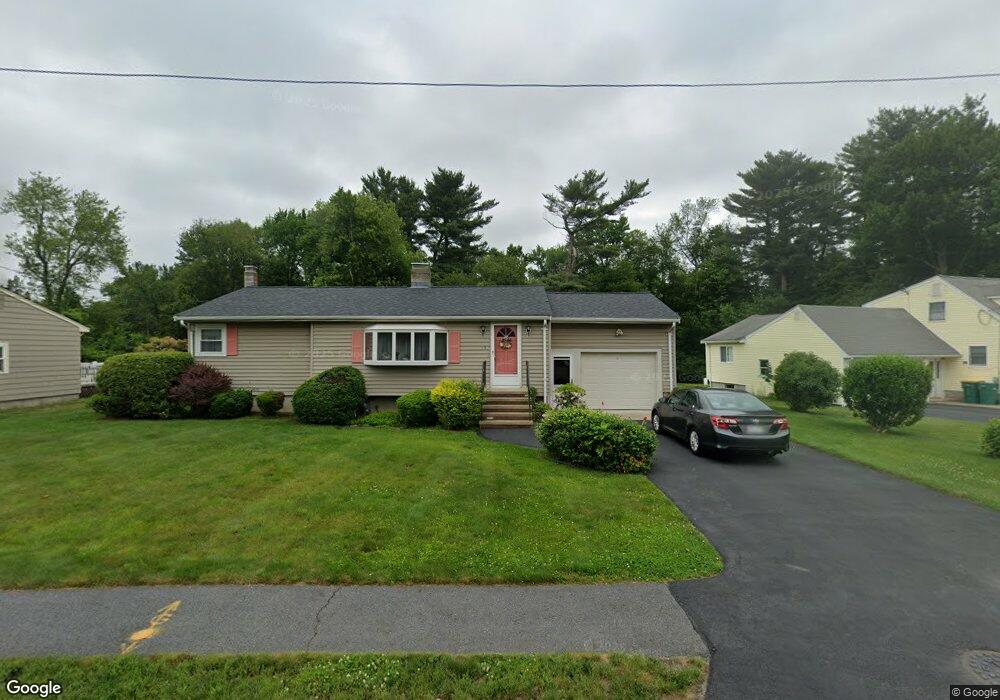
12 Yew Dr Norwood, MA 02062
Estimated Value: $650,070 - $664,000
3
Beds
2
Baths
1,066
Sq Ft
$614/Sq Ft
Est. Value
About This Home
This home is located at 12 Yew Dr, Norwood, MA 02062 and is currently estimated at $655,018, approximately $614 per square foot. 12 Yew Dr is a home located in Norfolk County with nearby schools including Norwood High School, St Catherine Of Siena School, and Norwood Montessori School.
Ownership History
Date
Name
Owned For
Owner Type
Purchase Details
Closed on
Jan 15, 2025
Sold by
Yew Drive Rt and Perednia
Bought by
12 Yew Drive Rt and Perednia
Current Estimated Value
Create a Home Valuation Report for This Property
The Home Valuation Report is an in-depth analysis detailing your home's value as well as a comparison with similar homes in the area
Home Values in the Area
Average Home Value in this Area
Purchase History
| Date | Buyer | Sale Price | Title Company |
|---|---|---|---|
| 12 Yew Drive Rt | -- | None Available |
Source: Public Records
Tax History Compared to Growth
Tax History
| Year | Tax Paid | Tax Assessment Tax Assessment Total Assessment is a certain percentage of the fair market value that is determined by local assessors to be the total taxable value of land and additions on the property. | Land | Improvement |
|---|---|---|---|---|
| 2025 | $6,326 | $601,300 | $348,100 | $253,200 |
| 2024 | $6,435 | $614,600 | $348,100 | $266,500 |
| 2023 | $5,696 | $551,900 | $291,600 | $260,300 |
| 2022 | $5,248 | $488,200 | $255,100 | $233,100 |
| 2021 | $5,044 | $444,800 | $258,000 | $186,800 |
| 2020 | $4,700 | $421,500 | $248,300 | $173,200 |
| 2019 | $4,628 | $425,000 | $241,100 | $183,900 |
| 2018 | $4,326 | $390,100 | $229,600 | $160,500 |
| 2017 | $4,212 | $377,800 | $229,600 | $148,200 |
| 2016 | $3,995 | $359,300 | $229,600 | $129,700 |
| 2015 | $3,914 | $341,200 | $208,700 | $132,500 |
| 2014 | $3,857 | $333,100 | $208,200 | $124,900 |
Source: Public Records
Map
Nearby Homes
- 124 Juniper Dr
- 136 Azalea Dr
- 794 Neponset St
- 816 Neponset St
- 53-55 Whitewood Cir
- 0 Deerfield Rd
- 188 Richland Rd
- 105 E Cross St
- 0 Quail Run
- 558 Pleasant St
- 22 Hillside Ave
- 28 Shaw St
- 49 Railroad Ave
- 301 Neponset St Unit 25
- 301 Neponset St Unit 17
- 19-21
- 1 Lenox St Unit 115
- 1 Lenox St Unit 312
- 909 Washington St Unit 14
- 909 Washington St