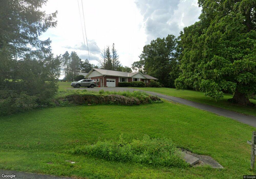
12 Yokun Rd Pittsfield, MA 01201
Estimated Value: $524,000 - $628,000
3
Beds
3
Baths
1,610
Sq Ft
$353/Sq Ft
Est. Value
About This Home
This home is located at 12 Yokun Rd, Pittsfield, MA 01201 and is currently estimated at $569,108, approximately $353 per square foot. 12 Yokun Rd is a home with nearby schools including Richmond Consolidated School.
Ownership History
Date
Name
Owned For
Owner Type
Purchase Details
Closed on
Jul 25, 1991
Sold by
Bartlett Francis A and Bartlett Elizabeth
Bought by
Bartlett Ronald J and Bartlett Cynthia M
Current Estimated Value
Home Financials for this Owner
Home Financials are based on the most recent Mortgage that was taken out on this home.
Original Mortgage
$80,000
Interest Rate
9.58%
Mortgage Type
Purchase Money Mortgage
Create a Home Valuation Report for This Property
The Home Valuation Report is an in-depth analysis detailing your home's value as well as a comparison with similar homes in the area
Home Values in the Area
Average Home Value in this Area
Purchase History
| Date | Buyer | Sale Price | Title Company |
|---|---|---|---|
| Bartlett Ronald J | $150,000 | -- |
Source: Public Records
Mortgage History
| Date | Status | Borrower | Loan Amount |
|---|---|---|---|
| Open | Bartlett Ronald J | $102,000 | |
| Closed | Bartlett Ronald J | $90,000 | |
| Closed | Bartlett Ronald J | $40,000 | |
| Closed | Bartlett Ronald J | $80,000 | |
| Closed | Bartlett Ronald J | $50,000 |
Source: Public Records
Tax History Compared to Growth
Tax History
| Year | Tax Paid | Tax Assessment Tax Assessment Total Assessment is a certain percentage of the fair market value that is determined by local assessors to be the total taxable value of land and additions on the property. | Land | Improvement |
|---|---|---|---|---|
| 2025 | $5,260 | $532,400 | $154,600 | $377,800 |
| 2024 | $5,167 | $531,000 | $148,300 | $382,700 |
| 2023 | $5,363 | $503,100 | $170,100 | $333,000 |
| 2022 | $5,235 | $410,900 | $170,100 | $240,800 |
| 2021 | $4,988 | $392,100 | $170,100 | $222,000 |
| 2020 | $4,615 | $372,800 | $169,900 | $202,900 |
| 2019 | $4,496 | $372,800 | $169,900 | $202,900 |
| 2018 | $4,380 | $372,800 | $169,900 | $202,900 |
| 2016 | $4,276 | $372,800 | $169,900 | $202,900 |
| 2015 | $4,093 | $372,800 | $169,900 | $202,900 |
Source: Public Records
Map
Nearby Homes
- 20 Pine Rd
- 399 State Rd
- 1136 Barker Rd Unit 11
- 1136 Barker Rd Unit 18
- 115 Cloverdale St
- 0 Dublin Rd
- 802 State Rd
- Lot 0 Dublin Rd
- 0 Swamp Rd
- 257 W Mountain Rd
- 1772 Swamp Rd
- 1130 East Rd
- 627 Lenox Rd
- 712 Barker Rd
- 551 Tamarack Rd
- 319 Under Mountain Rd
- 0 Jones Ave
- 103 Stearns Ave
- 90 Jones Ave
- 103 Alpine Trail