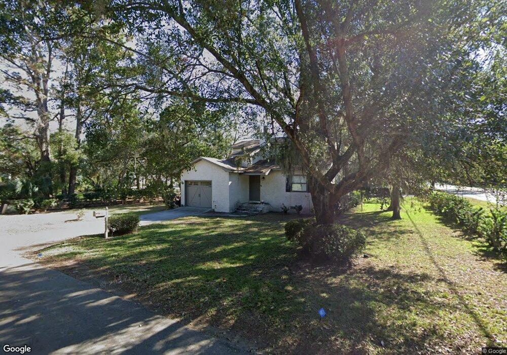
12 Yucca Ln Saint Simons Island, GA 31522
Estimated Value: $618,000 - $892,000
3
Beds
2
Baths
1,448
Sq Ft
$512/Sq Ft
Est. Value
About This Home
This home is located at 12 Yucca Ln, Saint Simons Island, GA 31522 and is currently estimated at $741,290, approximately $511 per square foot. 12 Yucca Ln is a home located in Glynn County with nearby schools including St. Simons Elementary School, Glynn Middle School, and Glynn Academy.
Ownership History
Date
Name
Owned For
Owner Type
Purchase Details
Closed on
Apr 30, 2008
Sold by
Gwynn Suzanne
Bought by
Bailey Gary B
Current Estimated Value
Home Financials for this Owner
Home Financials are based on the most recent Mortgage that was taken out on this home.
Original Mortgage
$260,528
Outstanding Balance
$163,347
Interest Rate
5.86%
Mortgage Type
New Conventional
Estimated Equity
$577,943
Create a Home Valuation Report for This Property
The Home Valuation Report is an in-depth analysis detailing your home's value as well as a comparison with similar homes in the area
Home Values in the Area
Average Home Value in this Area
Purchase History
| Date | Buyer | Sale Price | Title Company |
|---|---|---|---|
| Bailey Gary B | -- | -- | |
| Bailey Gary B | -- | -- | |
| Bailey Gary B | -- | -- | |
| Bailey Gary B | -- | -- | |
| Redd Doris Settle | $325,660 | -- |
Source: Public Records
Mortgage History
| Date | Status | Borrower | Loan Amount |
|---|---|---|---|
| Open | Redd Doris Settle | $260,528 | |
| Closed | Bailey Gary B | $260,528 | |
| Closed | Bailey Gary B | $40,000 |
Source: Public Records
Tax History Compared to Growth
Tax History
| Year | Tax Paid | Tax Assessment Tax Assessment Total Assessment is a certain percentage of the fair market value that is determined by local assessors to be the total taxable value of land and additions on the property. | Land | Improvement |
|---|---|---|---|---|
| 2025 | $4,892 | $195,080 | $128,760 | $66,320 |
| 2024 | $4,892 | $195,080 | $128,760 | $66,320 |
| 2023 | $2,093 | $100,680 | $49,040 | $51,640 |
| 2022 | $2,524 | $100,680 | $49,040 | $51,640 |
| 2021 | $2,570 | $99,560 | $49,040 | $50,520 |
| 2020 | $2,593 | $99,560 | $49,040 | $50,520 |
| 2019 | $2,593 | $99,560 | $49,040 | $50,520 |
| 2018 | $2,593 | $99,560 | $49,040 | $50,520 |
| 2017 | $2,593 | $99,560 | $49,040 | $50,520 |
| 2016 | $2,404 | $99,560 | $49,040 | $50,520 |
| 2015 | $2,413 | $99,560 | $49,040 | $50,520 |
| 2014 | $2,413 | $99,560 | $49,040 | $50,520 |
Source: Public Records
Map
Nearby Homes
- 118 Grand Oaks Ln
- 203 Grand Oaks Cir
- 11822 Old Demere Rd
- 105 Thompson Cove
- 108 Rosa Dorsey Ln
- 214 Island Dr
- 106 Sandcastle Way
- 103 Cater St
- 113 Peachtree St
- 134 Ibis Cove
- 1912 1st Ave
- 1528 Ocean Blvd
- 209 Sandcastle Way
- 104 Courtyard Villas Unit C7
- 600 Shore Edge Trc
- 600 Shore Edge Trace
- 4318 7th St
- 1495 Wood Ave
- 601 Shore Edge Trace
- 1524 Wood Ave Unit 303