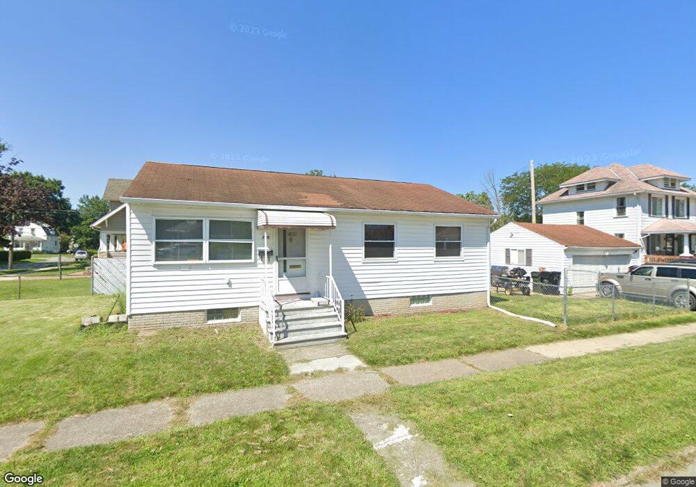
120 Brandtson Ave Elyria, OH 44035
Estimated Value: $141,462 - $165,000
3
Beds
1
Bath
925
Sq Ft
$161/Sq Ft
Est. Value
About This Home
This home is located at 120 Brandtson Ave, Elyria, OH 44035 and is currently estimated at $148,866, approximately $160 per square foot. 120 Brandtson Ave is a home located in Lorain County with nearby schools including Ely Elementary School, Northwood Middle School, and Elyria High School.
Ownership History
Date
Name
Owned For
Owner Type
Purchase Details
Closed on
Jun 29, 2007
Sold by
Barkas Edith J and Hennes Brenda S
Bought by
Jeffers Virgil and Jeffers Peyton J
Current Estimated Value
Home Financials for this Owner
Home Financials are based on the most recent Mortgage that was taken out on this home.
Original Mortgage
$84,333
Outstanding Balance
$52,047
Interest Rate
6.26%
Mortgage Type
FHA
Estimated Equity
$96,819
Create a Home Valuation Report for This Property
The Home Valuation Report is an in-depth analysis detailing your home's value as well as a comparison with similar homes in the area
Home Values in the Area
Average Home Value in this Area
Purchase History
| Date | Buyer | Sale Price | Title Company |
|---|---|---|---|
| Jeffers Virgil | $85,000 | Phoenix Title Agency |
Source: Public Records
Mortgage History
| Date | Status | Borrower | Loan Amount |
|---|---|---|---|
| Open | Jeffers Virgil | $84,333 |
Source: Public Records
Tax History
| Year | Tax Paid | Tax Assessment Tax Assessment Total Assessment is a certain percentage of the fair market value that is determined by local assessors to be the total taxable value of land and additions on the property. | Land | Improvement |
|---|---|---|---|---|
| 2024 | $1,689 | $35,186 | $8,453 | $26,733 |
| 2023 | $1,606 | $29,320 | $6,013 | $23,307 |
| 2022 | $1,592 | $29,320 | $6,013 | $23,307 |
| 2021 | $1,596 | $29,320 | $6,010 | $23,310 |
| 2020 | $1,468 | $23,990 | $4,920 | $19,070 |
| 2019 | $1,459 | $23,990 | $4,920 | $19,070 |
| 2018 | $1,506 | $23,990 | $4,920 | $19,070 |
| 2017 | $1,551 | $24,400 | $4,960 | $19,440 |
| 2016 | $1,530 | $24,400 | $4,960 | $19,440 |
| 2015 | $1,433 | $24,400 | $4,960 | $19,440 |
| 2014 | $1,442 | $24,840 | $5,050 | $19,790 |
| 2013 | $1,428 | $24,840 | $5,050 | $19,790 |
Source: Public Records
Map
Nearby Homes
- 129 Brandtson Ave
- 459 Ohio St
- 154 Bellfield Ave
- 147 Bellfield Ave
- 234 Bellfield Ave
- 164 Woodbury St
- 513 Gulf Rd
- 141 Elma Dr
- 209 Clark St
- 232 Hawthorne St
- 269 Hamilton Ave
- 276 Harrison St
- 347 Kenyon Ave
- 350 Beebe Ave
- 350 Concord Ave
- 118 Brandemere Ct
- 297 Abbe Rd N
- 113 Coronado Ct
- 335 Abbe Rd N
- 331 Abbe Rd N
- 126 Brandtson Ave
- 510 Ohio St
- 119 Brandtson Ave
- 119 121 Brandtson Ave
- 128 Brandtson Ave
- 121 Brandtson Ave
- 125 Brandtson Ave
- 211 Harwood St
- 201 Harwood St
- 132 Brandtson Ave
- 209 Harwood St
- 528 Ohio St
- 521 Ohio St
- 517 Ohio St
- 215 Harwood St
- 523 Ohio St
- 513 Ohio St
- 136 Brandtson Ave
- 137 Harwood St
- 133 Brandtson Ave
Your Personal Tour Guide
Ask me questions while you tour the home.