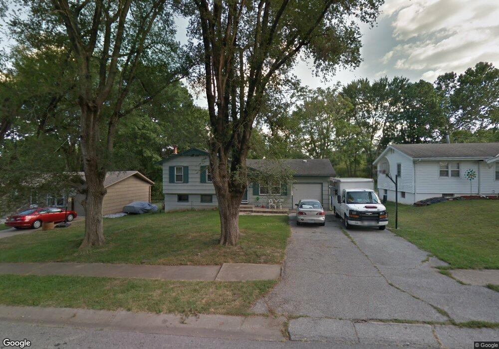
120 Brentwood Dr Liberty, MO 64068
Estimated Value: $240,995 - $265,000
3
Beds
2
Baths
884
Sq Ft
$286/Sq Ft
Est. Value
About This Home
This home is located at 120 Brentwood Dr, Liberty, MO 64068 and is currently estimated at $252,499, approximately $285 per square foot. 120 Brentwood Dr is a home located in Clay County with nearby schools including Alexander Doniphan Elementary School, Discovery Middle School, and Liberty High School.
Ownership History
Date
Name
Owned For
Owner Type
Purchase Details
Closed on
Mar 28, 2018
Sold by
Walker John
Bought by
Bledsoe Sharli
Current Estimated Value
Purchase Details
Closed on
Jul 24, 2003
Sold by
Willis Tina L and Sparks Cynthia A
Bought by
Walker John J and Walker Sharli L
Home Financials for this Owner
Home Financials are based on the most recent Mortgage that was taken out on this home.
Original Mortgage
$96,000
Interest Rate
5.15%
Mortgage Type
Purchase Money Mortgage
Purchase Details
Closed on
Oct 12, 2000
Sold by
Cassell Welles Carlton Brian and Cassell Jane
Bought by
Willis Tina L and Sparks Cynthia A
Home Financials for this Owner
Home Financials are based on the most recent Mortgage that was taken out on this home.
Original Mortgage
$104,760
Interest Rate
7.96%
Purchase Details
Closed on
Apr 4, 1997
Sold by
Cassell Welles Carlton Brian and Cassell Welles Jane
Bought by
Gleason Jennifer Ann and Miller Michael Allen
Create a Home Valuation Report for This Property
The Home Valuation Report is an in-depth analysis detailing your home's value as well as a comparison with similar homes in the area
Home Values in the Area
Average Home Value in this Area
Purchase History
| Date | Buyer | Sale Price | Title Company |
|---|---|---|---|
| Bledsoe Sharli | -- | None Available | |
| Walker John J | -- | United Title Company Inc | |
| Willis Tina L | -- | -- | |
| Gleason Jennifer Ann | -- | -- |
Source: Public Records
Mortgage History
| Date | Status | Borrower | Loan Amount |
|---|---|---|---|
| Previous Owner | Walker John J | $96,000 | |
| Previous Owner | Willis Tina L | $104,760 |
Source: Public Records
Tax History Compared to Growth
Tax History
| Year | Tax Paid | Tax Assessment Tax Assessment Total Assessment is a certain percentage of the fair market value that is determined by local assessors to be the total taxable value of land and additions on the property. | Land | Improvement |
|---|---|---|---|---|
| 2025 | $1,898 | $28,370 | -- | -- |
| 2024 | $1,898 | $24,680 | -- | -- |
| 2023 | $1,930 | $24,680 | $0 | $0 |
| 2022 | $1,818 | $22,950 | $0 | $0 |
| 2021 | $523 | $22,952 | $6,650 | $16,302 |
| 2020 | $1,783 | $21,300 | $0 | $0 |
| 2019 | $1,782 | $21,300 | $0 | $0 |
| 2018 | $1,555 | $18,240 | $0 | $0 |
| 2017 | $1,540 | $18,240 | $3,800 | $14,440 |
| 2016 | $1,540 | $18,240 | $3,800 | $14,440 |
| 2015 | $1,540 | $18,240 | $3,800 | $14,440 |
| 2014 | $1,496 | $17,580 | $3,800 | $13,780 |
Source: Public Records
Map
Nearby Homes
- 415 Monterey Ave
- 420 Belmont St
- 509 Belmont St
- 1124 Amesbury Ave
- 918 Amesbury Ave
- 862 Amesbury Ave
- 1323 Amesbury Ave
- 716 Bristol Ct
- 1218 Canterbury Ln
- 1507 Amesbury Ave
- 253 S Stewart Rd
- 7908 N Ditzler Ave
- 9102 NE 79th Terrace
- 1733 Welleslay Ln
- 9005 NE 80th St
- 1331 Park Ln
- 1537 Canterbury Ln
- 1317 Park Ln
- 11852 N Kentucky Ave
- 8826 NE 80th Terrace
- 124 Brentwood Dr
- 116 Brentwood Dr
- 112 Brentwood Dr
- 117 Avondale St
- 303 Monterey Ave
- 307 Monterey Ave
- 121 Avondale St
- 113 Avondale St
- 108 Brentwood Dr
- 109 Avondale St
- 311 Monterey Ave
- 107-123 Brentwood Dr
- 107-123 Brentwood Dr
- 104 Brentwood Dr
- 105 Avondale St
- 302 Monterey Ave
- 306 Monterey Ave
- 118 Avondale St
- 114 Avondale Ave
- 100 Brentwood Dr