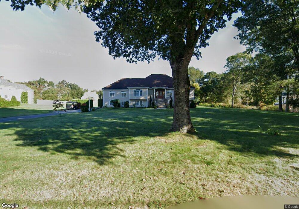
120 Broad St Rehoboth, MA 02769
Estimated Value: $855,386 - $974,000
3
Beds
3
Baths
3,285
Sq Ft
$282/Sq Ft
Est. Value
About This Home
This home is located at 120 Broad St, Rehoboth, MA 02769 and is currently estimated at $927,129, approximately $282 per square foot. 120 Broad St is a home located in Bristol County with nearby schools including Dighton-Rehoboth Regional High School, Cedar Brook School, and St Margaret School.
Ownership History
Date
Name
Owned For
Owner Type
Purchase Details
Closed on
Sep 19, 2005
Sold by
Hass Ft and Hass John R
Bought by
Vasconcelos Fernando and Vasconcelos Maria L
Current Estimated Value
Home Financials for this Owner
Home Financials are based on the most recent Mortgage that was taken out on this home.
Original Mortgage
$90,000
Outstanding Balance
$48,120
Interest Rate
5.84%
Mortgage Type
Purchase Money Mortgage
Estimated Equity
$879,009
Create a Home Valuation Report for This Property
The Home Valuation Report is an in-depth analysis detailing your home's value as well as a comparison with similar homes in the area
Home Values in the Area
Average Home Value in this Area
Purchase History
| Date | Buyer | Sale Price | Title Company |
|---|---|---|---|
| Vasconcelos Fernando | $230,000 | -- |
Source: Public Records
Mortgage History
| Date | Status | Borrower | Loan Amount |
|---|---|---|---|
| Open | Vasconcelos Fernando | $90,000 |
Source: Public Records
Tax History
| Year | Tax Paid | Tax Assessment Tax Assessment Total Assessment is a certain percentage of the fair market value that is determined by local assessors to be the total taxable value of land and additions on the property. | Land | Improvement |
|---|---|---|---|---|
| 2025 | $9,046 | $811,300 | $192,700 | $618,600 |
| 2024 | $8,372 | $737,000 | $192,700 | $544,300 |
| 2023 | $8,430 | $728,000 | $188,700 | $539,300 |
| 2022 | $7,933 | $626,100 | $180,300 | $445,800 |
| 2021 | $8,284 | $625,700 | $164,000 | $461,700 |
| 2020 | $8,176 | $605,300 | $164,000 | $441,300 |
| 2018 | $0 | $559,700 | $156,200 | $403,500 |
| 2017 | $0 | $485,800 | $156,200 | $329,600 |
| 2016 | $5,902 | $485,800 | $156,200 | $329,600 |
| 2015 | $6,025 | $489,400 | $149,000 | $340,400 |
| 2014 | $5,999 | $482,200 | $141,800 | $340,400 |
Source: Public Records
Map
Nearby Homes
- 149 Broad St
- 23 Colonial Way
- 16 Salisbury St
- 15 Hickory Ridge Rd
- 6 Running Stream Rd
- 67 Wheeler St
- 377 Read St
- 420 Chestnut St
- 31 Woodland Way
- 111 Summer St
- 52 Walker St
- 20 School St
- 0 Winter St
- 224 Arcade Ave
- 321 Winthrop St
- 42 Tee Jay Dr
- 156 Rocky Hill Rd
- 145 Winthrop St
- 139 Winthrop St
- 14 Field St
- 97 Salisbury St
- 93 Salisbury St
- 125 Broad St
- 119 Broad St
- 121 Broad St
- 89 Salisbury St
- 100 Salisbury St
- 85 Salisbury St
- 94 Salisbury St
- 132 Broad St
- 3 Blanding Rd
- 117 Broad St
- 0 Blanding Rd Unit 1 73302288
- 0 Blanding Rd
- 88 Salisbury St
- 103 Broad St
- 138 Broad St
- 7 Blanding Rd
- 80 Salisbury St
- 79 Salisbury St
Your Personal Tour Guide
Ask me questions while you tour the home.