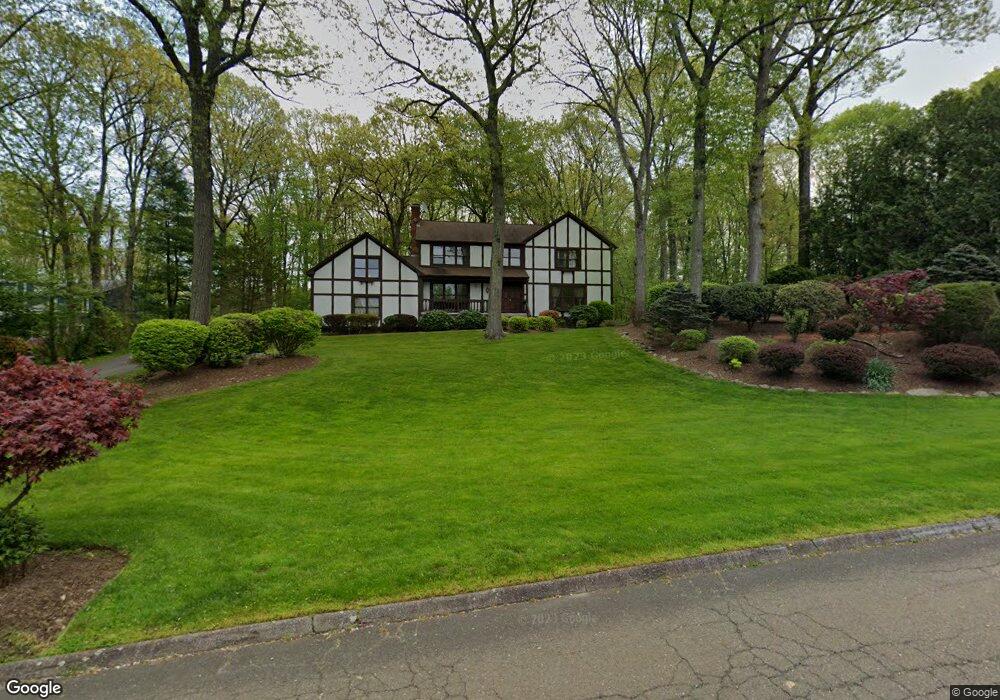
120 Cranbury Dr Trumbull, CT 06611
Daniel Farm District NeighborhoodEstimated Value: $828,548 - $989,000
4
Beds
3
Baths
2,802
Sq Ft
$329/Sq Ft
Est. Value
About This Home
This home is located at 120 Cranbury Dr, Trumbull, CT 06611 and is currently estimated at $922,637, approximately $329 per square foot. 120 Cranbury Dr is a home located in Fairfield County with nearby schools including Daniels Farm School, Hillcrest Middle School, and Trumbull High School.
Ownership History
Date
Name
Owned For
Owner Type
Purchase Details
Closed on
Feb 1, 2002
Sold by
Knopp Paul J and Knopp Mona
Bought by
Asgari Bardea and Preda Ioana S
Current Estimated Value
Purchase Details
Closed on
Mar 27, 1998
Sold by
Skawinski Stanley E and Skawinski Snadrda A
Bought by
Boye David A and Boye Susan
Purchase Details
Closed on
Aug 22, 1997
Sold by
Carroll Ronald G and Carroll Catherine
Bought by
Knopp Paul J and Knopp Mona
Purchase Details
Closed on
May 7, 1991
Sold by
Amabile Richard W and Amabile Sonai
Bought by
Carroll Ronald G and Carroll Catherine J
Create a Home Valuation Report for This Property
The Home Valuation Report is an in-depth analysis detailing your home's value as well as a comparison with similar homes in the area
Home Values in the Area
Average Home Value in this Area
Purchase History
| Date | Buyer | Sale Price | Title Company |
|---|---|---|---|
| Asgari Bardea | $514,900 | -- | |
| Boye David A | $340,000 | -- | |
| Knopp Paul J | $345,000 | -- | |
| Carroll Ronald G | $305,000 | -- |
Source: Public Records
Mortgage History
| Date | Status | Borrower | Loan Amount |
|---|---|---|---|
| Open | Carroll Ronald G | $330,000 | |
| Closed | Carroll Ronald G | $250,000 | |
| Closed | Carroll Ronald G | $300,000 |
Source: Public Records
Tax History Compared to Growth
Tax History
| Year | Tax Paid | Tax Assessment Tax Assessment Total Assessment is a certain percentage of the fair market value that is determined by local assessors to be the total taxable value of land and additions on the property. | Land | Improvement |
|---|---|---|---|---|
| 2025 | $13,186 | $357,140 | $155,820 | $201,320 |
| 2024 | $12,825 | $357,140 | $155,820 | $201,320 |
| 2023 | $12,618 | $357,140 | $155,820 | $201,320 |
| 2022 | $12,416 | $357,140 | $155,820 | $201,320 |
| 2021 | $11,890 | $325,360 | $141,680 | $183,680 |
| 2020 | $11,664 | $325,360 | $141,680 | $183,680 |
| 2018 | $11,376 | $325,360 | $141,680 | $183,680 |
| 2017 | $11,147 | $325,360 | $141,680 | $183,680 |
| 2016 | $10,922 | $325,360 | $141,680 | $183,680 |
| 2015 | $11,231 | $330,700 | $144,300 | $186,400 |
| 2014 | $10,989 | $330,700 | $144,300 | $186,400 |
Source: Public Records
Map
Nearby Homes
- 43 Moose Hill Rd
- 36 Moose Hill Rd
- 184 Hurd Rd
- 6 Brookview Dr
- 1209 Daniels Farm Rd
- 10 Greenwood Ln
- 121 Lewis Rd
- 119 Lewis Rd
- 18 Skating Pond Rd
- 118 Greenbrier Rd
- 340 Moose Hill Rd
- 3 Pam Bar Dr
- 349 Spring Hill Rd
- 152 Richards Dr
- 137 Greenwood Ln
- 93 Putting Green Rd N
- 13 School St
- 31 Parlor Rock Rd
- 75 Roosevelt Dr
- 6 Dartmouth Dr
- 124 Cranbury Dr
- 114 Cranbury Dr
- 128 Cranbury Dr
- 121 Cranbury Dr
- 12 Whitefield Dr
- 91 Moose Hill Rd
- 99 Moose Hill Rd
- 108 Cranbury Dr
- 97 Moose Hill Rd
- 115 Cranbury Dr
- 6 Whitefield Dr
- 107 Cranbury Dr
- 20 Whitefield Dr
- 107 Moose Hill Rd
- 101 Cranbury Dr
- 67 Moose Hill Rd
- 98 Moose Hill Rd
- 88 Moose Hill Rd
- 100 Moose Hill Rd
- 82 Moose Hill Rd