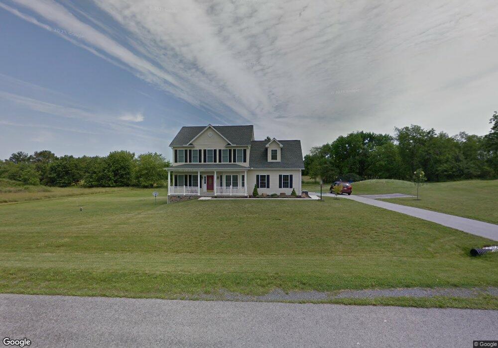
120 Crosswinds Dr Unit 10 Littlestown, PA 17340
Estimated Value: $431,778 - $451,000
3
Beds
3
Baths
2,116
Sq Ft
$208/Sq Ft
Est. Value
About This Home
This home is located at 120 Crosswinds Dr Unit 10, Littlestown, PA 17340 and is currently estimated at $440,695, approximately $208 per square foot. 120 Crosswinds Dr Unit 10 is a home located in Adams County with nearby schools including Rolling Acres El School, Maple Avenue Middle School, and Littlestown Senior High School.
Ownership History
Date
Name
Owned For
Owner Type
Purchase Details
Closed on
Sep 8, 2008
Sold by
Bon Ton Builders Inc and Forbes Floyd
Bought by
Parekh Vijay P and Parekh Karen M
Current Estimated Value
Home Financials for this Owner
Home Financials are based on the most recent Mortgage that was taken out on this home.
Original Mortgage
$243,200
Outstanding Balance
$168,142
Interest Rate
6.58%
Mortgage Type
Construction
Estimated Equity
$272,553
Create a Home Valuation Report for This Property
The Home Valuation Report is an in-depth analysis detailing your home's value as well as a comparison with similar homes in the area
Home Values in the Area
Average Home Value in this Area
Purchase History
| Date | Buyer | Sale Price | Title Company |
|---|---|---|---|
| Parekh Vijay P | $100,000 | -- |
Source: Public Records
Mortgage History
| Date | Status | Borrower | Loan Amount |
|---|---|---|---|
| Open | Parekh Vijay P | $243,200 |
Source: Public Records
Tax History Compared to Growth
Tax History
| Year | Tax Paid | Tax Assessment Tax Assessment Total Assessment is a certain percentage of the fair market value that is determined by local assessors to be the total taxable value of land and additions on the property. | Land | Improvement |
|---|---|---|---|---|
| 2025 | $5,453 | $288,100 | $124,500 | $163,600 |
| 2024 | $5,242 | $288,100 | $124,500 | $163,600 |
| 2023 | $5,110 | $288,100 | $124,500 | $163,600 |
| 2022 | $5,072 | $288,100 | $124,500 | $163,600 |
| 2021 | $4,892 | $288,100 | $124,500 | $163,600 |
| 2020 | $4,821 | $288,100 | $124,500 | $163,600 |
| 2019 | $4,718 | $288,100 | $124,500 | $163,600 |
| 2018 | $4,578 | $288,100 | $124,500 | $163,600 |
| 2017 | $4,434 | $288,100 | $124,500 | $163,600 |
| 2016 | -- | $288,100 | $124,500 | $163,600 |
| 2015 | -- | $288,100 | $124,500 | $163,600 |
| 2014 | -- | $288,100 | $124,500 | $163,600 |
Source: Public Records
Map
Nearby Homes
- 202 Plunkert Rd Unit 2
- 58 Windsor Ct
- 48 Windsor Ct
- 161 Stoners Cir
- 20 Locust Dr
- 20c Locust Dr
- 0 Locust Dr Unit PAAD2015910
- 1024 Frederick Pike Unit 6
- 58 N Gala Unit 397
- 52 Stayman Way Unit 81
- 440 N Queen St
- 135 Apple Grove Ln Unit 438
- 140 Apple Grove Ln Unit 425
- 22 Rita Marie Ave
- 464 Locust Ln
- 162 Newark St
- 129 W King St
- 2226 Harney Rd Unit 2
- 2238 Harney Rd Unit 3
- 0 Hershey Rd Unit PALA2058618
- 22 Crosswind Dr
- 26 Crosswind Dr
- 24 Crosswind Dr
- 140 Crosswinds Dr Unit 27
- 140 Crosswinds Dr
- 92 Crosswinds Dr
- 125 Crosswinds Dr
- Lot 20 Crosswinds
- 137 Crosswinds Dr
- 111 Crosswinds Dr
- 160 Crosswinds Dr
- 151 Crosswinds Dr
- 97 Crosswinds Dr
- 76 Crosswinds Dr
- 167 Crosswinds Dr
- 85 Crosswinds Dr
- 170 Crosswinds Dr Unit 7
- 61 Crosswinds Dr
- 179 Crosswinds Dr
- 100 Saint Johns Rd W