Estimated Value: $469,000 - $1,123,000
3
Beds
1
Bath
2,191
Sq Ft
$295/Sq Ft
Est. Value
About This Home
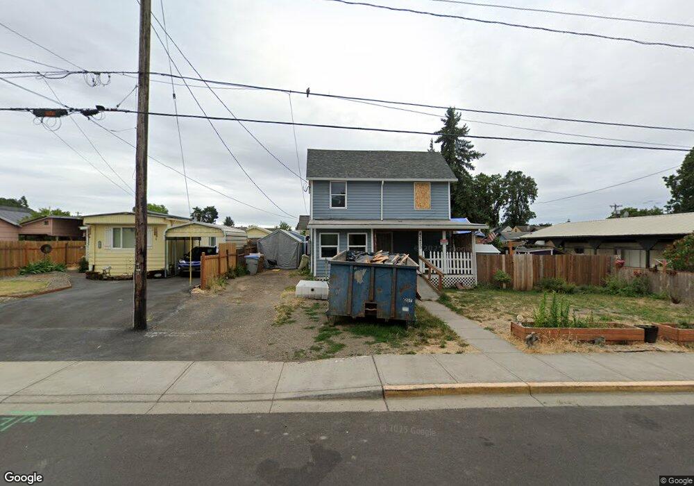
This home is located at 120 Depot St, Banks, OR 97106 and is currently estimated at $646,622, approximately $295 per square foot. 120 Depot St is a home located in Washington County with nearby schools including Banks Elementary School, Banks Middle School, and Banks High School.
Ownership History
Date
Name
Owned For
Owner Type
Purchase Details
Closed on
Jan 13, 2025
Sold by
Dier Grace Johnson and Dier Michael A
Bought by
Dier Living Trust and Johnson-Dier
Current Estimated Value
Purchase Details
Closed on
Jun 29, 2018
Sold by
Dier Grace Johnson and Johnson Grace E
Bought by
Dier Grace Johnson and Dier Michael A
Home Financials for this Owner
Home Financials are based on the most recent Mortgage that was taken out on this home.
Original Mortgage
$260,000
Interest Rate
4.6%
Mortgage Type
VA
Create a Home Valuation Report for This Property
The Home Valuation Report is an in-depth analysis detailing your home's value as well as a comparison with similar homes in the area
Home Values in the Area
Average Home Value in this Area
Purchase History
| Date | Buyer | Sale Price | Title Company |
|---|---|---|---|
| Dier Living Trust | -- | None Listed On Document | |
| Dier Grace Johnson | -- | None Available |
Source: Public Records
Mortgage History
| Date | Status | Borrower | Loan Amount |
|---|---|---|---|
| Previous Owner | Dier Grace Johnson | $260,000 |
Source: Public Records
Tax History Compared to Growth
Tax History
| Year | Tax Paid | Tax Assessment Tax Assessment Total Assessment is a certain percentage of the fair market value that is determined by local assessors to be the total taxable value of land and additions on the property. | Land | Improvement |
|---|---|---|---|---|
| 2025 | $3,129 | $170,320 | -- | -- |
| 2024 | $2,844 | $165,360 | -- | -- |
| 2023 | $2,844 | $160,550 | $0 | $0 |
| 2022 | $2,769 | $160,550 | $0 | $0 |
| 2021 | $2,671 | $151,340 | $0 | $0 |
| 2020 | $2,592 | $146,940 | $0 | $0 |
| 2019 | $2,488 | $142,660 | $0 | $0 |
| 2018 | $2,270 | $129,810 | $0 | $0 |
| 2017 | $2,174 | $126,040 | $0 | $0 |
| 2016 | $2,140 | $122,380 | $0 | $0 |
| 2015 | $2,056 | $118,820 | $0 | $0 |
| 2014 | $1,360 | $77,390 | $0 | $0 |
Source: Public Records
Map
Nearby Homes
- 42280 NW Banks Rd
- 42371 NW Banks Rd
- 0 NW Sellers Rd
- 43300 NW Cedar Canyon Rd
- 12874 NW Maplecrest Way
- 12838 NW Maplecrest Way
- 12734 NW Hammond Place
- 42015 NW Buckshire St
- 42098 NW Broadshire Ln
- 41710 NW Oak Way
- 41753 NW Buckshire St
- 41637 NW Buckshire St
- 0 NW Lodge Rd
- 48025 NW Strohmayer Rd
- 0 NW Green Mountain Rd Unit 1 23320324
- 0 NW Green Mountain Rd Unit 24253646
- 18282 NW Hilltop Place
- 46345 NW Strohmayer Rd
- 11911 NW Seavey Rd
- 21076 NW Green Mountain Rd
- 124 Depot St
- 110 Depot St
- 130 Depot St
- 240 S Main St
- 220 S Main St
- 13580 NW Main St
- 0 NW Sunset Ave Unit 15324750
- 0 NW Sunset Ave Unit 8091951
- 0 NW Sunset Ave Unit 8036963
- 0 NW Sunset Ave Unit 8036955
- 0 NW Sunset Ave Unit 9077968
- 0 NW Sunset Ave Unit Lot 3 10079777
- 0 NW Sunset Ave Unit 3 14598650
- 0 NW Sunset Ave Unit 2 14337529
- 0 NW Sunset Ave Unit 2 15647949
- 0 NW Sunset Ave Unit 15113532
- 42433 NW Sunset Ave
- 42437 NW Sunset Ave
- 202 E Main St Unit 1
- 0 NW Sunset Ave Ave Unit 15534344