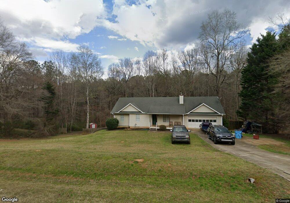
120 Duncans Mill Dr Locust Grove, GA 30248
Estimated Value: $256,534 - $310,000
3
Beds
2
Baths
1,289
Sq Ft
$220/Sq Ft
Est. Value
About This Home
This home is located at 120 Duncans Mill Dr, Locust Grove, GA 30248 and is currently estimated at $283,884, approximately $220 per square foot. 120 Duncans Mill Dr is a home located in Henry County with nearby schools including Unity Grove Elementary School, Locust Grove Middle School, and Locust Grove High School.
Ownership History
Date
Name
Owned For
Owner Type
Purchase Details
Closed on
Sep 10, 2002
Sold by
Tcif Reo1 Llc
Bought by
Worsham Christopher J
Current Estimated Value
Home Financials for this Owner
Home Financials are based on the most recent Mortgage that was taken out on this home.
Original Mortgage
$88,150
Interest Rate
6.19%
Mortgage Type
New Conventional
Purchase Details
Closed on
Apr 2, 2002
Sold by
Cimato Michael
Bought by
Fairbanks Cap Corp
Purchase Details
Closed on
May 24, 1999
Sold by
Standard Jerry A & William D
Bought by
Cimato Michael
Home Financials for this Owner
Home Financials are based on the most recent Mortgage that was taken out on this home.
Original Mortgage
$110,500
Interest Rate
6.9%
Mortgage Type
New Conventional
Create a Home Valuation Report for This Property
The Home Valuation Report is an in-depth analysis detailing your home's value as well as a comparison with similar homes in the area
Home Values in the Area
Average Home Value in this Area
Purchase History
| Date | Buyer | Sale Price | Title Company |
|---|---|---|---|
| Worsham Christopher J | $113,200 | -- | |
| Tcif Reo1 Llc | -- | -- | |
| Fairbanks Cap Corp | $94,360 | -- | |
| Cimato Michael | $109,900 | -- |
Source: Public Records
Mortgage History
| Date | Status | Borrower | Loan Amount |
|---|---|---|---|
| Previous Owner | Tcif Reo1 Llc | $88,150 | |
| Previous Owner | Cimato Michael | $110,500 |
Source: Public Records
Tax History Compared to Growth
Tax History
| Year | Tax Paid | Tax Assessment Tax Assessment Total Assessment is a certain percentage of the fair market value that is determined by local assessors to be the total taxable value of land and additions on the property. | Land | Improvement |
|---|---|---|---|---|
| 2025 | $3,125 | $110,760 | $14,000 | $96,760 |
| 2024 | $3,125 | $104,440 | $14,000 | $90,440 |
| 2023 | $2,655 | $108,600 | $14,000 | $94,600 |
| 2022 | $2,808 | $93,720 | $14,000 | $79,720 |
| 2021 | $2,389 | $75,960 | $14,000 | $61,960 |
| 2020 | $2,268 | $70,840 | $12,000 | $58,840 |
| 2019 | $2,079 | $62,840 | $12,000 | $50,840 |
| 2018 | $2,020 | $60,360 | $10,800 | $49,560 |
| 2016 | $1,756 | $50,880 | $10,000 | $40,880 |
| 2015 | $1,539 | $44,320 | $10,000 | $34,320 |
| 2014 | $1,471 | $42,240 | $10,000 | $32,240 |
Source: Public Records
Map
Nearby Homes
- 305 Annie Ln Unit 2
- 230 Leguin Mill Rd
- 108 Caraway Rd
- 165 Caraway Rd
- 1627 Leguin Mill Rd
- 604 Onieda Dr
- 1680 Leguin Mill Rd
- 1850 Old Jackson Rd
- 601 Amerigo Ct
- 218 Baxter Ln
- 705 Seabolt Rd
- 678 Seabolt Rd
- 521 Deadwood Trail
- 111 Cardell Farms Rd
- 943 Colvin Dr
- 1000 Coan Dr
- 735 Strawflower Ln
- 1145 Larkspur Dr
- 143 Kimbell Farm Dr
- 1815 S Ola Rd
- 124 Duncans Mill Dr
- 116 Duncans Mill Dr
- 119 Duncans Mill Dr
- 123 Duncans Mill Rd
- 123 Duncans Mill Dr
- 115 Duncans Mill Dr
- 112 Duncans Mill Dr
- 128 Duncans Mill Dr
- 0 Duncans Mill Rd Unit 8660186
- 0 Duncans Mill Rd Unit 8098281
- 0 Duncans Mill Rd Unit 9073385
- 0 Duncans Mill Rd Unit 3159593
- 0 Duncans Mill Rd Unit 7206173
- 0 Duncans Mill Rd Unit 7346690
- 0 Duncans Mill Rd Unit 7441558
- 111 Duncans Mill Dr
- 127 Duncans Mill Dr
- 108 Duncans Mill Dr
- 132 Duncans Mill Dr
- 407 Jordan Ln