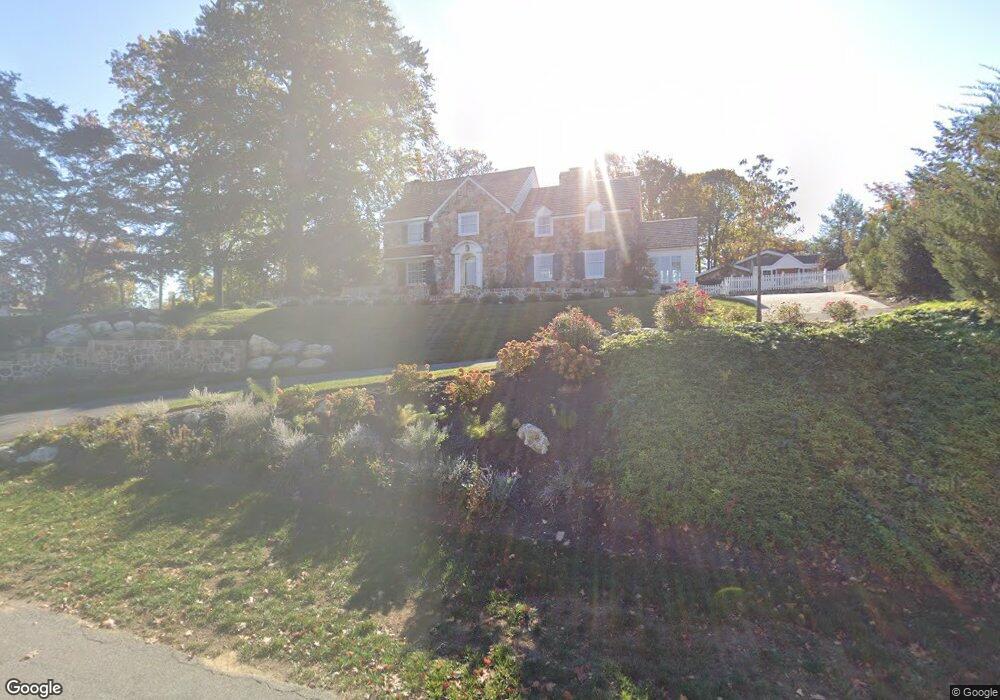
120 E Ashbridge St West Chester, PA 19380
Estimated Value: $1,324,864 - $1,485,000
4
Beds
3
Baths
3,395
Sq Ft
$405/Sq Ft
Est. Value
About This Home
This home is located at 120 E Ashbridge St, West Chester, PA 19380 and is currently estimated at $1,374,216, approximately $404 per square foot. 120 E Ashbridge St is a home located in Chester County with nearby schools including Hillsdale Elementary School, E.N. Peirce Middle School, and Henderson High School.
Ownership History
Date
Name
Owned For
Owner Type
Purchase Details
Closed on
Jul 11, 2022
Sold by
Gordon Porter Jr James and Gordon Sandra G
Bought by
Price Jeffrey and Price Christina
Current Estimated Value
Home Financials for this Owner
Home Financials are based on the most recent Mortgage that was taken out on this home.
Original Mortgage
$920,000
Outstanding Balance
$875,351
Interest Rate
5.1%
Mortgage Type
New Conventional
Estimated Equity
$498,865
Create a Home Valuation Report for This Property
The Home Valuation Report is an in-depth analysis detailing your home's value as well as a comparison with similar homes in the area
Home Values in the Area
Average Home Value in this Area
Purchase History
| Date | Buyer | Sale Price | Title Company |
|---|---|---|---|
| Price Jeffrey | $1,200,000 | -- |
Source: Public Records
Mortgage History
| Date | Status | Borrower | Loan Amount |
|---|---|---|---|
| Open | Price Jeffrey | $920,000 |
Source: Public Records
Tax History Compared to Growth
Tax History
| Year | Tax Paid | Tax Assessment Tax Assessment Total Assessment is a certain percentage of the fair market value that is determined by local assessors to be the total taxable value of land and additions on the property. | Land | Improvement |
|---|---|---|---|---|
| 2025 | $9,178 | $261,650 | $47,020 | $214,630 |
| 2024 | $9,178 | $261,650 | $47,020 | $214,630 |
| 2023 | $9,076 | $261,650 | $47,020 | $214,630 |
| 2022 | $8,978 | $261,650 | $47,020 | $214,630 |
| 2021 | $8,795 | $261,650 | $47,020 | $214,630 |
| 2020 | $8,632 | $261,650 | $47,020 | $214,630 |
| 2019 | $8,530 | $261,650 | $47,020 | $214,630 |
| 2018 | $8,376 | $261,650 | $47,020 | $214,630 |
| 2017 | $8,223 | $261,650 | $47,020 | $214,630 |
| 2016 | $5,702 | $261,650 | $47,020 | $214,630 |
| 2015 | $5,702 | $261,650 | $47,020 | $214,630 |
| 2014 | $5,702 | $261,650 | $47,020 | $214,630 |
Source: Public Records
Map
Nearby Homes
- 626 N Matlack St
- 532 N Walnut St
- 204 Ford Cir
- 347 E Biddle St
- 911 Baylowell Dr
- 314 Mayfield Ave
- 303 W Washington St
- 505 S Maryland Ave
- 145 E Miner St
- 333 Hannum Ave
- 110 S Matlack St
- 112 S Matlack St
- 418 Hannum Ave
- 1103 Judson Dr
- 112 Crosspointe Dr
- 110 S Adams St
- 110 S High St
- 19 S New St
- 342 E Barnard St
- 433 W Gay St
- 116 E Ashbridge St
- 117 E Ashbridge St
- 631 N Matlack St
- 611 N Matlack St
- 127 Elbow Ln
- 620 N Matlack St
- 615 N Walnut St
- 201 E Ashbridge St
- 125 Elbow Ln
- 101 E Ashbridge St
- 704 Penny Ln
- 611 Elizabeth St
- 715 N Walnut St
- 205 E Ashbridge St
- 607 N Matlack St
- 220 E Ashbridge St
- 603 N Walnut St
- 121 E Virginia Ave
- 721 N Walnut St
- 624 N Walnut St