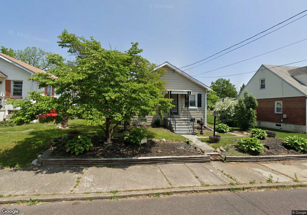
120 Elm St Pottstown, PA 19464
Estimated Value: $178,000 - $232,000
2
Beds
1
Bath
768
Sq Ft
$277/Sq Ft
Est. Value
About This Home
This home is located at 120 Elm St, Pottstown, PA 19464 and is currently estimated at $212,677, approximately $276 per square foot. 120 Elm St is a home located in Montgomery County with nearby schools including Lower Pottsgrove Elementary School, Pottsgrove Middle School, and Pottsgrove Senior High School.
Ownership History
Date
Name
Owned For
Owner Type
Purchase Details
Closed on
Sep 11, 2024
Sold by
Scholl Susan K
Bought by
Scholl Susan K
Current Estimated Value
Home Financials for this Owner
Home Financials are based on the most recent Mortgage that was taken out on this home.
Original Mortgage
$158,000
Outstanding Balance
$155,859
Interest Rate
6.73%
Mortgage Type
New Conventional
Estimated Equity
$56,818
Purchase Details
Closed on
Jan 31, 2008
Sold by
Styer Carole L and Styer Kenneth R
Bought by
Scholl Susan K and Scholl Scott A
Home Financials for this Owner
Home Financials are based on the most recent Mortgage that was taken out on this home.
Original Mortgage
$135,000
Interest Rate
6.14%
Purchase Details
Closed on
Jun 26, 2007
Sold by
Matthews Polly G Moore
Bought by
Styer Carole L and Styer Kenneth R
Purchase Details
Closed on
Jan 21, 2005
Sold by
Not Provided
Bought by
Not Provided
Create a Home Valuation Report for This Property
The Home Valuation Report is an in-depth analysis detailing your home's value as well as a comparison with similar homes in the area
Home Values in the Area
Average Home Value in this Area
Purchase History
| Date | Buyer | Sale Price | Title Company |
|---|---|---|---|
| Scholl Susan K | -- | None Listed On Document | |
| Scholl Susan K | $135,000 | None Available | |
| Styer Carole L | $85,000 | None Available | |
| Not Provided | -- | -- |
Source: Public Records
Mortgage History
| Date | Status | Borrower | Loan Amount |
|---|---|---|---|
| Open | Scholl Susan K | $158,000 | |
| Previous Owner | Scholl Susan K | $135,000 |
Source: Public Records
Tax History Compared to Growth
Tax History
| Year | Tax Paid | Tax Assessment Tax Assessment Total Assessment is a certain percentage of the fair market value that is determined by local assessors to be the total taxable value of land and additions on the property. | Land | Improvement |
|---|---|---|---|---|
| 2025 | $2,882 | $60,020 | $34,320 | $25,700 |
| 2024 | $2,882 | $60,020 | $34,320 | $25,700 |
| 2023 | $2,791 | $60,020 | $34,320 | $25,700 |
| 2022 | $2,749 | $60,020 | $34,320 | $25,700 |
| 2021 | $2,708 | $60,020 | $34,320 | $25,700 |
| 2020 | $2,668 | $60,020 | $34,320 | $25,700 |
| 2019 | $2,654 | $60,020 | $34,320 | $25,700 |
| 2018 | $2,654 | $60,020 | $34,320 | $25,700 |
| 2017 | $2,645 | $60,020 | $34,320 | $25,700 |
| 2016 | $2,622 | $60,020 | $34,320 | $25,700 |
| 2015 | $2,530 | $60,020 | $34,320 | $25,700 |
| 2014 | $2,530 | $60,020 | $34,320 | $25,700 |
Source: Public Records
Map
Nearby Homes
- 160 Linden St Unit 69
- 624 E Howard St
- 530 E Howard St
- 104 Pulaski St
- 501 and 507 E Race St
- 8 Ryan St
- 226 School Ln
- 1036 Edgewood Dr
- 303 Grosstown Rd
- 356 W Beech St Unit 160
- 601 W High St
- 32 E Race St
- 7 E Vine St
- 3 W Race St
- 425 Center St
- 1209 Grosstown Rd
- 156 Gable Ave
- 377 Circle of Progress Dr
- 0 Ash St Unit PAMC2144590
- 221 W King St