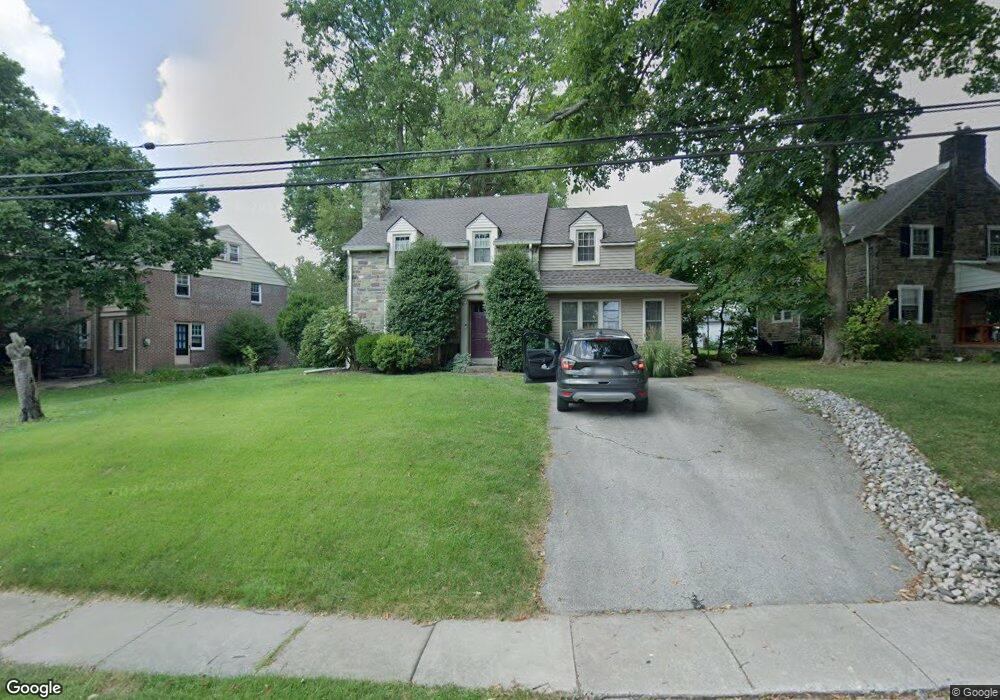
120 Forest Rd Springfield, PA 19064
Estimated Value: $543,000 - $583,000
3
Beds
2
Baths
2,176
Sq Ft
$256/Sq Ft
Est. Value
About This Home
This home is located at 120 Forest Rd, Springfield, PA 19064 and is currently estimated at $557,644, approximately $256 per square foot. 120 Forest Rd is a home located in Delaware County with nearby schools including Springfield High School, St Francis Of Assisi School, and Holy Cross School.
Ownership History
Date
Name
Owned For
Owner Type
Purchase Details
Closed on
Aug 31, 1994
Sold by
Handley Don W and Handley Ann V
Bought by
Knaub Darryl M and Knaub Beth A Dombroski
Current Estimated Value
Home Financials for this Owner
Home Financials are based on the most recent Mortgage that was taken out on this home.
Original Mortgage
$136,800
Interest Rate
4.37%
Create a Home Valuation Report for This Property
The Home Valuation Report is an in-depth analysis detailing your home's value as well as a comparison with similar homes in the area
Home Values in the Area
Average Home Value in this Area
Purchase History
| Date | Buyer | Sale Price | Title Company |
|---|---|---|---|
| Knaub Darryl M | $152,000 | Commonwealth Land Title Ins |
Source: Public Records
Mortgage History
| Date | Status | Borrower | Loan Amount |
|---|---|---|---|
| Closed | Knaub Darryl M | $136,800 |
Source: Public Records
Tax History
| Year | Tax Paid | Tax Assessment Tax Assessment Total Assessment is a certain percentage of the fair market value that is determined by local assessors to be the total taxable value of land and additions on the property. | Land | Improvement |
|---|---|---|---|---|
| 2025 | $8,692 | $309,240 | $98,210 | $211,030 |
| 2024 | $8,692 | $309,240 | $98,210 | $211,030 |
| 2023 | $8,369 | $309,240 | $98,210 | $211,030 |
| 2022 | $8,188 | $309,240 | $98,210 | $211,030 |
| 2021 | $12,681 | $309,240 | $98,210 | $211,030 |
| 2020 | $7,293 | $160,940 | $47,210 | $113,730 |
| 2019 | $7,122 | $160,940 | $47,210 | $113,730 |
| 2018 | $7,020 | $160,940 | $0 | $0 |
| 2017 | $6,857 | $160,940 | $0 | $0 |
| 2016 | $883 | $160,940 | $0 | $0 |
| 2015 | $883 | $160,940 | $0 | $0 |
| 2014 | $883 | $160,940 | $0 | $0 |
Source: Public Records
Map
Nearby Homes
- 111 Forest Rd
- 147 Snyder Ln
- 606 W Springfield Rd
- 31 Wayfield Rd
- 120 W Springfield Rd
- 364 S Rolling Rd
- 641 W Sproul Rd
- 226 Lynbrooke Rd
- 227 E Leamy Ave
- 29 School Ln
- 19 Wayne Ave
- 501 Flora Cir
- 493 Wheatsheaf Rd
- 34 Schuyler Rd
- 332 Franklin Ave
- 220 N Rolling Rd
- 516 Beatty Rd
- 464 Conard Dr
- 1291 Country Club Dr Unit Q137
- 1299 Country Club Dr Unit Q141
- 114 Forest Rd
- 126 Forest Rd
- Lot 2 Barry Dr
- lot5 Hill Farm Ln
- Lot 3 Hill Farm Ln
- lot 10 Hill Farm Ln
- Lot 1 Hill Farm Ln
- lot20 Hill Farm Ln
- lot8 Hill Farm Ln
- lot 13 Hill Farm Ln
- Lot 2 Hill Farm Ln
- Lot 11 Hill Farm Ln
- lot4 Hill Farm Ln
- lot22 Hill Farm Ln
- lot21 Hill Farm Ln
- 89 Shelburne Rd
- 104 Forest Rd
- 131 Forest Rd
- 93 Shelburne Rd
- 79 Shelburne Rd
Your Personal Tour Guide
Ask me questions while you tour the home.