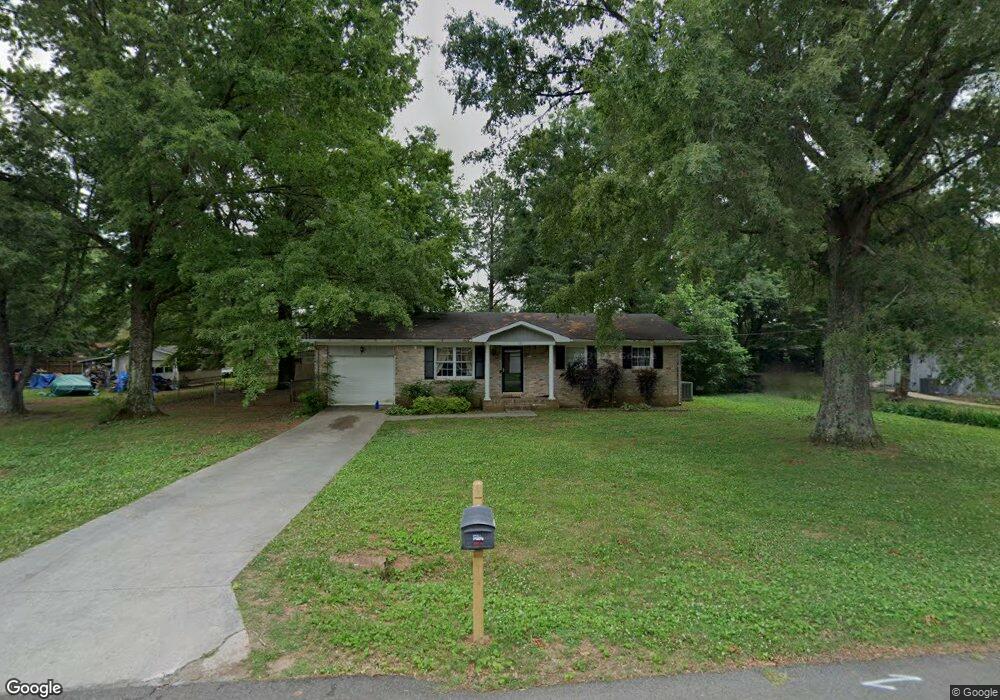
120 Forrest Dr Madison, AL 35758
Estimated Value: $212,000 - $283,000
3
Beds
2
Baths
1,200
Sq Ft
$205/Sq Ft
Est. Value
About This Home
This home is located at 120 Forrest Dr, Madison, AL 35758 and is currently estimated at $246,342, approximately $205 per square foot. 120 Forrest Dr is a home located in Madison County with nearby schools including Rainbow Elementary School, Discovery Middle School, and Bob Jones High School.
Ownership History
Date
Name
Owned For
Owner Type
Purchase Details
Closed on
Apr 28, 2015
Sold by
Trumm Matthew and Trumm Julie
Bought by
Brooks Morris J
Current Estimated Value
Home Financials for this Owner
Home Financials are based on the most recent Mortgage that was taken out on this home.
Original Mortgage
$80,000
Outstanding Balance
$29,026
Interest Rate
3.87%
Mortgage Type
New Conventional
Estimated Equity
$217,316
Purchase Details
Closed on
Mar 25, 2010
Sold by
Azzam Richard and Azzam Edward B
Bought by
Trumm Matthew and Trumm Julie
Home Financials for this Owner
Home Financials are based on the most recent Mortgage that was taken out on this home.
Original Mortgage
$86,320
Interest Rate
4.93%
Mortgage Type
New Conventional
Purchase Details
Closed on
Jun 19, 2007
Sold by
Thomason Gorden E and Thomason Sally R
Bought by
Azzam Edward B
Purchase Details
Closed on
Dec 7, 2006
Sold by
Chunn Michael A
Bought by
Thomason Gorden E and Thomason Sally R
Create a Home Valuation Report for This Property
The Home Valuation Report is an in-depth analysis detailing your home's value as well as a comparison with similar homes in the area
Home Values in the Area
Average Home Value in this Area
Purchase History
| Date | Buyer | Sale Price | Title Company |
|---|---|---|---|
| Brooks Morris J | $100,000 | None Available | |
| Trumm Matthew | -- | -- | |
| Azzam Edward B | -- | -- | |
| Thomason Gorden E | -- | -- |
Source: Public Records
Mortgage History
| Date | Status | Borrower | Loan Amount |
|---|---|---|---|
| Open | Brooks Morris J | $80,000 | |
| Previous Owner | Trumm Matthew | $86,320 |
Source: Public Records
Tax History
| Year | Tax Paid | Tax Assessment Tax Assessment Total Assessment is a certain percentage of the fair market value that is determined by local assessors to be the total taxable value of land and additions on the property. | Land | Improvement |
|---|---|---|---|---|
| 2025 | $1,831 | $26,260 | $4,100 | $22,160 |
| 2024 | $1,831 | $24,680 | $4,100 | $20,580 |
| 2023 | $1,721 | $24,680 | $4,100 | $20,580 |
| 2022 | $1,531 | $21,940 | $4,100 | $17,840 |
| 2021 | $1,439 | $20,620 | $4,100 | $16,520 |
| 2020 | $1,406 | $20,140 | $3,620 | $16,520 |
| 2019 | $1,164 | $20,140 | $3,620 | $16,520 |
| 2018 | $1,169 | $20,220 | $0 | $0 |
| 2017 | $1,169 | $20,220 | $0 | $0 |
| 2016 | $1,169 | $20,220 | $0 | $0 |
| 2015 | $316 | $10,120 | $0 | $0 |
| 2014 | -- | $9,720 | $0 | $0 |
Source: Public Records
Map
Nearby Homes
- 7627 Highway 72 W
- 1.7 Highway 72 W
- 8809 Highway 72 W
- 303 Bradford Farms Dr
- 325 Bradford Farms Dr
- 100 Brogans Way
- 289 Yancy Rd
- 3.44 acres Highway 72
- 4.9 Acres Highway 72
- 104 Brookdel Dr
- 1231 Hughes Rd
- 7600 Buncombe Place
- 139 Stoneway Trail
- 102 Forest Pointe Dr
- 7740 N Catawba Cir NW
- 7731 N Catawba Cir NW
- 29111 Highway 72
- 104 Clift Farm Dr
- 108 Clift Farm Dr
- 114 Clift Farm Dr
Your Personal Tour Guide
Ask me questions while you tour the home.