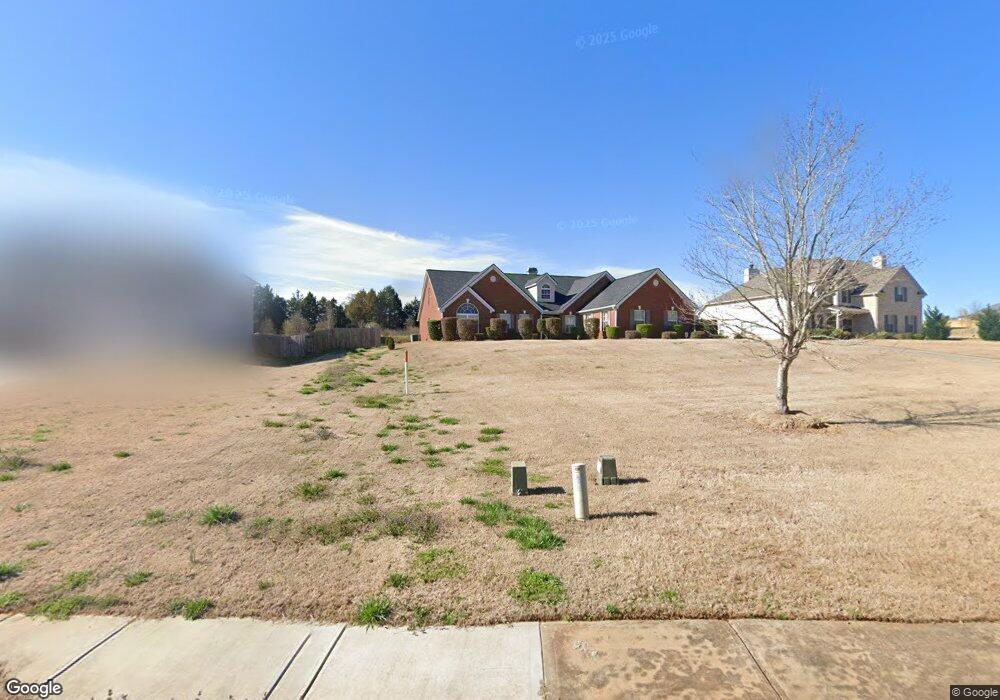
120 Hampton Place Covington, GA 30016
Estimated Value: $351,799 - $439,000
Studio
2
Baths
2,771
Sq Ft
$144/Sq Ft
Est. Value
About This Home
This home is located at 120 Hampton Place, Covington, GA 30016 and is currently estimated at $397,700, approximately $143 per square foot. 120 Hampton Place is a home located in Newton County with nearby schools including Livingston Elementary School, Liberty Middle School, and Alcovy High School.
Ownership History
Date
Name
Owned For
Owner Type
Purchase Details
Closed on
Jan 29, 2018
Sold by
Mckoy Dorothy
Bought by
Mckoy Family Trust
Current Estimated Value
Purchase Details
Closed on
Jul 6, 2007
Sold by
Manor Hms Inc
Bought by
Mckoy Dorothy and Mckoy Barrington
Home Financials for this Owner
Home Financials are based on the most recent Mortgage that was taken out on this home.
Original Mortgage
$143,000
Interest Rate
6.52%
Mortgage Type
New Conventional
Create a Home Valuation Report for This Property
The Home Valuation Report is an in-depth analysis detailing your home's value as well as a comparison with similar homes in the area
Home Values in the Area
Average Home Value in this Area
Purchase History
| Date | Buyer | Sale Price | Title Company |
|---|---|---|---|
| Mckoy Family Trust | -- | -- | |
| Mckoy Dorothy | $234,900 | -- |
Source: Public Records
Mortgage History
| Date | Status | Borrower | Loan Amount |
|---|---|---|---|
| Previous Owner | Mckoy Dorothy | $143,000 |
Source: Public Records
Tax History
| Year | Tax Paid | Tax Assessment Tax Assessment Total Assessment is a certain percentage of the fair market value that is determined by local assessors to be the total taxable value of land and additions on the property. | Land | Improvement |
|---|---|---|---|---|
| 2025 | $3,639 | $143,320 | $23,600 | $119,720 |
| 2024 | $3,555 | $137,480 | $23,600 | $113,880 |
| 2023 | $3,908 | $141,360 | $11,200 | $130,160 |
| 2022 | $3,006 | $108,160 | $11,200 | $96,960 |
| 2021 | $2,832 | $91,040 | $11,200 | $79,840 |
| 2020 | $2,973 | $88,480 | $11,200 | $77,280 |
| 2019 | $2,996 | $87,840 | $11,200 | $76,640 |
| 2018 | $2,390 | $69,600 | $11,200 | $58,400 |
| 2017 | $2,109 | $61,440 | $8,800 | $52,640 |
| 2016 | $1,816 | $52,880 | $7,000 | $45,880 |
| 2015 | $1,948 | $54,720 | $7,000 | $47,720 |
| 2014 | $1,941 | $54,720 | $0 | $0 |
Source: Public Records
Map
Nearby Homes
- 179 Ellis Trail
- 66 Ellis Trail
- 60 Muirfield Dr
- 335 Glen Echo Dr
- 230 Laurel Way
- 50 Glen Echo Dr
- 35 Maggie Ct
- 15 Glen Echo Dr
- 395 Willow Shoals Dr
- 75 Cannonade Ct
- 15 Granville Ln
- 110 Lamar Ln
- 25 Castlehill Ct
- 230 Belmont Trail
- 300 Arthurs Ln
- 230 Barcelona Dr
- 40 Belmont Cir Unit 2
- 345 Arthurs Ln
- 10 Lamar Ln
- 1752 Highway 162
- 110 Hampton Place
- 130 Hampton Place
- 405 Hampton Ct
- 140 Hampton Place
- 415 Hampton Ct
- 125 Hampton Place
- 135 Hampton Place
- 145 Hampton Place
- 115 Hampton Place
- 400 Hampton Ct
- 410 Hampton Ct
- 55 Mission Pointe Ln
- 385 Hampton Ct
- 45 Mission Point Unit 45
- 45 Mission Point
- 45 Mission Pointe Ln
- 155 Hampton Place
- 60 Hampton Place
- 65 Mission Pointe Ln
- 35 Mission Pointe Ln
Your Personal Tour Guide
Ask me questions while you tour the home.