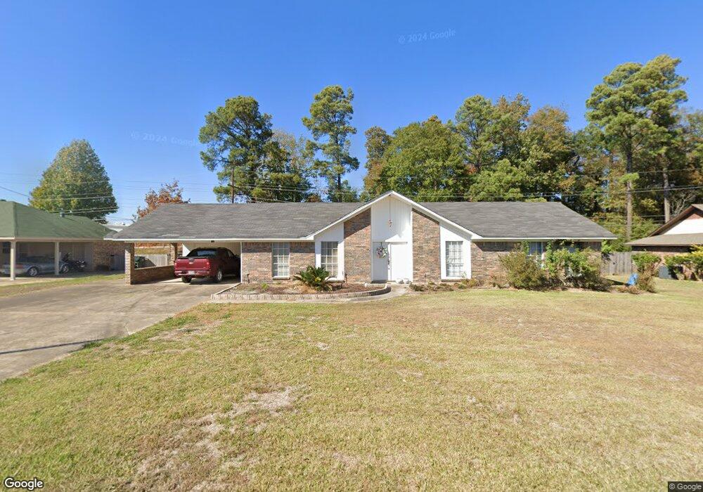
120 Hemlock Cir West Monroe, LA 71291
Estimated Value: $200,030 - $233,000
3
Beds
3
Baths
2,570
Sq Ft
$84/Sq Ft
Est. Value
About This Home
This home is located at 120 Hemlock Cir, West Monroe, LA 71291 and is currently estimated at $215,008, approximately $83 per square foot. 120 Hemlock Cir is a home located in Ouachita Parish with nearby schools including Boley Elementary School, Good Hope Middle School, and West Monroe High School.
Ownership History
Date
Name
Owned For
Owner Type
Purchase Details
Closed on
Oct 15, 2010
Sold by
The Wo And June B Risher Revocable Trust
Bought by
Person Charles Alfred and Person Barbara Jean
Current Estimated Value
Home Financials for this Owner
Home Financials are based on the most recent Mortgage that was taken out on this home.
Original Mortgage
$135,000
Outstanding Balance
$89,357
Interest Rate
4.41%
Mortgage Type
VA
Estimated Equity
$125,651
Create a Home Valuation Report for This Property
The Home Valuation Report is an in-depth analysis detailing your home's value as well as a comparison with similar homes in the area
Home Values in the Area
Average Home Value in this Area
Purchase History
| Date | Buyer | Sale Price | Title Company |
|---|---|---|---|
| Person Charles Alfred | $135,000 | Title West |
Source: Public Records
Mortgage History
| Date | Status | Borrower | Loan Amount |
|---|---|---|---|
| Open | Person Charles Alfred | $135,000 |
Source: Public Records
Tax History Compared to Growth
Tax History
| Year | Tax Paid | Tax Assessment Tax Assessment Total Assessment is a certain percentage of the fair market value that is determined by local assessors to be the total taxable value of land and additions on the property. | Land | Improvement |
|---|---|---|---|---|
| 2024 | $613 | $13,500 | $2,035 | $11,465 |
| 2023 | $552 | $13,500 | $2,035 | $11,465 |
| 2022 | $1,105 | $13,500 | $2,035 | $11,465 |
| 2021 | $1,105 | $13,500 | $2,035 | $11,465 |
| 2020 | $1,105 | $13,500 | $2,035 | $11,465 |
| 2019 | $1,083 | $13,500 | $2,035 | $11,465 |
| 2018 | $545 | $13,500 | $2,035 | $11,465 |
| 2017 | $1,082 | $13,500 | $2,035 | $11,465 |
| 2016 | $1,082 | $13,500 | $2,035 | $11,465 |
| 2015 | $543 | $13,500 | $2,035 | $11,465 |
| 2014 | $543 | $13,500 | $2,035 | $11,465 |
| 2013 | $541 | $13,500 | $2,035 | $11,465 |
Source: Public Records
Map
Nearby Homes
- 121 Hemlock Cir
- 0 Basic Dr
- 0 Basic Dr
- 204 Mcbeth Ave
- 0 Thomas Rd Unit 217370
- 106 Mcalpine Dr
- 304 Medorah Dr
- 399 Constitution Dr
- 1717 N 7th St
- 525 Thomas Rd
- 305 Mcmillan Rd
- 1311 Mcmillan Rd
- 1910 N 7th St
- 514 Commercial Pkwy
- 127 and 134 Nora St
- 114 Horne St
- 625 Commercial Pkwy
- 0 Cypress St Unit 198872
- 0 Cypress St Unit 207975
- 0 Cypress St Unit 201774
- 122 Hemlock Cir
- 118 Hemlock Cir
- 124 Hemlock Cir
- 116 Hemlock Cir
- 117 Hemlock Cir
- 123 Hemlock Cir
- 115 Hemlock Cir
- 114 Hemlock Cir
- 126 Hemlock Cir
- 106 Teakwood Dr
- 108 Teakwood Dr
- 104 Teakwood Dr
- 125 Hemlock Cir
- 110 Teakwood Dr
- 102 Teakwood Dr
- 113 Hemlock Cir
- 128 Hemlock Cir
- 112 Teakwood Dr
- 130 Hemlock Cir
- 100 Teakwood Dr