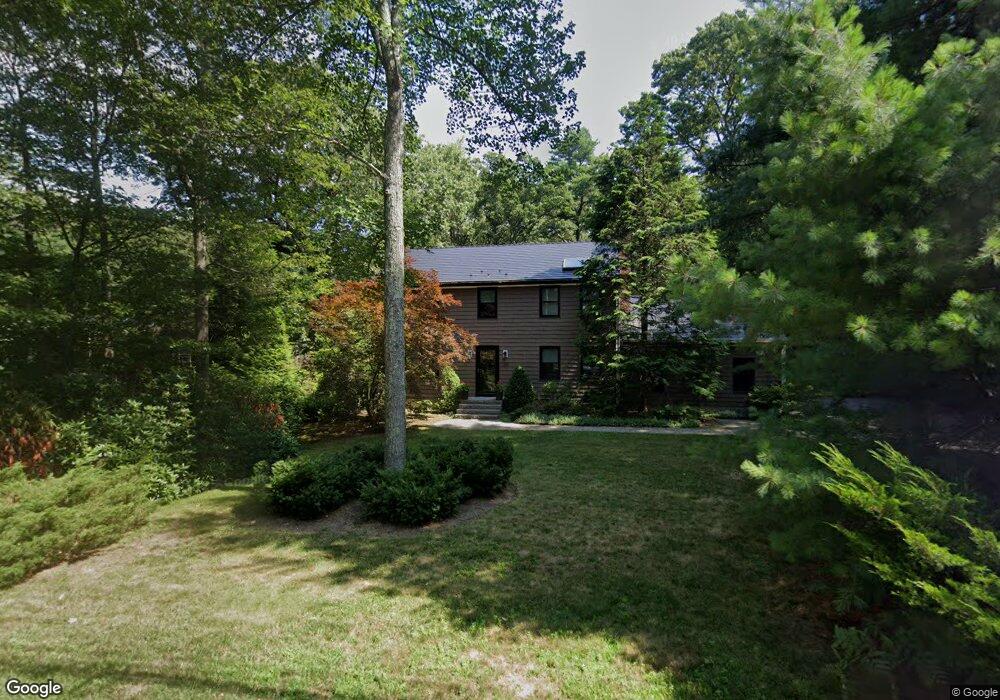
120 High Plain St Walpole, MA 02081
Estimated Value: $683,000 - $975,000
4
Beds
3
Baths
1,886
Sq Ft
$433/Sq Ft
Est. Value
About This Home
This home is located at 120 High Plain St, Walpole, MA 02081 and is currently estimated at $815,901, approximately $432 per square foot. 120 High Plain St is a home located in Norfolk County with nearby schools including Old Post Road School, Walpole Middle School, and Walpole High School.
Ownership History
Date
Name
Owned For
Owner Type
Purchase Details
Closed on
Jun 4, 2025
Sold by
Emilia Mancini T and Emilia Mancini
Bought by
Howe Sandra P and Howe Robert
Current Estimated Value
Purchase Details
Closed on
Jun 14, 2012
Sold by
Mancini Secondo and Mancini Emilia
Bought by
Emilia Mancini T and Emilia Mancini
Purchase Details
Closed on
Feb 28, 1997
Sold by
Hansen Assoc Inc
Bought by
Howe Robert and Howe Sandra
Home Financials for this Owner
Home Financials are based on the most recent Mortgage that was taken out on this home.
Original Mortgage
$50,000
Interest Rate
7.78%
Mortgage Type
Purchase Money Mortgage
Create a Home Valuation Report for This Property
The Home Valuation Report is an in-depth analysis detailing your home's value as well as a comparison with similar homes in the area
Home Values in the Area
Average Home Value in this Area
Purchase History
| Date | Buyer | Sale Price | Title Company |
|---|---|---|---|
| Howe Sandra P | -- | -- | |
| Howe Sandra P | -- | -- | |
| Emilia Mancini T | -- | -- | |
| Emilia Mancini T | -- | -- | |
| Howe Robert | $240,000 | -- | |
| Howe Robert | $240,000 | -- |
Source: Public Records
Mortgage History
| Date | Status | Borrower | Loan Amount |
|---|---|---|---|
| Previous Owner | Howe Robert | $50,000 |
Source: Public Records
Tax History
| Year | Tax Paid | Tax Assessment Tax Assessment Total Assessment is a certain percentage of the fair market value that is determined by local assessors to be the total taxable value of land and additions on the property. | Land | Improvement |
|---|---|---|---|---|
| 2025 | $8,814 | $687,000 | $288,300 | $398,700 |
| 2024 | $8,528 | $645,100 | $277,400 | $367,700 |
| 2023 | $8,246 | $593,700 | $241,100 | $352,600 |
| 2022 | $7,717 | $533,700 | $223,200 | $310,500 |
| 2021 | $7,589 | $511,400 | $210,500 | $300,900 |
| 2020 | $7,305 | $487,300 | $188,100 | $299,200 |
| 2019 | $7,018 | $464,800 | $180,800 | $284,000 |
| 2018 | $6,522 | $427,100 | $164,300 | $262,800 |
| 2017 | $6,342 | $413,700 | $158,000 | $255,700 |
| 2016 | $6,327 | $406,600 | $162,600 | $244,000 |
| 2015 | $5,818 | $370,600 | $137,800 | $232,800 |
| 2014 | $5,581 | $354,100 | $137,800 | $216,300 |
Source: Public Records
Map
Nearby Homes
- 486 Washington St
- 2 Kendall St
- 1 Providence Hwy
- 1 Palace Ct
- 224 School St Unit 9
- 222 School St Unit 9
- 56 North St
- 291 Plimpton St
- 881 Main St Unit 9
- 41 Gill St Unit A
- 37 Alice Ave
- Unit 11 Powder House Ln Unit 11
- 8 Powder House Ln Unit 2
- Unit 12 Powder House Ln Unit 12
- Unit 3 Powder House Ln Unit 3
- 635 Old Post Rd Unit 303
- 635 Old Post Rd Unit 302
- 1110 Main St
- 145 South St Unit 5
- 587 Common St
- 116 High Plain St
- 653 Washington St
- 106 High Plain St
- 645 Washington St
- 100 High Plain St
- 640 Washington St
- 640 Washington St
- 90 High Plain St
- 634 Washington St
- 680 Washington St Unit 3
- 688 Washington St Unit 4
- 680 Washington St Unit 1
- 680 Washington St
- 686 Washington St Unit 3
- 688 Washington St
- 686 Washington St Unit 4
- 686 Washington St
- 684 Washington St Unit 3
- 174 High Plain St
- 82 High Plain St
Your Personal Tour Guide
Ask me questions while you tour the home.