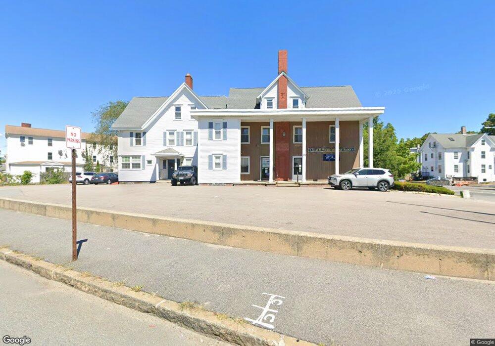
120 High St Taunton, MA 02780
City Center Neighborhood
--
Bed
--
Bath
5,745
Sq Ft
0.25
Acres
About This Home
This home is located at 120 High St, Taunton, MA 02780. 120 High St is a home located in Bristol County with nearby schools including H. H. Galligan School, Taunton High School, and John F. Parker Middle School.
Ownership History
Date
Name
Owned For
Owner Type
Purchase Details
Closed on
Aug 2, 2018
Sold by
Quinn Ft
Bought by
Binda Michael
Home Financials for this Owner
Home Financials are based on the most recent Mortgage that was taken out on this home.
Original Mortgage
$75,000
Outstanding Balance
$65,134
Interest Rate
4.5%
Mortgage Type
New Conventional
Purchase Details
Closed on
Oct 16, 2012
Sold by
Quinn Michael R and Quinn Terrence C
Bought by
Town Crier T and Quinn Terrence C
Purchase Details
Closed on
Jan 28, 2008
Sold by
Quinn Ft and Quinn Alice M
Bought by
Quinn Joseph I and Quinn Michael R
Create a Home Valuation Report for This Property
The Home Valuation Report is an in-depth analysis detailing your home's value as well as a comparison with similar homes in the area
Home Values in the Area
Average Home Value in this Area
Purchase History
| Date | Buyer | Sale Price | Title Company |
|---|---|---|---|
| Binda Michael | $100,000 | -- | |
| Town Crier T | -- | -- | |
| Quinn Joseph I | -- | -- |
Source: Public Records
Mortgage History
| Date | Status | Borrower | Loan Amount |
|---|---|---|---|
| Open | Binda Michael | $75,000 |
Source: Public Records
Tax History Compared to Growth
Tax History
| Year | Tax Paid | Tax Assessment Tax Assessment Total Assessment is a certain percentage of the fair market value that is determined by local assessors to be the total taxable value of land and additions on the property. | Land | Improvement |
|---|---|---|---|---|
| 2025 | -- | $760,900 | $186,000 | $574,900 |
| 2024 | -- | $735,100 | $186,000 | $549,100 |
| 2023 | $0 | $672,300 | $186,000 | $486,300 |
| 2022 | $0 | $596,200 | $174,200 | $422,000 |
| 2021 | $0 | $596,200 | $174,200 | $422,000 |
| 2020 | $0 | $501,500 | $139,400 | $362,100 |
| 2019 | $0 | $480,400 | $136,700 | $343,700 |
| 2018 | -- | $468,700 | $132,700 | $336,000 |
| 2017 | -- | $464,800 | $131,400 | $333,400 |
| 2016 | -- | $464,800 | $131,400 | $333,400 |
| 2015 | $7,855 | $439,900 | $137,000 | $302,900 |
| 2014 | $7,855 | $439,900 | $137,000 | $302,900 |
Source: Public Records
Map
Nearby Homes
- 48 Taunton Green
- 46 Harrison St Unit 4
- 19 Mason St
- 0, M64 L51 Knapp St
- 0 M64 L39 Knapp St
- 0, M64 L49 Knapp St
- 0, M64 L50 Knapp St
- 278 Cohannet St
- 98 Winthrop St
- 5 Dean Ave
- 16 Clinton St
- 48 Oak St
- 39 Myrtle St
- 31 Church Green Unit 303
- 72 Barnum St
- 16 Kilton St
- 215 High St Unit 21
- 215 High St Unit 20
- 132 Winthrop St
- 54 Adams St
- 47 Winthrop St
- 112 High St
- 112 High St Unit 2R
- 43 Winthrop St
- 108 High St
- 44 Winthrop St
- 44 Winthrop St Unit 1
- 44 Winthrop St Unit 2
- 44 Winthrop St Unit 3
- 41 Winthrop St Unit R
- 41 Winthrop St
- 104 High St
- 111 High St
- 42 Winthrop St Unit Winthrop st
- 42 Winthrop St Unit 1
- 42 Winthrop St Unit 3
- 125 High St Unit B
- 54 Winthrop St
- 100 High St
- 57 Winthrop St