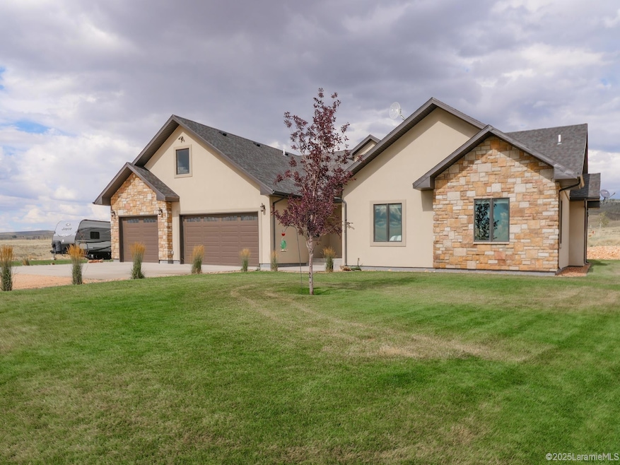
120 Katie Canyon Loop Laramie, WY 82072
Estimated payment $5,138/month
Highlights
- Popular Property
- 35.1 Acre Lot
- Ranch Style House
- Indian Paintbrush Elementary School Rated A-
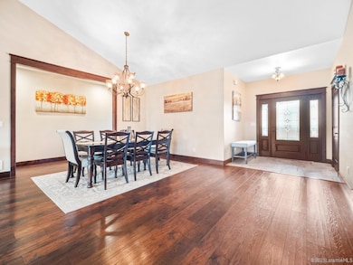
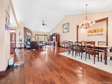
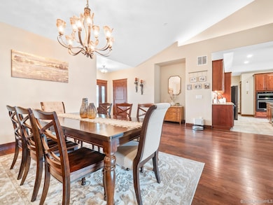
- Vaulted Ceiling
- Wood Flooring
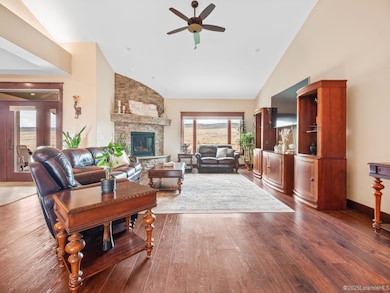
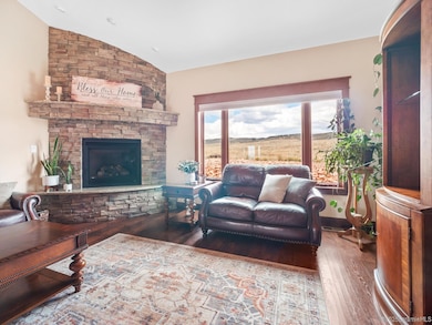
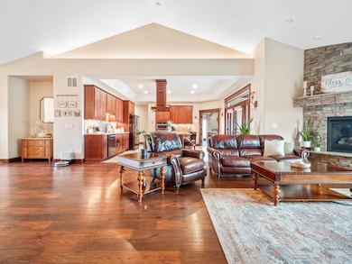
About This Home
Welcome to this 4-bedroom, 3-bathroom home where warmth and Wyoming charm meet everyday comfort. Step inside and you’ll immediately feel at home — the open floor plan connects the living, dining, and kitchen spaces so everything flows together, perfect for busy mornings, quiet nights, or gathering everyone around the table. Big windows bring in that Laramie light, and every finish feels warm and welcoming. The kitchen is ready for anything — weekday dinners or holiday spreads — with generous counter space, modern appliances, and room for everyone to pitch in. The private primary suite gives you a peaceful spot to unwind, while the additional bedrooms and bathrooms offer flexibility for guests, work, or play. And tucked above the garage is a hidden gem accessible by pull-down ladder — a one-of-a-kind space with endless possibilities. Whether you use it for creative projects, extra storage, or a quiet retreat, it’s a fun surprise that makes this home stand out. Step outside to enjoy a backyard built for Wyoming evenings — plenty of space for gardening, gathering, or just watching the sunset stretch across the sky. Comfort, charm, and a few unexpected touches — this home captures the feeling of Wyoming living, right where you want to be.
Home Details
Home Type
- Single Family
Est. Annual Taxes
- $4,533
Year Built
- Built in 2017
Lot Details
- 35.1 Acre Lot
- Landscaped
- Sprinkler System
- Hillside Location
HOA Fees
- $21 Monthly HOA Fees
Parking
- 3 Car Attached Garage
Home Design
- Ranch Style House
- Shingle Roof
- Stucco
Interior Spaces
- 3,510 Sq Ft Home
- Vaulted Ceiling
- Ceiling Fan
- Gas Fireplace
- French Doors
- Dining Area
- Bonus Room
- Wood Flooring
- Crawl Space
- Fire and Smoke Detector
- Laundry Room
Kitchen
- Built-In Double Oven
- Built-In Gas Range
- Microwave
- Dishwasher
- Granite Countertops
- Disposal
Bedrooms and Bathrooms
- 4 Bedrooms
- Walk-In Closet
- 3 Bathrooms
- Dual Sinks
- Hydromassage or Jetted Bathtub
- Separate Shower
Outdoor Features
- Covered Patio or Porch
- Storage Shed
Utilities
- Forced Air Heating and Cooling System
- Propane
Listing and Financial Details
- Exclusions: Washer and Dryer and freezer in the garage
Map
Home Values in the Area
Average Home Value in this Area
Tax History
| Year | Tax Paid | Tax Assessment Tax Assessment Total Assessment is a certain percentage of the fair market value that is determined by local assessors to be the total taxable value of land and additions on the property. | Land | Improvement |
|---|---|---|---|---|
| 2025 | $4,534 | $52,121 | $8,382 | $43,739 |
| 2024 | $4,534 | $66,673 | $10,746 | $55,927 |
| 2023 | $4,583 | $67,390 | $10,548 | $56,842 |
| 2022 | $4,089 | $60,139 | $10,507 | $49,632 |
| 2021 | $1,914 | $58,328 | $11,595 | $46,733 |
| 2020 | $3,773 | $55,480 | $11,373 | $44,107 |
| 2019 | $3,714 | $54,612 | $11,125 | $43,487 |
| 2018 | $1,914 | $28,147 | $10,691 | $17,456 |
| 2017 | $5 | $68 | $68 | $0 |
| 2015 | $4 | $61 | $61 | $0 |
| 2014 | $4 | $60 | $0 | $0 |
Property History
| Date | Event | Price | List to Sale | Price per Sq Ft |
|---|---|---|---|---|
| 10/25/2025 10/25/25 | For Sale | $899,000 | -- | $256 / Sq Ft |
Purchase History
| Date | Type | Sale Price | Title Company |
|---|---|---|---|
| Interfamily Deed Transfer | -- | First American Title |
Mortgage History
| Date | Status | Loan Amount | Loan Type |
|---|---|---|---|
| Closed | $424,100 | New Conventional |
Source: Laramie Board of REALTORS® MLS
MLS Number: 250719
APN: 05-1772-31-1-01-009.00
- 52 Domino Rd
- 94 Antelope Ave
- 292 Roger Canyon Rd
- 4324 Pueblo Dr
- 1772 Eaglecrest Ct
- TBD Hayford Ave
- 3734 Reynolds St
- 4106 Kiowa Dr
- 4222 E Grays Gable Rd
- 1615 Beaufort St
- 1058 Granito Dr
- 1071 Duna Dr
- 1515 Beaufort St
- 2611 Reynolds St Unit A
- 2167 N 16th St
- 2122 E Curtis St
- 1320 Beaufort St
- 1725 E Beaufort St
- 1554 Henry Dr
- 1520 W Hill Rd
