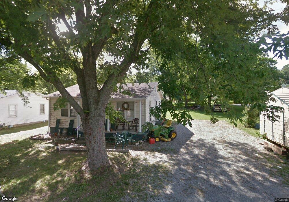
120 Lancaster Dr Hopkinsville, KY 42240
Estimated Value: $65,000 - $143,000
2
Beds
1
Bath
792
Sq Ft
$143/Sq Ft
Est. Value
About This Home
This home is located at 120 Lancaster Dr, Hopkinsville, KY 42240 and is currently estimated at $113,090, approximately $142 per square foot. 120 Lancaster Dr is a home located in Christian County with nearby schools including Freedom Elementary School.
Ownership History
Date
Name
Owned For
Owner Type
Purchase Details
Closed on
Jan 11, 2023
Sold by
Daniel Ronald E and Daniel Kathy L
Bought by
Earl Daniel Thomas
Current Estimated Value
Purchase Details
Closed on
Sep 27, 2022
Sold by
Moore Vivian S
Bought by
Hopkinsville & Christian County Landbank Auth
Purchase Details
Closed on
Aug 23, 2022
Sold by
Christian Circuit Court
Bought by
Rtlf-Ky Llc
Purchase Details
Closed on
Mar 16, 2004
Sold by
Grace Phillip
Bought by
Mashburn Glenn and Mashburn Edna
Home Financials for this Owner
Home Financials are based on the most recent Mortgage that was taken out on this home.
Original Mortgage
$42,075
Interest Rate
7.87%
Mortgage Type
Adjustable Rate Mortgage/ARM
Create a Home Valuation Report for This Property
The Home Valuation Report is an in-depth analysis detailing your home's value as well as a comparison with similar homes in the area
Home Values in the Area
Average Home Value in this Area
Purchase History
| Date | Buyer | Sale Price | Title Company |
|---|---|---|---|
| Earl Daniel Thomas | $156,175 | -- | |
| Hopkinsville & Christian County Landbank Auth | -- | -- | |
| Rtlf-Ky Llc | $542,410 | None Listed On Document | |
| Mashburn Glenn | $30,000 | None Available |
Source: Public Records
Mortgage History
| Date | Status | Borrower | Loan Amount |
|---|---|---|---|
| Previous Owner | Mashburn Glenn | $42,075 |
Source: Public Records
Tax History Compared to Growth
Tax History
| Year | Tax Paid | Tax Assessment Tax Assessment Total Assessment is a certain percentage of the fair market value that is determined by local assessors to be the total taxable value of land and additions on the property. | Land | Improvement |
|---|---|---|---|---|
| 2024 | $296 | $40,000 | $0 | $0 |
| 2023 | $311 | $40,000 | $0 | $0 |
| 2022 | $312 | $40,000 | $0 | $0 |
| 2021 | $315 | $40,000 | $0 | $0 |
| 2020 | $317 | $40,000 | $0 | $0 |
| 2019 | $319 | $40,000 | $0 | $0 |
| 2018 | $319 | $40,000 | $0 | $0 |
| 2017 | $314 | $40,000 | $0 | $0 |
| 2016 | $311 | $40,000 | $0 | $0 |
| 2015 | $600 | $40,000 | $0 | $0 |
| 2014 | $600 | $40,000 | $0 | $0 |
| 2013 | -- | $40,000 | $0 | $0 |
Source: Public Records
Map
Nearby Homes
- 107 Lancaster Dr
- 329 Pine Hill Dr
- 525 Highpoint Dr
- 247 Johnston Trace
- 600 Colonette Dr
- 0 Sanderson Dr
- 1405 Barberry Place
- 605 Colonelette Dr
- 601 Evergreen Park Dr
- 1409 Honeysuckle Dr
- 1412 Honeysuckle Dr
- 600 A Colonelette Dr
- 1413 Glass Ave
- 2210 Princeton Rd
- 1191 Emerson Cir
- 612 North Dr
- 151 N Mcpherson St
- 153 N Mcpherson St
- 119 N Fowler Ave
- 151 N Mcpherson Ave
- 118 Lancaster Dr
- 116 Lancaster Dr
- 108 N Saltsman Dr
- 504 Sanderson Dr
- 111 Lancaster Dr
- 102 N Saltsman Dr
- 500 Sanderson Dr
- 119 Lancaster Dr
- 109 Lancaster Dr
- 105 Lancaster Dr
- 505 Sanderson Dr
- 503 Sanderson Dr
- 501 Sanderson Dr
- 410 Sanderson Dr
- 620 Sanderson Dr
- 618 Sanderson Dr
- 616 Sanderson Dr
- 614 Sanderson Dr
- 608 Sanderson Dr
- 604 Sanderson Dr