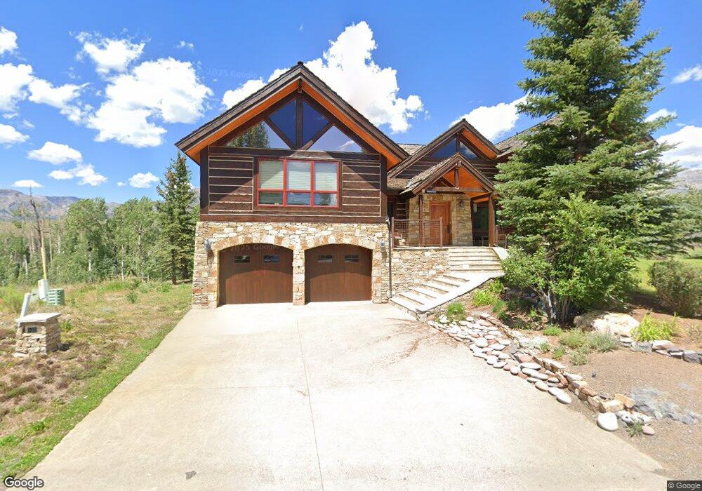
120 Lawson Point Unit 412 Telluride, CO 81435
Estimated Value: $5,296,101 - $6,985,000
4
Beds
5
Baths
4,482
Sq Ft
$1,402/Sq Ft
Est. Value
About This Home
This home is located at 120 Lawson Point Unit 412, Telluride, CO 81435 and is currently estimated at $6,282,275, approximately $1,401 per square foot. 120 Lawson Point Unit 412 is a home located in San Miguel County with nearby schools including Telluride Intermediate School, Telluride Middle School, and Telluride High School.
Ownership History
Date
Name
Owned For
Owner Type
Purchase Details
Closed on
Jul 13, 2007
Sold by
Ludwin Davdi M
Bought by
David M Ludwig
Current Estimated Value
Purchase Details
Closed on
Jan 22, 1998
Sold by
Rock Sales Co
Bought by
Ludwig David M
Purchase Details
Closed on
Jun 19, 1997
Sold by
Mccarthy William L Per Treasu
Bought by
Rock Sales Co
Purchase Details
Closed on
Dec 4, 1992
Sold by
Lander Corp and Lander Lincoln
Bought by
Mccarthy W
Purchase Details
Closed on
Nov 15, 1989
Sold by
Telluride Co
Bought by
Lander Corp
Create a Home Valuation Report for This Property
The Home Valuation Report is an in-depth analysis detailing your home's value as well as a comparison with similar homes in the area
Home Values in the Area
Average Home Value in this Area
Purchase History
| Date | Buyer | Sale Price | Title Company |
|---|---|---|---|
| David M Ludwig | -- | None Available | |
| Ludwig David M | $149,500 | -- | |
| Rock Sales Co | -- | -- | |
| Mccarthy W | $210,000 | -- | |
| Lander Corp | $2,400,000 | -- |
Source: Public Records
Tax History Compared to Growth
Tax History
| Year | Tax Paid | Tax Assessment Tax Assessment Total Assessment is a certain percentage of the fair market value that is determined by local assessors to be the total taxable value of land and additions on the property. | Land | Improvement |
|---|---|---|---|---|
| 2024 | $18,493 | $307,190 | $54,940 | $252,250 |
| 2023 | $17,673 | $310,160 | $55,470 | $254,690 |
| 2022 | $9,981 | $214,650 | $55,470 | $159,180 |
| 2021 | $10,285 | $192,550 | $24,310 | $168,240 |
| 2020 | $9,069 | $172,110 | $25,740 | $146,370 |
| 2019 | $9,010 | $172,110 | $25,740 | $146,370 |
| 2018 | $7,974 | $155,760 | $0 | $0 |
| 2017 | $7,286 | $155,760 | $27,000 | $128,760 |
| 2016 | $10,356 | $181,570 | $29,850 | $151,720 |
| 2015 | $10,151 | $181,570 | $29,850 | $151,720 |
| 2014 | $9,434 | $0 | $0 | $0 |
Source: Public Records
Map
Nearby Homes
- 0 Adams Way Unit 57R2 43661
- 0 Adams Way Unit 57R1 43640
- 0 Adams Way Unit AR54 43629
- 0 Lawson Unit AR25 43605
- 121 Adams Way
- 167 Adams Ranch Rd
- 134 Adams Way
- 316 Fairway Dr Unit 25
- 209 Knoll Estates Dr Unit 19
- 100 Eagle Dr
- 12 Eagle Dr
- 206 Society Dr
- 501 Society Dr Unit 3
- 566 Society Dr Unit 314
- 118 Alexander Overlook Unit SV141
- 102 Double Eagle Way
- 103 Double Eagle Way Unit 412
- 215 Double Eagle Dr Unit C-1
- 114 Arizona St Unit 27A
- 0 Arizona St Unit 810 B 43366
- 126 Lawson Point Unit AR24R
- 101 Lawson Point Unit 613 C-1
- 8 Lawson Point Unit 8
- Lot 8 Lawson Point Unit 8
- 118 Lawson Point Unit AR10
- 105 Lawson Point
- Lot AR25 Lawson Point
- 117 Adams Way Unit AR50
- 116 Lawson Point Unit F
- 115 Lawson Point Unit 412
- 113 Lawson Point Unit AR2
- 113 Lawson Point
- 117 Lawson Point
- 0 Adams Way Unit 57R2 43161
- 0 Adams Way Unit AR54 42668
- 0 Adams Way Unit AR53R2 35852
- 0 Adams Way Unit AR49 32041
- 0 Adams Way Unit AR52R 35853
- 0 Adams Way Unit AR55R2 32042
- 0 Adams Way Unit AR59 36602