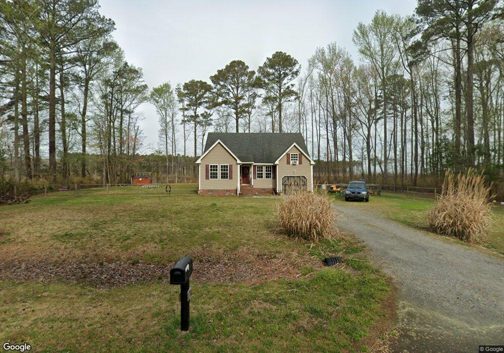
120 Longhorn Dr Moyock, NC 27958
Estimated Value: $307,000 - $357,000
3
Beds
2
Baths
1,345
Sq Ft
$245/Sq Ft
Est. Value
About This Home
This home is located at 120 Longhorn Dr, Moyock, NC 27958 and is currently estimated at $330,139, approximately $245 per square foot. 120 Longhorn Dr is a home located in Currituck County with nearby schools including Shawboro Elementary School, Moyock Middle School, and Currituck County High School.
Ownership History
Date
Name
Owned For
Owner Type
Purchase Details
Closed on
Apr 4, 2007
Sold by
Mack Scott M and Mack Melinda B
Bought by
Suthers Eddie H and Papa-Suthers Deborah L
Current Estimated Value
Home Financials for this Owner
Home Financials are based on the most recent Mortgage that was taken out on this home.
Original Mortgage
$246,039
Outstanding Balance
$148,762
Interest Rate
6.15%
Mortgage Type
FHA
Estimated Equity
$181,377
Create a Home Valuation Report for This Property
The Home Valuation Report is an in-depth analysis detailing your home's value as well as a comparison with similar homes in the area
Home Values in the Area
Average Home Value in this Area
Purchase History
| Date | Buyer | Sale Price | Title Company |
|---|---|---|---|
| Suthers Eddie H | $250,000 | None Available |
Source: Public Records
Mortgage History
| Date | Status | Borrower | Loan Amount |
|---|---|---|---|
| Open | Suthers Eddie H | $246,039 |
Source: Public Records
Tax History Compared to Growth
Tax History
| Year | Tax Paid | Tax Assessment Tax Assessment Total Assessment is a certain percentage of the fair market value that is determined by local assessors to be the total taxable value of land and additions on the property. | Land | Improvement |
|---|---|---|---|---|
| 2024 | $1,594 | $209,000 | $40,400 | $168,600 |
| 2023 | $1,595 | $209,000 | $40,400 | $168,600 |
| 2022 | $1,241 | $209,000 | $40,400 | $168,600 |
| 2021 | $1,233 | $145,700 | $30,300 | $115,400 |
| 2020 | $888 | $145,700 | $30,300 | $115,400 |
| 2019 | $888 | $145,700 | $30,300 | $115,400 |
| 2018 | $873 | $145,700 | $30,300 | $115,400 |
| 2017 | $837 | $145,700 | $30,300 | $115,400 |
| 2016 | $837 | $145,700 | $30,300 | $115,400 |
| 2015 | $837 | $145,700 | $30,300 | $115,400 |
Source: Public Records
Map
Nearby Homes
- 163 Saint Andrews Rd
- 106 Ryker Rd W
- 102 Ryker Rd W
- TBD Tulls Creek Rd
- 213 Iris Cir
- 307 Iris Cir Unit Lot 123
- 307 Iris Cir
- 309 Iris Cir
- 309 Iris Cir Unit Lot 124
- 120 Ryker Rd W
- 209 Eagle Creek Rd
- 111 Iris Cir
- 111 Iris Cir Unit Lot 28
- 212 Leif St
- The Lennox Plan at FOST
- The Brixton Plan at FOST
- The Kingston Plan at FOST
- The Jackson Plan at FOST
- The Remington Plan at FOST
- 102 Ryker Rd E