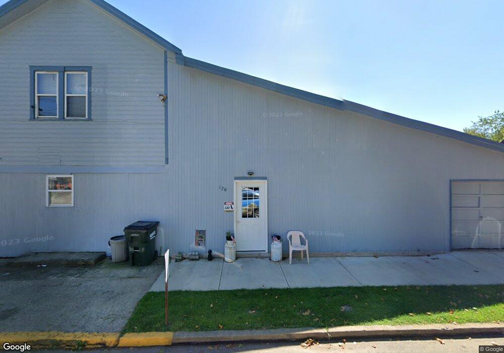
120 Main St Glenmont, OH 44628
Estimated Value: $74,000 - $112,000
--
Bed
2
Baths
1,944
Sq Ft
$45/Sq Ft
Est. Value
About This Home
This home is located at 120 Main St, Glenmont, OH 44628 and is currently estimated at $87,250, approximately $44 per square foot. 120 Main St is a home with nearby schools including West Holmes High School.
Ownership History
Date
Name
Owned For
Owner Type
Purchase Details
Closed on
Jun 20, 2014
Sold by
Aunt Farms Ltd
Bought by
Boughman James and Boughman Cindy
Current Estimated Value
Purchase Details
Closed on
Jul 15, 2002
Bought by
U-M Properties Limited
Purchase Details
Closed on
Jan 14, 2000
Bought by
Frenette Larry and Frenette Arnold
Purchase Details
Closed on
Jan 1, 1990
Bought by
Sprang Sprang R and Sprang Henderson
Create a Home Valuation Report for This Property
The Home Valuation Report is an in-depth analysis detailing your home's value as well as a comparison with similar homes in the area
Home Values in the Area
Average Home Value in this Area
Purchase History
| Date | Buyer | Sale Price | Title Company |
|---|---|---|---|
| Boughman James | $35,000 | Attorney | |
| U-M Properties Limited | $127,000 | -- | |
| Frenette Larry | $32,000 | -- | |
| Sprang Sprang R | -- | -- |
Source: Public Records
Tax History Compared to Growth
Tax History
| Year | Tax Paid | Tax Assessment Tax Assessment Total Assessment is a certain percentage of the fair market value that is determined by local assessors to be the total taxable value of land and additions on the property. | Land | Improvement |
|---|---|---|---|---|
| 2024 | $662 | $17,130 | $2,500 | $14,630 |
| 2023 | $631 | $17,130 | $2,500 | $14,630 |
| 2022 | $657 | $17,130 | $2,500 | $14,630 |
| 2021 | $759 | $15,140 | $2,710 | $12,430 |
| 2020 | $746 | $15,140 | $2,710 | $12,430 |
| 2019 | $733 | $15,140 | $2,710 | $12,430 |
| 2018 | $681 | $13,720 | $2,620 | $11,100 |
| 2017 | $682 | $13,720 | $2,620 | $11,100 |
| 2016 | $678 | $13,720 | $2,620 | $11,100 |
| 2015 | $672 | $13,210 | $2,320 | $10,890 |
| 2014 | $693 | $13,210 | $2,320 | $10,890 |
| 2013 | $356 | $13,210 | $2,320 | $10,890 |
Source: Public Records
Map
Nearby Homes
- 0 State Route 520
- 835 Depot St
- 839 Depot St
- 837 Depot St
- 2818 Township Road 29
- 4453 County Road 51
- 2580 County Road 75
- 0 County Road 75 Unit 5151290
- 1917 Township Road 26
- 10870 County Road 6
- 6070 Township Road 219
- 11771 Township Road 259
- 12427 Township Road 217
- 0 Township Road 54
- 12882 Ohio 39
- 5553 Township Road 260
- 5770 Township Road 276
- 5758 Township Road 276
- 15171 US Highway 62
- 15171 U S 62