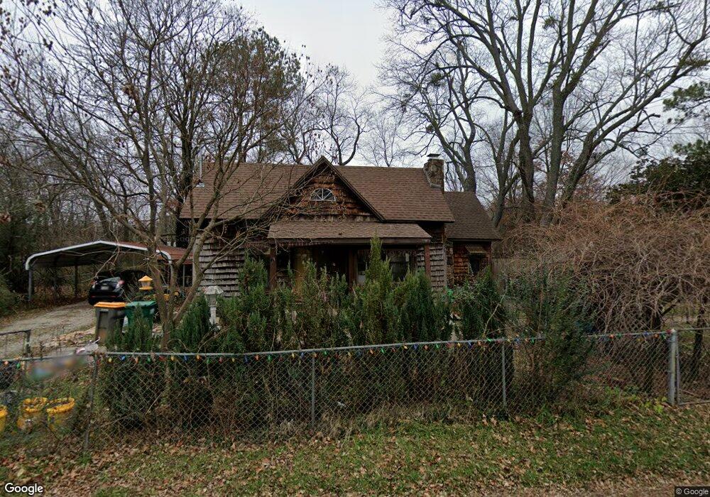
120 Maple Ave West Fork, AR 72774
Estimated Value: $181,000 - $243,000
1
Bed
1
Bath
1,081
Sq Ft
$197/Sq Ft
Est. Value
About This Home
This home is located at 120 Maple Ave, West Fork, AR 72774 and is currently estimated at $213,372, approximately $197 per square foot. 120 Maple Ave is a home located in Washington County with nearby schools including West Fork Elementary School, West Fork Middle School, and West Fork High School.
Ownership History
Date
Name
Owned For
Owner Type
Purchase Details
Closed on
Oct 5, 2021
Sold by
Engtand Lenore and Mitchell Elizabeth S
Bought by
Moraies Martin and Moraies Greace
Current Estimated Value
Home Financials for this Owner
Home Financials are based on the most recent Mortgage that was taken out on this home.
Original Mortgage
$140,000
Outstanding Balance
$127,390
Interest Rate
2.8%
Mortgage Type
New Conventional
Estimated Equity
$85,982
Purchase Details
Closed on
Nov 30, 2007
Sold by
Barnhart Darrin and Barnhart Darcy
Bought by
Mitchell Elizabeth
Home Financials for this Owner
Home Financials are based on the most recent Mortgage that was taken out on this home.
Original Mortgage
$122,000
Interest Rate
6.43%
Mortgage Type
Purchase Money Mortgage
Purchase Details
Closed on
Jun 15, 2005
Sold by
Linthicum Thomas L and Linthicum Patricia C
Bought by
Barnhart Darrin and Barnhart Darcy
Home Financials for this Owner
Home Financials are based on the most recent Mortgage that was taken out on this home.
Original Mortgage
$83,500
Interest Rate
5.78%
Mortgage Type
Fannie Mae Freddie Mac
Purchase Details
Closed on
Jan 1, 1985
Bought by
Eden Dorothy and Flannery Richard L
Create a Home Valuation Report for This Property
The Home Valuation Report is an in-depth analysis detailing your home's value as well as a comparison with similar homes in the area
Home Values in the Area
Average Home Value in this Area
Purchase History
| Date | Buyer | Sale Price | Title Company |
|---|---|---|---|
| Moraies Martin | $175,000 | Waco Title | |
| Mitchell Elizabeth | $90,000 | None Available | |
| Barnhart Darrin | $84,000 | Waco Title Company | |
| Eden Dorothy | -- | -- |
Source: Public Records
Mortgage History
| Date | Status | Borrower | Loan Amount |
|---|---|---|---|
| Open | Moraies Martin | $140,000 | |
| Previous Owner | Mitchell Elizabeth | $122,000 | |
| Previous Owner | Barnhart Darrin | $83,500 |
Source: Public Records
Tax History
| Year | Tax Paid | Tax Assessment Tax Assessment Total Assessment is a certain percentage of the fair market value that is determined by local assessors to be the total taxable value of land and additions on the property. | Land | Improvement |
|---|---|---|---|---|
| 2025 | $886 | $34,430 | $6,000 | $28,430 |
| 2024 | $918 | $34,430 | $6,000 | $28,430 |
| 2023 | $937 | $34,430 | $6,000 | $28,430 |
| 2022 | $922 | $24,420 | $3,000 | $21,420 |
| 2021 | $234 | $24,420 | $3,000 | $21,420 |
| 2020 | $922 | $24,420 | $3,000 | $21,420 |
| 2019 | $605 | $18,450 | $3,000 | $15,450 |
| 2018 | $620 | $18,450 | $3,000 | $15,450 |
| 2017 | $602 | $18,450 | $3,000 | $15,450 |
| 2016 | $602 | $18,450 | $3,000 | $15,450 |
| 2015 | $602 | $18,450 | $3,000 | $15,450 |
| 2014 | $313 | $12,840 | $2,800 | $10,040 |
Source: Public Records
Map
Nearby Homes
- 224 Maple Ave
- 0000 Highway 170
- 185 Wheeler St
- 0 W Smith St Unit 1334508
- 327 W Smith St
- 385 W Smith St
- 365 W Smith St
- 353 W Smith St
- 222 Rivendale Dr
- 503 Clark Ave
- 338 Hidden Creek Place
- 67 S Red Oak Ave
- 846 James Place
- 815 James Place
- 260 Culp Trail
- 13582 S Highway 170
- 696 E Thornstone Ave
- 13653 W Mountain Rd
Your Personal Tour Guide
Ask me questions while you tour the home.