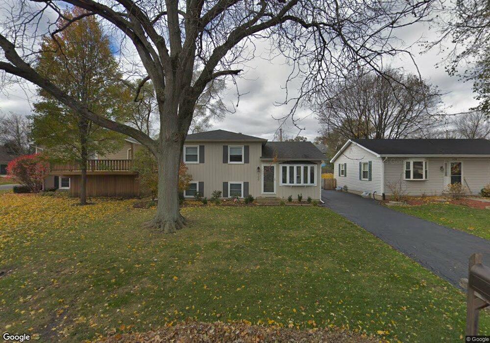
120 Maple Ct Geneva, IL 60134
Northwest Central Geneva NeighborhoodEstimated Value: $345,908 - $389,000
3
Beds
2
Baths
1,500
Sq Ft
$250/Sq Ft
Est. Value
About This Home
This home is located at 120 Maple Ct, Geneva, IL 60134 and is currently estimated at $374,727, approximately $249 per square foot. 120 Maple Ct is a home located in Kane County with nearby schools including Williamsburg Elementary School, Geneva Community High School, and St. Peter School.
Ownership History
Date
Name
Owned For
Owner Type
Purchase Details
Closed on
Nov 19, 2020
Sold by
Courtin Alan
Bought by
Courtin Alan and Adams Courtin Heather
Current Estimated Value
Purchase Details
Closed on
Jul 11, 2001
Sold by
Arensmeier Mark D and Arensmeier Cindy M
Bought by
Courtin Alan
Home Financials for this Owner
Home Financials are based on the most recent Mortgage that was taken out on this home.
Original Mortgage
$137,600
Outstanding Balance
$53,528
Interest Rate
7.27%
Estimated Equity
$321,199
Create a Home Valuation Report for This Property
The Home Valuation Report is an in-depth analysis detailing your home's value as well as a comparison with similar homes in the area
Home Values in the Area
Average Home Value in this Area
Purchase History
| Date | Buyer | Sale Price | Title Company |
|---|---|---|---|
| Courtin Alan | -- | First American Title Ins Co | |
| Courtin Alan | $172,000 | Fox Title Company |
Source: Public Records
Mortgage History
| Date | Status | Borrower | Loan Amount |
|---|---|---|---|
| Open | Courtin Alan | $137,600 |
Source: Public Records
Tax History
| Year | Tax Paid | Tax Assessment Tax Assessment Total Assessment is a certain percentage of the fair market value that is determined by local assessors to be the total taxable value of land and additions on the property. | Land | Improvement |
|---|---|---|---|---|
| 2024 | $5,849 | $84,870 | $18,872 | $65,998 |
| 2023 | $5,673 | $77,154 | $17,156 | $59,998 |
| 2022 | $5,485 | $71,691 | $15,941 | $55,750 |
| 2021 | $5,316 | $69,027 | $15,349 | $53,678 |
| 2020 | $5,251 | $67,974 | $15,115 | $52,859 |
| 2019 | $5,233 | $66,687 | $14,829 | $51,858 |
| 2018 | $4,876 | $62,630 | $14,829 | $47,801 |
| 2017 | $4,814 | $60,960 | $14,434 | $46,526 |
| 2016 | $4,589 | $57,387 | $11,722 | $45,665 |
| 2015 | -- | $54,561 | $11,145 | $43,416 |
| 2014 | -- | $54,561 | $11,145 | $43,416 |
| 2013 | -- | $59,071 | $11,145 | $47,926 |
Source: Public Records
Map
Nearby Homes
- 1736 Kaneville Rd
- 301 Country Club Place
- 369 Fritz Ln
- 629 N Lincoln Ave
- 525 Bradbury Ln Unit 525
- 544 Bradbury Ln Unit 544
- 1949 Gary Ln
- 524 Bradbury Ln
- 640 Anderson Blvd
- 2300 Kaneville Rd
- 718 North St
- 2250 South St
- 518 Illinois St
- 422 Hamilton St
- 2187 Vanderbilt Dr
- 632 Illinois St
- 549 Bloomfield Cir
- 1334 S 5th St
- 804 Dow Ave
- 629 Peck Rd
Your Personal Tour Guide
Ask me questions while you tour the home.