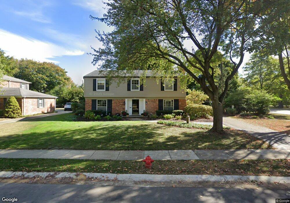
120 N Glenhurst Dr Bloomfield Hills, MI 48301
Estimated Value: $710,826 - $898,000
4
Beds
3
Baths
2,545
Sq Ft
$323/Sq Ft
Est. Value
About This Home
This home is located at 120 N Glenhurst Dr, Bloomfield Hills, MI 48301 and is currently estimated at $820,957, approximately $322 per square foot. 120 N Glenhurst Dr is a home located in Oakland County with nearby schools including Quarton Elementary, Derby Middle School, and Ernest W. Seaholm High School.
Ownership History
Date
Name
Owned For
Owner Type
Purchase Details
Closed on
Oct 15, 2015
Sold by
Lavens Karen
Bought by
Lavens Robert and Lavens Karen
Current Estimated Value
Purchase Details
Closed on
Aug 4, 2004
Sold by
Beardman Sharon L
Bought by
Prudential Residential Services Lp and Prudential Homes Corp
Purchase Details
Closed on
Sep 13, 2002
Sold by
Fitzsimmons Marion S
Bought by
Beardman Sharon L
Create a Home Valuation Report for This Property
The Home Valuation Report is an in-depth analysis detailing your home's value as well as a comparison with similar homes in the area
Home Values in the Area
Average Home Value in this Area
Purchase History
| Date | Buyer | Sale Price | Title Company |
|---|---|---|---|
| Lavens Robert | -- | Attorney | |
| Prudential Residential Services Lp | $425,000 | Metropolitan | |
| Beardman Sharon L | $425,000 | -- |
Source: Public Records
Tax History Compared to Growth
Tax History
| Year | Tax Paid | Tax Assessment Tax Assessment Total Assessment is a certain percentage of the fair market value that is determined by local assessors to be the total taxable value of land and additions on the property. | Land | Improvement |
|---|---|---|---|---|
| 2024 | $3,630 | $272,780 | $0 | $0 |
| 2023 | $3,484 | $243,810 | $0 | $0 |
| 2022 | $6,143 | $226,770 | $0 | $0 |
| 2021 | $6,194 | $233,660 | $0 | $0 |
| 2020 | $3,347 | $229,490 | $0 | $0 |
| 2019 | $6,176 | $224,700 | $0 | $0 |
| 2018 | $6,110 | $215,350 | $0 | $0 |
| 2017 | $6,110 | $210,210 | $0 | $0 |
| 2016 | $6,145 | $204,510 | $0 | $0 |
| 2015 | -- | $195,080 | $0 | $0 |
| 2014 | -- | $177,070 | $0 | $0 |
| 2011 | -- | $129,230 | $0 | $0 |
Source: Public Records
Map
Nearby Homes
- 120 Westchester Way
- 345 Kimberly St
- 1834 Fairview St
- 394 S Glenhurst Dr
- 1882 Melbourne St
- 520 Pleasant St
- 222 Arlington St
- 586 Fairfax St
- 695 Westchester Way
- 397 S Cranbrook Rd
- 956 Westwood Dr
- 2579 Amberly Rd
- 1019 N Cranbrook Rd
- 329 Linden Rd
- 999 Pleasant Ave
- 1120 Lyonhurst St
- 1057 Arlington St
- 633 Hawthorne St
- 1777 Fairway Dr
- 786 S Cranbrook Rd
- 140 N Glenhurst Dr
- 166 N Glenhurst Dr
- 125 S Glenhurst Dr
- 169 N Glenhurst Dr
- 2048 W Maple Rd
- 188 N Glenhurst Dr
- 189 N Glenhurst Dr
- 168 Westwood Dr
- 145 S Glenhurst Dr
- 142 Westchester Way
- 210 N Glenhurst Dr
- 130 Argyle St Unit Bldg-Unit
- 130 Argyle St
- 211 N Glenhurst Dr
- 161 S Glenhurst Dr
- 186 Westwood Dr
- 164 Westchester Way
- 2117 W Maple Rd
- 212 Westwood Dr Unit Bldg-Unit
- 212 Westwood Dr