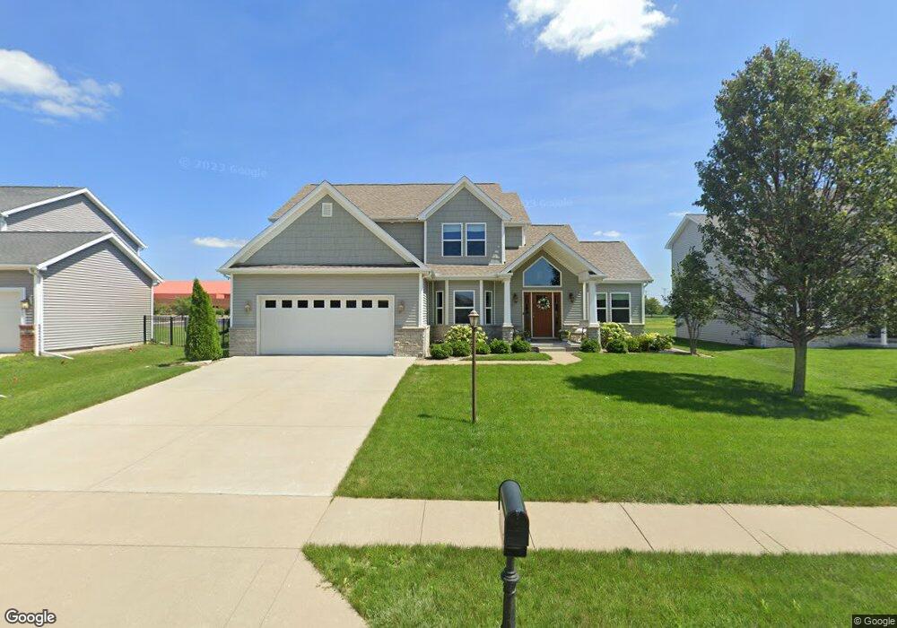
120 N Rhode Island Ave Morton, IL 61550
Estimated Value: $462,000 - $531,000
5
Beds
4
Baths
3,622
Sq Ft
$137/Sq Ft
Est. Value
About This Home
This home is located at 120 N Rhode Island Ave, Morton, IL 61550 and is currently estimated at $494,657, approximately $136 per square foot. 120 N Rhode Island Ave is a home located in Tazewell County with nearby schools including Morton High School, Blessed Sacrament School, and Bethel Lutheran School.
Ownership History
Date
Name
Owned For
Owner Type
Purchase Details
Closed on
Feb 15, 2013
Sold by
Armstrong Builders Of Peoria Inc
Bought by
Winter Gene C and Winter Lindsay M
Current Estimated Value
Home Financials for this Owner
Home Financials are based on the most recent Mortgage that was taken out on this home.
Original Mortgage
$356,250
Interest Rate
3.3%
Mortgage Type
New Conventional
Purchase Details
Closed on
Jun 30, 2010
Sold by
Ak Morton Development Llc
Bought by
Fieldstone Morton Llc
Create a Home Valuation Report for This Property
The Home Valuation Report is an in-depth analysis detailing your home's value as well as a comparison with similar homes in the area
Home Values in the Area
Average Home Value in this Area
Purchase History
| Date | Buyer | Sale Price | Title Company |
|---|---|---|---|
| Winter Gene C | $375,500 | None Available | |
| Armstrong Builders Of Peoria Inc | -- | None Available | |
| Fieldstone Morton Llc | $66,000 | None Available |
Source: Public Records
Mortgage History
| Date | Status | Borrower | Loan Amount |
|---|---|---|---|
| Previous Owner | Winter Gene C | $356,250 |
Source: Public Records
Tax History Compared to Growth
Tax History
| Year | Tax Paid | Tax Assessment Tax Assessment Total Assessment is a certain percentage of the fair market value that is determined by local assessors to be the total taxable value of land and additions on the property. | Land | Improvement |
|---|---|---|---|---|
| 2024 | $10,811 | $158,240 | $24,690 | $133,550 |
| 2023 | $10,811 | $147,420 | $23,000 | $124,420 |
| 2022 | $10,455 | $135,380 | $21,120 | $114,260 |
| 2021 | $10,057 | $130,180 | $20,310 | $109,870 |
| 2020 | $9,749 | $128,890 | $20,110 | $108,780 |
| 2019 | $9,723 | $128,890 | $20,110 | $108,780 |
| 2018 | $9,545 | $128,890 | $20,110 | $108,780 |
| 2017 | $9,298 | $122,900 | $19,170 | $103,730 |
| 2016 | $9,119 | $122,900 | $19,170 | $103,730 |
| 2015 | $8,803 | $0 | $0 | $0 |
| 2013 | $5,294 | $122,900 | $19,170 | $103,730 |
Source: Public Records
Map
Nearby Homes
- 1043 E Jefferson St
- 329 Pocono Ave
- 314 N Oklahoma Ave
- 1021 E Madison St
- 353 Pocono Ave
- 519 Ohio Ct
- 430 N Montana Ave
- 300 S Kansas Ave
- 324 S Kansas Ave
- 1414 S Missouri Ave
- 517 E Tyler St
- 754 Taylor St
- 505 E Tyler St
- 501-503 Pierce St
- 324 N 2nd Ave
- 360 E Edgewood St
- 452 N Bauman Ave
- 392 E Forestwood St
- 428 N Bauman Ave
- 315 E Birchwood St
- 114 N Rhode Island Ave
- 126 N Rhode Island Ave
- 108 N Rhode Island Ave
- 132 N Rhode Island Ave
- 87 Warwick Cir
- 15 Warwick Cir
- 100 N Rhode Island Ave
- 200 N Rhode Island Ave
- 1201 E Jefferson St
- 16 Warwick Cir
- 88 Warwick Cir
- 81 Warwick Cir
- 206 N Rhode Island Ave
- 82 Warwick Cir
- 22 Warwick Cir
- 1278 E Monroe St
- 27 Warwick Cir
- 75 Warwick Cir