Estimated Value: $1,284,000 - $1,678,000
--
Bed
--
Bath
14,364
Sq Ft
$106/Sq Ft
Est. Value
About This Home
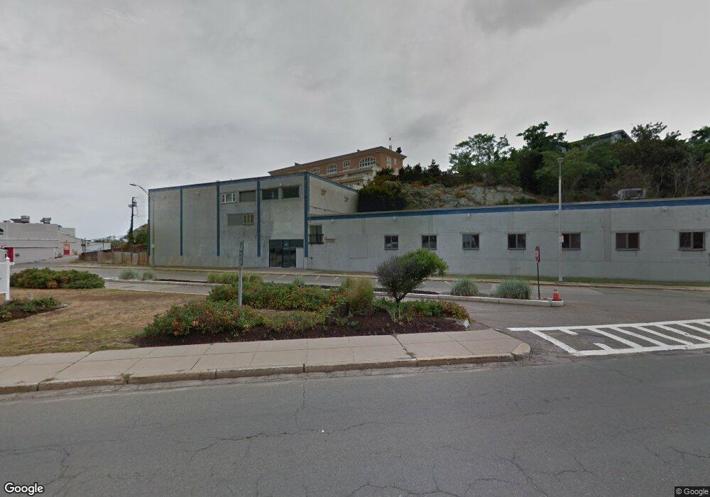
This home is located at 120 Nantasket Ave, Hull, MA 02045 and is currently estimated at $1,523,352, approximately $106 per square foot. 120 Nantasket Ave is a home located in Plymouth County with nearby schools including Lillian M. Jacobs Elementary School, Memorial Middle School, and Hull High School.
Ownership History
Date
Name
Owned For
Owner Type
Purchase Details
Closed on
Aug 15, 2022
Sold by
Latitude 42 Re Llc
Bought by
120 Nantasket Avenue Llc
Current Estimated Value
Purchase Details
Closed on
Dec 20, 2019
Sold by
D J & Nick Enterprises Llc
Bought by
Latitude 42 Real Estate
Purchase Details
Closed on
Sep 28, 2010
Sold by
Miroj Llc
Bought by
Hanflig Jay I and Hanflig Robert A
Purchase Details
Closed on
Dec 13, 2006
Sold by
Ait Rt and Nardo
Bought by
Miroj Llc
Create a Home Valuation Report for This Property
The Home Valuation Report is an in-depth analysis detailing your home's value as well as a comparison with similar homes in the area
Home Values in the Area
Average Home Value in this Area
Purchase History
| Date | Buyer | Sale Price | Title Company |
|---|---|---|---|
| 120 Nantasket Avenue Llc | $1,450,000 | None Available | |
| Latitude 42 Real Estate | $900,000 | None Available | |
| Hanflig Jay I | -- | -- | |
| D J & Nick Ent Llc | -- | -- | |
| Hanflig Jay I | -- | -- | |
| Miroj Llc | $1,250,000 | -- | |
| Miroj Llc | $1,250,000 | -- |
Source: Public Records
Tax History Compared to Growth
Tax History
| Year | Tax Paid | Tax Assessment Tax Assessment Total Assessment is a certain percentage of the fair market value that is determined by local assessors to be the total taxable value of land and additions on the property. | Land | Improvement |
|---|---|---|---|---|
| 2025 | $19,877 | $1,774,700 | $1,601,400 | $173,300 |
| 2024 | $16,098 | $1,381,800 | $761,100 | $620,700 |
| 2023 | $13,136 | $1,079,400 | $622,800 | $456,600 |
| 2022 | $11,015 | $878,400 | $395,400 | $483,000 |
| 2021 | $11,449 | $902,900 | $395,400 | $507,500 |
| 2020 | $6,291 | $490,700 | $369,000 | $121,700 |
| 2019 | $6,224 | $476,900 | $359,800 | $117,100 |
| 2018 | $6,201 | $452,000 | $342,700 | $109,300 |
| 2017 | $6,201 | $452,000 | $342,700 | $109,300 |
| 2016 | $6,093 | $452,000 | $342,700 | $109,300 |
| 2015 | $6,283 | $450,700 | $342,700 | $108,000 |
| 2014 | $6,251 | $450,700 | $342,700 | $108,000 |
Source: Public Records
Map
Nearby Homes
- 121 Nantasket Ave Unit 503
- 20 Rockland House Rd Unit 203
- 25 Oceanside Dr
- 62 Oceanside Dr
- 4 Atherton Rd
- 6 State Park Rd Unit 2
- 22 Berkley Rd Unit B
- 22 Berkley Rd Unit C
- 23 Wyola Rd
- 54 Salisbury St Waterfront
- 321 Rockland St
- 6 Grace Dr
- 10 Ocean Ledge Dr
- 45 Ocean Ledge Dr
- 10 Chestnut Place
- 166 Hull St
- 134 Hampton Cir
- 127 Hampton Cir
- 15 Lincoln Ave
- 114 Hull St
- 120 Nantasket Ave Unit 304
- 120 Nantasket Ave Unit PH5
- 120 Nantasket Ave Unit PH3
- 120 Nantasket Ave Unit 201
- 120 Nantasket Ave Unit PH2
- 42 State Park Rd
- 1 Longbeach Ave Unit 404
- 1 Longbeach Ave Unit 403
- 1 Longbeach Ave Unit 402
- 1 Longbeach Ave Unit 401
- 1 Longbeach Ave Unit 304
- 1 Longbeach Ave Unit 303
- 1 Longbeach Ave Unit 301
- 1 Longbeach Ave Unit 204
- 1 Longbeach Ave Unit 203
- 1 Longbeach Ave Unit 202
- 1 Longbeach Ave Unit 201
- 1 Longbeach Ave Unit 104
- 1 Longbeach Ave Unit 103
- 1 Longbeach Ave Unit 102