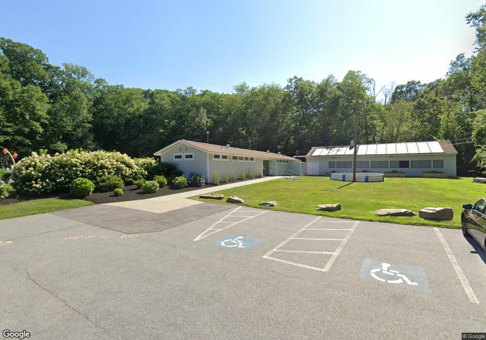
120 Parker Rd Framingham, MA 01702
Estimated Value: $1,461,700
--
Bed
--
Bath
3,168
Sq Ft
$461/Sq Ft
Est. Value
About This Home
This home is located at 120 Parker Rd, Framingham, MA 01702 and is currently estimated at $1,461,700, approximately $461 per square foot. 120 Parker Rd is a home located in Middlesex County with nearby schools including Framingham High School, Pincushion Hill Montessori School, and Summit Montessori School.
Ownership History
Date
Name
Owned For
Owner Type
Purchase Details
Closed on
Jul 17, 2013
Sold by
Jewish Community Cente
Bought by
Metrowest Ymca Inc
Current Estimated Value
Purchase Details
Closed on
Dec 13, 2001
Sold by
Clearbrook Swim Club
Bought by
Jewish Community Ctrs
Purchase Details
Closed on
Dec 19, 1994
Sold by
Baron Joseph A
Bought by
Rock Joseph E and Macpherson-Rock Jennie
Home Financials for this Owner
Home Financials are based on the most recent Mortgage that was taken out on this home.
Original Mortgage
$126,000
Interest Rate
9.03%
Mortgage Type
Commercial
Create a Home Valuation Report for This Property
The Home Valuation Report is an in-depth analysis detailing your home's value as well as a comparison with similar homes in the area
Home Values in the Area
Average Home Value in this Area
Purchase History
| Date | Buyer | Sale Price | Title Company |
|---|---|---|---|
| Metrowest Ymca Inc | $675,000 | -- | |
| Metrowest Ymca Inc | $675,000 | -- | |
| Jewish Community Ctrs | $150,000 | -- | |
| Rock Joseph E | $209,000 | -- |
Source: Public Records
Mortgage History
| Date | Status | Borrower | Loan Amount |
|---|---|---|---|
| Previous Owner | Rock Joseph E | $40,000 | |
| Previous Owner | Rock Joseph E | $167,000 | |
| Previous Owner | Rock Joseph E | $126,000 | |
| Previous Owner | Rock Joseph E | $94,000 |
Source: Public Records
Tax History Compared to Growth
Tax History
| Year | Tax Paid | Tax Assessment Tax Assessment Total Assessment is a certain percentage of the fair market value that is determined by local assessors to be the total taxable value of land and additions on the property. | Land | Improvement |
|---|---|---|---|---|
| 2025 | -- | $1,922,900 | $1,214,900 | $708,000 |
| 2024 | -- | $1,525,500 | $1,221,700 | $303,800 |
| 2023 | $0 | $1,414,100 | $1,111,100 | $303,000 |
| 2022 | $0 | $1,297,800 | $1,009,300 | $288,500 |
| 2021 | $0 | $1,284,100 | $1,009,300 | $274,800 |
| 2020 | $0 | $1,333,000 | $1,009,300 | $323,700 |
| 2019 | $0 | $1,258,600 | $965,400 | $293,200 |
| 2018 | $0 | $1,012,200 | $633,400 | $378,800 |
| 2017 | -- | $1,029,200 | $633,400 | $395,800 |
| 2016 | -- | $873,100 | $668,200 | $204,900 |
| 2015 | -- | $873,100 | $668,200 | $204,900 |
Source: Public Records
Map
Nearby Homes
- 3 Mccarthy Cir
- 43 Oregon Rd
- 0 Oregon Rd
- 8 Pilgrim Rd
- 45 Gates St
- 1550 Worcester Rd Unit 621
- 1550 Worcester Rd Unit 101
- 0 Oak St
- 1500 Worcester Rd Unit 202
- 1500 Worcester Rd Unit 502
- 1500 Worcester Rd Unit 215
- 1500 Worcester Rd Unit 624
- 1500 Worcester Rd Unit 217
- 1 Blueberry Ln
- 21 William Onthank Ln
- 1022 Pleasant St
- 38 William Onthank Ln
- 61-65 Turnpike
- 40 William Onthank Ln
- 2 High Ridge Rd