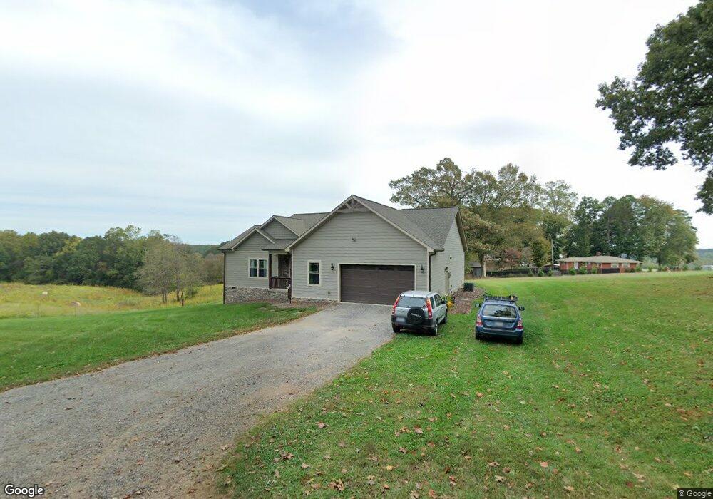
120 Porter Farm Dr Statesville, NC 28625
Estimated Value: $308,000 - $787,000
3
Beds
2
Baths
3,025
Sq Ft
$152/Sq Ft
Est. Value
About This Home
This home is located at 120 Porter Farm Dr, Statesville, NC 28625 and is currently estimated at $461,152, approximately $152 per square foot. 120 Porter Farm Dr is a home with nearby schools including Cool Spring Elementary School, East Iredell Middle School, and North Iredell High School.
Ownership History
Date
Name
Owned For
Owner Type
Purchase Details
Closed on
Aug 19, 2016
Sold by
Beaty Christopher N and Beaty Melissa S
Bought by
Andreson Sandra Green
Current Estimated Value
Purchase Details
Closed on
Nov 26, 2013
Sold by
Patricia L Porter Living Trust
Bought by
Beaty Christopher N and Beaty Melissa A
Purchase Details
Closed on
Jun 26, 2011
Sold by
Porter Patricia L
Bought by
Engle Sheryl
Purchase Details
Closed on
Jul 1, 1990
Sold by
Porter Patricia L
Bought by
Porter Patricia L
Purchase Details
Closed on
Jun 1, 1961
Create a Home Valuation Report for This Property
The Home Valuation Report is an in-depth analysis detailing your home's value as well as a comparison with similar homes in the area
Home Values in the Area
Average Home Value in this Area
Purchase History
| Date | Buyer | Sale Price | Title Company |
|---|---|---|---|
| Andreson Sandra Green | $15,000 | None Available | |
| Beaty Christopher N | $120,000 | None Available | |
| Engle Sheryl | -- | -- | |
| Porter Patricia L | -- | -- | |
| -- | $600 | -- |
Source: Public Records
Tax History Compared to Growth
Tax History
| Year | Tax Paid | Tax Assessment Tax Assessment Total Assessment is a certain percentage of the fair market value that is determined by local assessors to be the total taxable value of land and additions on the property. | Land | Improvement |
|---|---|---|---|---|
| 2024 | $1,557 | $253,690 | $11,600 | $242,090 |
| 2023 | $1,557 | $253,690 | $11,600 | $242,090 |
| 2022 | $1,267 | $192,400 | $11,600 | $180,800 |
| 2021 | $1,263 | $192,400 | $11,600 | $180,800 |
| 2020 | $1,263 | $192,400 | $11,600 | $180,800 |
| 2019 | $1,244 | $192,400 | $11,600 | $180,800 |
| 2018 | $1,056 | $167,980 | $11,600 | $156,380 |
| 2017 | $113 | $18,960 | $8,880 | $10,080 |
| 2016 | $113 | $18,960 | $8,880 | $10,080 |
| 2015 | -- | $18,960 | $8,880 | $10,080 |
| 2014 | -- | $20,470 | $8,880 | $11,590 |
Source: Public Records
Map
Nearby Homes
- 190 Campground Rd
- 00000 Garden Valley Rd
- 146 Coolwood Dr
- 304 Deerchase Cir
- 274 Deerchase Cir
- 311 Society Rd
- 157 Poplar Leaf Ln Unit 10
- 118 Swan Park Ln Unit 25
- Plan 2505 at Swann Hills
- Plan 2328 at Swann Hills
- Plan 3210 at Swann Hills
- Plan 2906 at Swann Hills
- Plan 2700 at Swann Hills
- Plan 3119 at Swann Hills
- Plan 3130 at Swann Hills
- Plan 3040 at Swann Hills
- Plan 3629 at Swann Hills
- Plan 2239 at Swann Hills
- Plan 2620 at Swann Hills
- Plan 3327 at Swann Hills
- 112 Porter Farm Dr
- 2215 Mocksville Hwy
- 107 Porter Farm Dr
- 2229 Mocksville Hwy
- 2249 Mocksville Hwy
- 2200 Mocksville Hwy
- 162 Porter Farm Dr
- 2157 Mocksville Hwy
- 2148 Mocksville Hwy
- 2143 Mocksville Hwy
- 147 Harper Dr
- 133 Harper Dr
- 133 Harper Dr
- 2135 Mocksville Hwy
- 2141 Mocksville Hwy
- 2134 Mocksville Hwy
- 196 Porter Farm Dr Unit 202
- 196 Porter Farm Dr
- 2293 Mocksville Hwy
- 2129 Mocksville Hwy