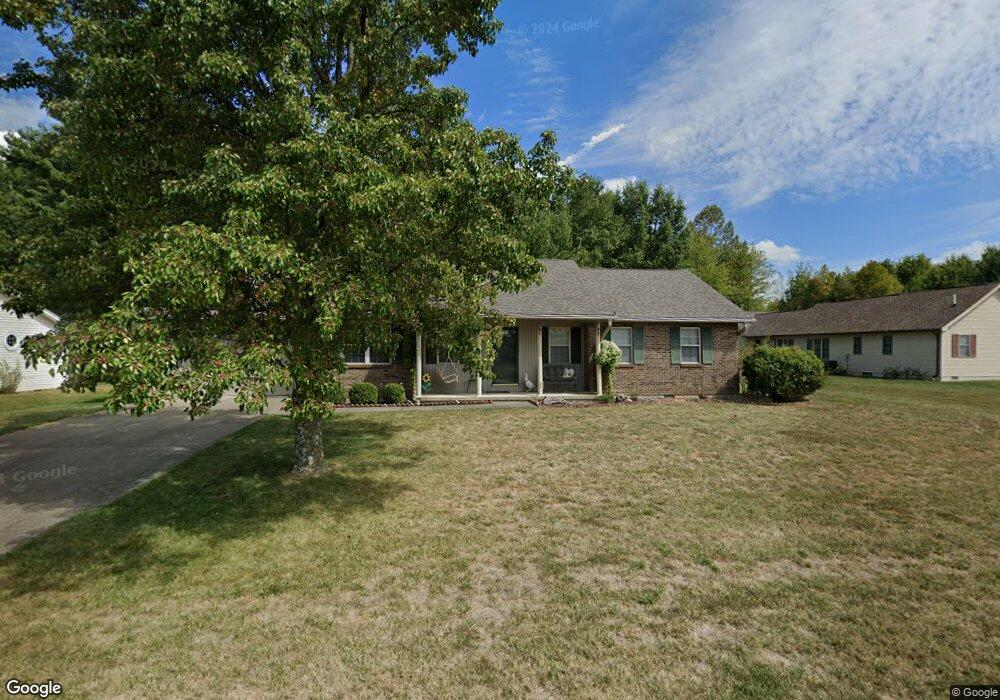
120 Roundhouse Cir Georgetown, OH 45121
Estimated Value: $226,213 - $305,000
3
Beds
2
Baths
1,368
Sq Ft
$188/Sq Ft
Est. Value
About This Home
This home is located at 120 Roundhouse Cir, Georgetown, OH 45121 and is currently estimated at $257,053, approximately $187 per square foot. 120 Roundhouse Cir is a home located in Brown County with nearby schools including Georgetown Elementary School and Georgetown Jr/Sr High School.
Ownership History
Date
Name
Owned For
Owner Type
Purchase Details
Closed on
Apr 17, 2008
Sold by
Haitz Greg D and Haitz Lisa
Bought by
Clark William R and Clark Donna S
Current Estimated Value
Home Financials for this Owner
Home Financials are based on the most recent Mortgage that was taken out on this home.
Original Mortgage
$120,944
Outstanding Balance
$76,213
Interest Rate
5.87%
Mortgage Type
FHA
Estimated Equity
$180,840
Purchase Details
Closed on
Mar 16, 1998
Sold by
Deer Creek Builders
Bought by
Haitz Greg D
Home Financials for this Owner
Home Financials are based on the most recent Mortgage that was taken out on this home.
Original Mortgage
$93,500
Interest Rate
8%
Mortgage Type
New Conventional
Create a Home Valuation Report for This Property
The Home Valuation Report is an in-depth analysis detailing your home's value as well as a comparison with similar homes in the area
Home Values in the Area
Average Home Value in this Area
Purchase History
| Date | Buyer | Sale Price | Title Company |
|---|---|---|---|
| Clark William R | $121,900 | Landstar Title Llc | |
| Haitz Greg D | $98,500 | -- |
Source: Public Records
Mortgage History
| Date | Status | Borrower | Loan Amount |
|---|---|---|---|
| Open | Clark William R | $120,944 | |
| Previous Owner | Haitz Greg D | $93,500 |
Source: Public Records
Tax History
| Year | Tax Paid | Tax Assessment Tax Assessment Total Assessment is a certain percentage of the fair market value that is determined by local assessors to be the total taxable value of land and additions on the property. | Land | Improvement |
|---|---|---|---|---|
| 2024 | $1,736 | $59,190 | $6,410 | $52,780 |
| 2023 | $1,750 | $46,700 | $5,540 | $41,160 |
| 2022 | $1,463 | $46,700 | $5,540 | $41,160 |
| 2021 | $1,450 | $46,700 | $5,540 | $41,160 |
| 2020 | $1,224 | $38,920 | $4,620 | $34,300 |
| 2019 | $1,215 | $38,920 | $4,620 | $34,300 |
| 2018 | $1,207 | $38,920 | $4,620 | $34,300 |
| 2017 | $938 | $36,590 | $5,080 | $31,510 |
| 2016 | $938 | $36,590 | $5,080 | $31,510 |
| 2015 | $974 | $36,590 | $5,080 | $31,510 |
| 2014 | $974 | $36,130 | $4,620 | $31,510 |
| 2013 | $971 | $36,130 | $4,620 | $31,510 |
Source: Public Records
Map
Nearby Homes
- 2 N Kenwood Ave
- 1 N Kenwood Ave
- 427 Kenwood Ave
- 508 Mount Orab Pike
- 399 Elmwood Ct
- 60 New St
- 406 E North St
- 405 N Main St
- 666 E State St
- 510 W State St
- 505 S Water St
- 708 E State St
- 4279 Sunshine Rd
- 25 Douglas Ln
- 9995 U S 68
- 0 Barnes Rd Unit 1851215
- 3486 Barnes Rd
- 0 St Rt 221 & Footbridge Unit 1826509
- 155 Free Soil Rd
- 175 Douglas Cir
- 140 Roundhouse Cir
- 155 Station Dr
- 160 Roundhouse Cir
- 8 Roundhouse Cir
- 135 Roundhouse Cir
- 125 Station Dr
- 155 Roundhouse Cir
- 200 Station Dr
- 180 Roundhouse Cir
- 195 Roundhouse Cir
- 112 Station Dr
- 175 Roundhouse Cir
- 115 Station Dr
- 75 Depot Cir
- 60 Depot Cir
- 105 Station Dr
- 40 Depot Cir
- 40 Depot Cir
- 110 Station Dr
- 55 Depot Cir
Your Personal Tour Guide
Ask me questions while you tour the home.