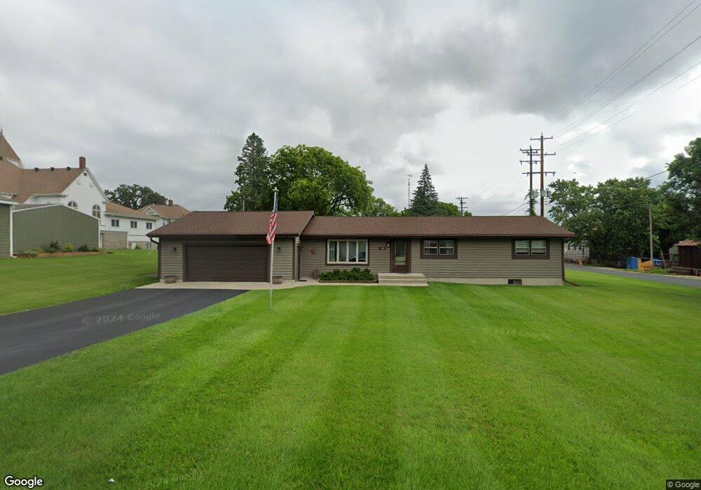
120 S 4th St Palmyra, WI 53156
Estimated Value: $261,000 - $306,000
--
Bed
--
Bath
--
Sq Ft
10,280
Sq Ft Lot
About This Home
This home is located at 120 S 4th St, Palmyra, WI 53156 and is currently estimated at $277,121. 120 S 4th St is a home with nearby schools including Palmyra-Eagle High School.
Ownership History
Date
Name
Owned For
Owner Type
Purchase Details
Closed on
May 3, 2005
Sold by
Maney Rhonda R and Mueller Rhonda R
Bought by
Maney Richard J and Maney Rhonda R
Current Estimated Value
Home Financials for this Owner
Home Financials are based on the most recent Mortgage that was taken out on this home.
Original Mortgage
$70,000
Outstanding Balance
$39,717
Interest Rate
7.24%
Mortgage Type
Adjustable Rate Mortgage/ARM
Estimated Equity
$237,404
Create a Home Valuation Report for This Property
The Home Valuation Report is an in-depth analysis detailing your home's value as well as a comparison with similar homes in the area
Home Values in the Area
Average Home Value in this Area
Purchase History
| Date | Buyer | Sale Price | Title Company |
|---|---|---|---|
| Maney Richard J | -- | None Available |
Source: Public Records
Mortgage History
| Date | Status | Borrower | Loan Amount |
|---|---|---|---|
| Open | Maney Richard J | $70,000 |
Source: Public Records
Tax History Compared to Growth
Tax History
| Year | Tax Paid | Tax Assessment Tax Assessment Total Assessment is a certain percentage of the fair market value that is determined by local assessors to be the total taxable value of land and additions on the property. | Land | Improvement |
|---|---|---|---|---|
| 2024 | $3,576 | $239,800 | $39,800 | $200,000 |
| 2023 | $3,224 | $144,400 | $25,800 | $118,600 |
| 2022 | $2,788 | $144,400 | $25,800 | $118,600 |
| 2021 | $2,973 | $144,400 | $25,800 | $118,600 |
| 2020 | $3,028 | $144,400 | $25,800 | $118,600 |
| 2019 | $2,873 | $144,400 | $25,800 | $118,600 |
| 2018 | $3,023 | $144,400 | $25,800 | $118,600 |
| 2017 | $3,090 | $144,400 | $25,800 | $118,600 |
| 2016 | $3,068 | $144,400 | $25,800 | $118,600 |
| 2015 | $3,494 | $170,000 | $27,300 | $142,700 |
| 2014 | $3,419 | $170,000 | $27,300 | $142,700 |
| 2013 | $3,363 | $170,000 | $27,300 | $142,700 |
Source: Public Records
Map
Nearby Homes
- 227 S 3rd St
- 213 N Fourth St
- 212 Mill Rd
- 698 N 1st St Unit 700
- 314 Jefferson St
- W1306 N Blue Spring Lake Dr
- W1260 S Shore Dr
- W1278 S Shore Dr
- W1325 S Shore Dr
- W1446 S Shore Dr
- W5200 Bluff Rd
- W397 S11030 Chimney Rock
- W397S11030 Chimney Rock
- N9171 Nelson Rd
- W914 County Road CI
- N2639 County Road z
- W4429 Little Prairie Rd
- W5950 U S 12
- 542 Anton Ct
- W6098 U S 12