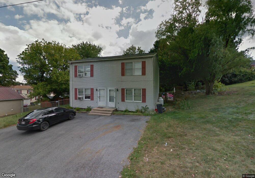
120 S Hawbaker Cir Clear Spring, MD 21722
Estimated Value: $155,000 - $272,000
2
Beds
1
Bath
1,116
Sq Ft
$183/Sq Ft
Est. Value
About This Home
This home is located at 120 S Hawbaker Cir, Clear Spring, MD 21722 and is currently estimated at $204,512, approximately $183 per square foot. 120 S Hawbaker Cir is a home located in Washington County with nearby schools including Clear Spring Elementary School, Clear Spring Middle School, and Clear Spring High School.
Ownership History
Date
Name
Owned For
Owner Type
Purchase Details
Closed on
Jun 10, 2005
Sold by
Dittman Matthew J and Dittman Melissa A
Bought by
Glaze David E and Glaze Jamie L
Current Estimated Value
Home Financials for this Owner
Home Financials are based on the most recent Mortgage that was taken out on this home.
Original Mortgage
$130,254
Outstanding Balance
$68,088
Interest Rate
5.78%
Mortgage Type
FHA
Estimated Equity
$136,424
Purchase Details
Closed on
Feb 7, 2001
Sold by
Yost Christine A
Bought by
Dittman Matthew J and Dittman Melissa A
Purchase Details
Closed on
Apr 25, 2000
Sold by
Alexander Lesa C
Bought by
Yost Christine A
Purchase Details
Closed on
Sep 22, 1998
Sold by
Alexander Lesa C
Bought by
Alexander Lesa C
Purchase Details
Closed on
Nov 1, 1995
Sold by
Alexander Lesa C
Bought by
Alexander Lesa C and Weller Keith A
Create a Home Valuation Report for This Property
The Home Valuation Report is an in-depth analysis detailing your home's value as well as a comparison with similar homes in the area
Home Values in the Area
Average Home Value in this Area
Purchase History
| Date | Buyer | Sale Price | Title Company |
|---|---|---|---|
| Glaze David E | $132,000 | -- | |
| Dittman Matthew J | $74,000 | -- | |
| Yost Christine A | $72,000 | -- | |
| Alexander Lesa C | -- | -- | |
| Alexander Lesa C | -- | -- |
Source: Public Records
Mortgage History
| Date | Status | Borrower | Loan Amount |
|---|---|---|---|
| Open | Glaze David E | $130,254 | |
| Closed | Yost Christine A | -- |
Source: Public Records
Tax History Compared to Growth
Tax History
| Year | Tax Paid | Tax Assessment Tax Assessment Total Assessment is a certain percentage of the fair market value that is determined by local assessors to be the total taxable value of land and additions on the property. | Land | Improvement |
|---|---|---|---|---|
| 2025 | $805 | $107,100 | $0 | $0 |
| 2024 | $805 | $95,400 | $0 | $0 |
| 2023 | $766 | $83,700 | $33,800 | $49,900 |
| 2022 | $766 | $83,700 | $33,800 | $49,900 |
| 2021 | $779 | $83,700 | $33,800 | $49,900 |
| 2020 | $707 | $94,900 | $33,800 | $61,100 |
| 2019 | $887 | $94,900 | $33,800 | $61,100 |
| 2018 | $887 | $94,900 | $33,800 | $61,100 |
| 2017 | $868 | $96,000 | $0 | $0 |
| 2016 | -- | $92,800 | $0 | $0 |
| 2015 | $855 | $89,600 | $0 | $0 |
| 2014 | $855 | $86,400 | $0 | $0 |
Source: Public Records
Map
Nearby Homes
- 154 Cumberland St
- 20 N Martin St
- 12343 Big Spring Rd
- 13407 Rhodes Ct
- 13013 Draper Rd
- 0 Boyd Rd Unit MDWA2028012
- 13140 Blairs Valley Rd
- 12530 Ashton Rd
- 0 National Pike Unit MDWA2025232
- 11737 Ashton Rd
- 11868 National Pike
- 11705 Ashton Rd
- 12524 Big Pool Rd
- 13609 Blairs Valley Rd
- 11431 Ashton Rd
- 13707 Blairs Valley Rd
- 11430 National Pike
- 11915 Cove Rd
- Block 139 Lot 56 Boo Blvd
- 11408 National Pike
- 120 Hawbaker Circle B S
- 120 S Hawbaker Cir
- 132 S Hawbaker Cir
- 132 S Hawbaker Cir
- 10 Mulberry St
- 121 Cumberland St
- 111 Cumberland St
- 107 Cumberland St
- 14 Mulberry St
- 14 Mulberry Street B
- 16 S Martin St
- 115 Cumberland St
- 12 S Martin St
- 20 Mulberry St
- 22 S Martin St
- 9 Mulberry St
- 125 Cumberland St
- 105 Cumberland St Unit 3
- 129 Cumberland St
- 111-113 Cumberland St