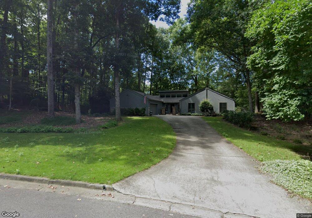
120 S Shore Ct Roswell, GA 30076
Martin's Landing NeighborhoodEstimated Value: $592,000 - $664,000
4
Beds
3
Baths
2,230
Sq Ft
$286/Sq Ft
Est. Value
About This Home
This home is located at 120 S Shore Ct, Roswell, GA 30076 and is currently estimated at $637,061, approximately $285 per square foot. 120 S Shore Ct is a home located in Fulton County with nearby schools including Jackson Elementary School, Holcomb Bridge Middle School, and Centennial High School.
Ownership History
Date
Name
Owned For
Owner Type
Purchase Details
Closed on
Mar 1, 2025
Sold by
Northrop Kelly Ray
Bought by
Northrop Jennifer Ann and Northrop Kelly Ray
Current Estimated Value
Purchase Details
Closed on
Jun 11, 2014
Sold by
Northrop Mary Katherine
Bought by
Northrop Kelly Ray
Purchase Details
Closed on
Sep 16, 2013
Sold by
Northrop Kelly
Bought by
Northrop Mary Katherine
Purchase Details
Closed on
Oct 28, 2011
Sold by
Loveland Dolores L
Bought by
Northrop Kelly
Home Financials for this Owner
Home Financials are based on the most recent Mortgage that was taken out on this home.
Original Mortgage
$172,425
Interest Rate
4.09%
Mortgage Type
New Conventional
Create a Home Valuation Report for This Property
The Home Valuation Report is an in-depth analysis detailing your home's value as well as a comparison with similar homes in the area
Home Values in the Area
Average Home Value in this Area
Purchase History
| Date | Buyer | Sale Price | Title Company |
|---|---|---|---|
| Northrop Jennifer Ann | -- | -- | |
| Northrop Kelly Ray | -- | -- | |
| Northrop Mary Katherine | -- | -- | |
| Northrop Kelly | $181,500 | -- |
Source: Public Records
Mortgage History
| Date | Status | Borrower | Loan Amount |
|---|---|---|---|
| Previous Owner | Northrop Kelly | $172,425 |
Source: Public Records
Tax History Compared to Growth
Tax History
| Year | Tax Paid | Tax Assessment Tax Assessment Total Assessment is a certain percentage of the fair market value that is determined by local assessors to be the total taxable value of land and additions on the property. | Land | Improvement |
|---|---|---|---|---|
| 2025 | $687 | $176,080 | $48,320 | $127,760 |
| 2023 | $687 | $214,800 | $48,320 | $166,480 |
| 2022 | $2,758 | $196,120 | $29,760 | $166,360 |
| 2021 | $3,268 | $141,480 | $25,400 | $116,080 |
| 2020 | $3,319 | $147,120 | $22,520 | $124,600 |
| 2019 | $546 | $144,520 | $22,120 | $122,400 |
| 2018 | $3,299 | $141,120 | $21,600 | $119,520 |
| 2017 | $2,686 | $104,000 | $16,120 | $87,880 |
| 2016 | $2,685 | $104,000 | $16,120 | $87,880 |
| 2015 | $3,615 | $104,000 | $16,120 | $87,880 |
| 2014 | $2,427 | $104,000 | $16,120 | $87,880 |
Source: Public Records
Map
Nearby Homes
- 0 Riverside Rd Unit 10339509
- 0 Riverside Rd Unit 7421838
- 1155 Northshore Dr
- 1140 Northshore Dr
- 510 Watergate Ct
- 1045 Martin Ridge Rd
- 545 Woodman Place Unit 83
- 1595 Northcliff Trace
- 415 Cliffcove Ct
- 230 Lakeview Ridge E
- 130 Lakeview Ridge W
- 3040 Gray Hawk Ln
- 1320 Northcliff Trace
- 9470 Hillside Dr
- 8846 Long Beach Cir
- 2875 Stoneglen Close
- 502 Brandywine Cir
- 2020 Rivermont Alley
- 2020 Rivermont Way
- 303 Brandywine Cir Unit 303
- 8905 Martin Rd
- 130 S Shore Ct Unit 1
- 100 S Shore Ct Unit 1
- S S Shore Ct
- 135 S Shore Ct
- 135 S Shore
- 140 S Shore Ct
- 125 S Shore Ct
- 145 S Shore Ct
- 0 Riverside Rd Unit 5875334
- 0 Riverside Rd Unit 5167227
- 00 Riverside Rd
- 0 Riverside Rd Unit 3212433
- 0 Riverside Rd Unit 7449010
- 0 Riverside Rd Unit 7066776
- 0 Riverside Rd Unit 7292319
- 0 Riverside Rd Unit 3195516
- 0 Riverside Rd Unit 8485275
- 0 Riverside Rd Unit 8421809
- 0 Riverside Rd Unit 7183041