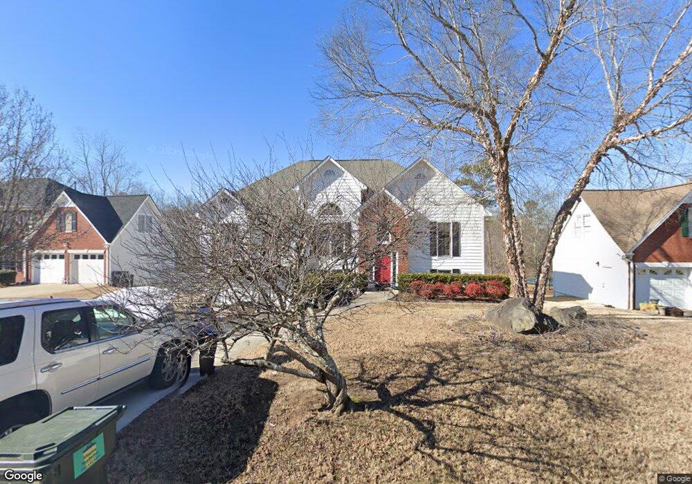
120 Saddle Brooke Farms Dr NW Unit PHS 1 Dallas, GA 30132
East Paulding County NeighborhoodEstimated Value: $325,000 - $379,000
5
Beds
3
Baths
1,619
Sq Ft
$214/Sq Ft
Est. Value
About This Home
This home is located at 120 Saddle Brooke Farms Dr NW Unit PHS 1, Dallas, GA 30132 and is currently estimated at $345,753, approximately $213 per square foot. 120 Saddle Brooke Farms Dr NW Unit PHS 1 is a home located in Paulding County with nearby schools including Northside Elementary School, Lena Mae Moses Middle School, and East Paulding High School.
Ownership History
Date
Name
Owned For
Owner Type
Purchase Details
Closed on
Apr 26, 2019
Sold by
Wood Lisa P
Bought by
Hamby David and Hamby Lisa M
Current Estimated Value
Home Financials for this Owner
Home Financials are based on the most recent Mortgage that was taken out on this home.
Original Mortgage
$221,415
Outstanding Balance
$201,888
Interest Rate
6.25%
Mortgage Type
FHA
Estimated Equity
$143,865
Purchase Details
Closed on
Apr 5, 2018
Sold by
Chamlee Kenneth
Bought by
Wood Lisa P
Purchase Details
Closed on
Oct 21, 2009
Sold by
Chamlee Virgil K and Chamlee Brenda J
Bought by
Chamlee Brenda J and Chamlee Virgil K
Create a Home Valuation Report for This Property
The Home Valuation Report is an in-depth analysis detailing your home's value as well as a comparison with similar homes in the area
Home Values in the Area
Average Home Value in this Area
Purchase History
| Date | Buyer | Sale Price | Title Company |
|---|---|---|---|
| Hamby David | $225,500 | -- | |
| Wood Lisa P | -- | -- | |
| Chamlee Brenda J | -- | -- |
Source: Public Records
Mortgage History
| Date | Status | Borrower | Loan Amount |
|---|---|---|---|
| Open | Hamby David | $221,415 |
Source: Public Records
Tax History Compared to Growth
Tax History
| Year | Tax Paid | Tax Assessment Tax Assessment Total Assessment is a certain percentage of the fair market value that is determined by local assessors to be the total taxable value of land and additions on the property. | Land | Improvement |
|---|---|---|---|---|
| 2024 | $3,310 | $133,052 | $12,000 | $121,052 |
| 2023 | $3,412 | $130,876 | $12,000 | $118,876 |
| 2022 | $2,876 | $110,304 | $12,000 | $98,304 |
| 2021 | $2,559 | $88,072 | $12,000 | $76,072 |
| 2020 | $2,431 | $81,848 | $12,000 | $69,848 |
| 2019 | $2,132 | $72,608 | $12,000 | $60,608 |
| 2018 | $1,980 | $67,576 | $12,000 | $55,576 |
| 2017 | $1,879 | $63,364 | $12,000 | $51,364 |
| 2016 | $1,748 | $59,672 | $12,000 | $47,672 |
| 2015 | $1,514 | $51,060 | $12,000 | $39,060 |
| 2014 | $1,234 | $40,940 | $12,000 | $28,940 |
| 2013 | -- | $34,680 | $12,000 | $22,680 |
Source: Public Records
Map
Nearby Homes
- 57 Saddle Brooke Dr
- 16 Riders Ridge
- 74 Riders Ridge
- The McGinnis Plan at Jones Ridge
- The Langford Plan at Jones Ridge
- The Ellijay Plan at Jones Ridge
- The Palmer Plan at Jones Ridge
- The James Plan at Jones Ridge
- The Lancaster Plan at Jones Ridge
- The Avery Plan at Jones Ridge
- 70 Stallion Run
- 791 Brooks Rd
- 32 Stable Ln
- 443 Brooks Rd
- 68 Wagon Trail Cir
- 181 Beckett Dr
- 272 Kades Cove Dr
- 265 Huntleigh Chase Dr
- 18 Mountain Ct
- 120 Saddle Brooke Farms Dr NW
- 120 Saddle Brooke Dr
- 102 Saddle Brooke Dr
- 130 Saddle Brooke Dr
- 96 Saddle Brooke Dr Unit 10
- 96 Saddle Brooke Dr
- 0 Bridle Ct Unit 5874757
- 0 Bridle Ct Unit 962 7026692
- 0 Bridle Ct Unit 95 7133396
- 0 Bridle Ct
- 0 Bridle Ct Unit 7565041
- 0 Bridle Ct Unit 7106980
- 0 Bridle Ct Unit 8845992
- 0 Bridle Ct Unit 8868805
- 0 Bridle Ct Unit 5090546
- 0 Bridle Ct Unit 7449205
- 0 Bridle Ct Unit 7547645
- 115 Saddle Brooke Dr
- 12 Bridle Ct
- 15 Bridle Ct