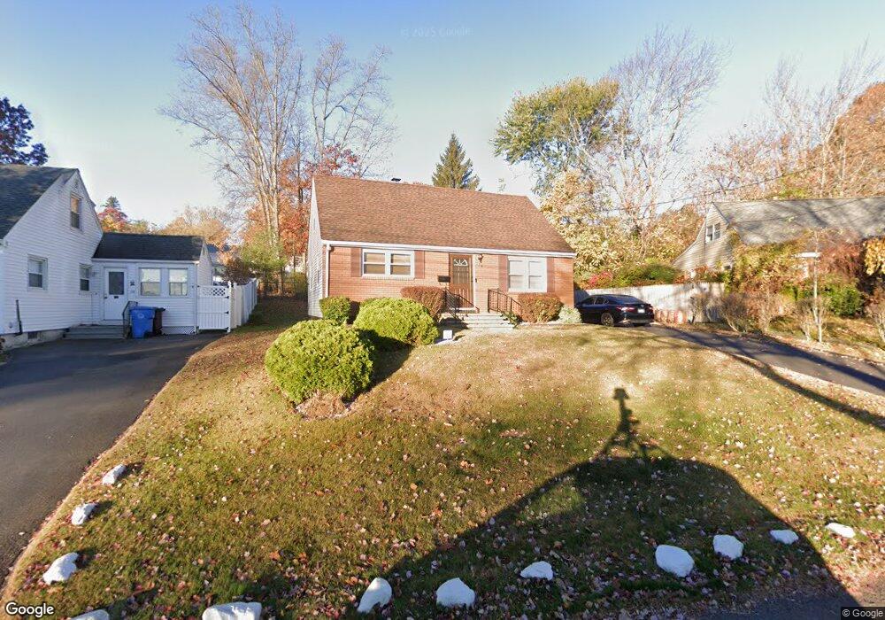
120 Skipper St New Britain, CT 06053
Estimated Value: $260,000 - $300,000
4
Beds
2
Baths
1,152
Sq Ft
$245/Sq Ft
Est. Value
About This Home
This home is located at 120 Skipper St, New Britain, CT 06053 and is currently estimated at $282,416, approximately $245 per square foot. 120 Skipper St is a home located in Hartford County with nearby schools including Jefferson School, Pulaski Middle School, and St. Francis of Assisi Middle School.
Ownership History
Date
Name
Owned For
Owner Type
Purchase Details
Closed on
Mar 20, 2001
Sold by
Central Bldg&Rmdlg Llc
Bought by
Santos Manuel and Santos Lydia
Current Estimated Value
Purchase Details
Closed on
Sep 13, 2000
Sold by
Kilduff Raymond T
Bought by
Central Bldg Rmdlngllc
Purchase Details
Closed on
Jul 30, 1997
Sold by
Starkie Willard V and Starkie Phyllis C
Bought by
Warren Mark E
Home Financials for this Owner
Home Financials are based on the most recent Mortgage that was taken out on this home.
Original Mortgage
$107,500
Interest Rate
6.63%
Mortgage Type
Unknown
Purchase Details
Closed on
Apr 1, 1997
Sold by
Kamis Edward J
Bought by
Strange Gleen D
Home Financials for this Owner
Home Financials are based on the most recent Mortgage that was taken out on this home.
Original Mortgage
$278,000
Interest Rate
8%
Mortgage Type
Unknown
Purchase Details
Closed on
Jan 29, 1997
Sold by
Cote Wilfred and Cote Linda M
Bought by
Girard Dale A and Girard Janine H
Home Financials for this Owner
Home Financials are based on the most recent Mortgage that was taken out on this home.
Original Mortgage
$135,600
Interest Rate
7.65%
Mortgage Type
Unknown
Create a Home Valuation Report for This Property
The Home Valuation Report is an in-depth analysis detailing your home's value as well as a comparison with similar homes in the area
Home Values in the Area
Average Home Value in this Area
Purchase History
| Date | Buyer | Sale Price | Title Company |
|---|---|---|---|
| Santos Manuel | $94,000 | -- | |
| Central Bldg Rmdlngllc | $44,500 | -- | |
| Warren Mark E | $134,375 | -- | |
| Strange Gleen D | $95,000 | -- | |
| Girard Dale A | $169,500 | -- |
Source: Public Records
Mortgage History
| Date | Status | Borrower | Loan Amount |
|---|---|---|---|
| Previous Owner | Girard Dale A | $107,500 | |
| Previous Owner | Girard Dale A | $278,000 | |
| Previous Owner | Girard Dale A | $135,600 |
Source: Public Records
Tax History Compared to Growth
Tax History
| Year | Tax Paid | Tax Assessment Tax Assessment Total Assessment is a certain percentage of the fair market value that is determined by local assessors to be the total taxable value of land and additions on the property. | Land | Improvement |
|---|---|---|---|---|
| 2025 | $5,521 | $140,910 | $39,900 | $101,010 |
| 2024 | $5,579 | $140,910 | $39,900 | $101,010 |
| 2023 | $5,394 | $140,910 | $39,900 | $101,010 |
| 2022 | $4,771 | $96,390 | $16,800 | $79,590 |
| 2021 | $4,771 | $96,390 | $16,800 | $79,590 |
| 2020 | $4,868 | $96,390 | $16,800 | $79,590 |
| 2019 | $4,868 | $96,390 | $16,800 | $79,590 |
| 2018 | $4,868 | $96,390 | $16,800 | $79,590 |
| 2017 | $4,532 | $89,740 | $16,800 | $72,940 |
| 2016 | $4,532 | $89,740 | $16,800 | $72,940 |
| 2015 | $4,397 | $89,740 | $16,800 | $72,940 |
| 2014 | $4,397 | $89,740 | $16,800 | $72,940 |
Source: Public Records
Map
Nearby Homes
- 55 Horseplain Rd
- 34 Hutchinson St
- 801 Farmington Ave
- 133 Mckinley Dr
- 97 Mckinley Dr
- 140 Lewis Rd
- 67 Eastwick Rd
- 28 SyMcO Dr
- 148 Governor St
- 187 Miriam Rd
- 410 Farmington Ave Unit O6
- 410 Farmington Ave Unit H6
- 234 Pierremount Ave
- 73 Beach St
- 1114 Fienemann Rd
- 394 Mcclintock St
- 343 Eddy Glover Blvd
- 248 Farmington Ave
- 258 Eddy Glover Blvd
- 8128 Colt Hwy
- 114 Skipper St
- 126 Skipper St
- 108 Skipper St
- 132 Skipper St
- 191 Horseplain Rd
- 151 Emily Dr
- 199 Horseplain Rd
- 183 Horseplain Rd
- 102 Skipper St
- 207 Horseplain Rd
- 177 Horseplain Rd
- 131 Skipper St
- 150 Emily Dr
- 1191 Slater Rd
- 145 Emily Dr
- 96 Skipper St
- 29 Scarlett Dr
- 23 Scarlett Dr
- 169 Horseplain Rd
- 144 Emily Dr