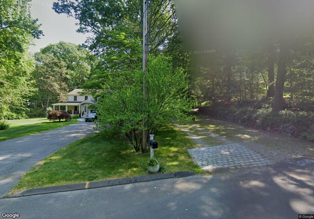
120 Sturbridge Ln Southport, CT 06890
Estimated Value: $1,816,000 - $2,027,000
4
Beds
3
Baths
3,307
Sq Ft
$582/Sq Ft
Est. Value
About This Home
This home is located at 120 Sturbridge Ln, Southport, CT 06890 and is currently estimated at $1,925,057, approximately $582 per square foot. 120 Sturbridge Ln is a home located in Fairfield County with nearby schools including Dwight Elementary School, Roger Ludlowe Middle School, and Fairfield Ludlowe High School.
Ownership History
Date
Name
Owned For
Owner Type
Purchase Details
Closed on
Oct 6, 1995
Sold by
Buzzard James A and Buzzard Vivian K
Bought by
Doyle William E and Doyle Susan L
Current Estimated Value
Purchase Details
Closed on
Oct 25, 1994
Sold by
Ryan John T
Bought by
Buzzard James A and Buzzard Vivian K
Purchase Details
Closed on
Apr 30, 1987
Sold by
Mcgee Raymond L
Bought by
Ryan John T
Create a Home Valuation Report for This Property
The Home Valuation Report is an in-depth analysis detailing your home's value as well as a comparison with similar homes in the area
Home Values in the Area
Average Home Value in this Area
Purchase History
| Date | Buyer | Sale Price | Title Company |
|---|---|---|---|
| Doyle William E | $517,000 | -- | |
| Doyle William E | $517,000 | -- | |
| Buzzard James A | $535,000 | -- | |
| Buzzard James A | $535,000 | -- | |
| Ryan John T | $510,000 | -- |
Source: Public Records
Mortgage History
| Date | Status | Borrower | Loan Amount |
|---|---|---|---|
| Closed | Ryan John T | $223,000 | |
| Open | Ryan John T | $350,000 | |
| Closed | Ryan John T | $200,000 |
Source: Public Records
Tax History Compared to Growth
Tax History
| Year | Tax Paid | Tax Assessment Tax Assessment Total Assessment is a certain percentage of the fair market value that is determined by local assessors to be the total taxable value of land and additions on the property. | Land | Improvement |
|---|---|---|---|---|
| 2025 | $24,730 | $871,080 | $631,470 | $239,610 |
| 2024 | $24,303 | $871,080 | $631,470 | $239,610 |
| 2023 | $23,963 | $871,080 | $631,470 | $239,610 |
| 2022 | $23,728 | $871,080 | $631,470 | $239,610 |
| 2021 | $23,502 | $871,080 | $631,470 | $239,610 |
| 2020 | $24,246 | $905,030 | $631,470 | $273,560 |
| 2019 | $24,246 | $905,030 | $631,470 | $273,560 |
| 2018 | $23,857 | $905,030 | $631,470 | $273,560 |
| 2017 | $23,368 | $905,030 | $631,470 | $273,560 |
| 2016 | $23,033 | $905,030 | $631,470 | $273,560 |
| 2015 | $23,517 | $948,640 | $661,710 | $286,930 |
| 2014 | $23,147 | $948,640 | $661,710 | $286,930 |
Source: Public Records
Map
Nearby Homes
- 1135 Mill Hill Rd
- 688 Hulls Farm Rd
- 646 Mill Hill Terrace
- 1213 Cedar Rd
- 476 Mill Hill Terrace
- 844 Mill Hill Terrace
- 1001 Hulls Farm Rd
- 153 Pease Ave
- 647 Bronson Rd
- 53 Hilltop Dr
- 254 Sherwood Farm Rd
- 232 Pell Meadow Dr
- 2683 Bronson Rd
- 1 Sturges Hwy Unit Lot 1
- 1 Sturges Hwy Unit 2
- 28 Mill Hill Rd Unit 28
- 125 Old Rd
- 2 Elmwood Dr Unit 2
- 10 Debra Ln
- 21 Queens Grant Dr
- 86 Fawn Ridge Ln
- 60 Fawn Ridge Ln
- 22 Fawn Ridge Ln
- 314 Sturbridge Ln
- 100 Sturbridge Ln
- 537 Cedar Rd
- 306 Sturbridge Ln
- 160 Sturbridge Ln
- 1305 Mill Hill Rd
- 1429 Mill Hill Rd
- 583 Cedar Rd
- 1301 Mill Hill Rd
- 230 Sturbridge Ln
- 200 Sturbridge Ln
- 102 Fawn Ridge Ln
- 207 Sturbridge Ln
- 330 Sturbridge Ln
- 175 Sturbridge Ln
- 140 Sturbridge Ln
- 141 Sturbridge Ln