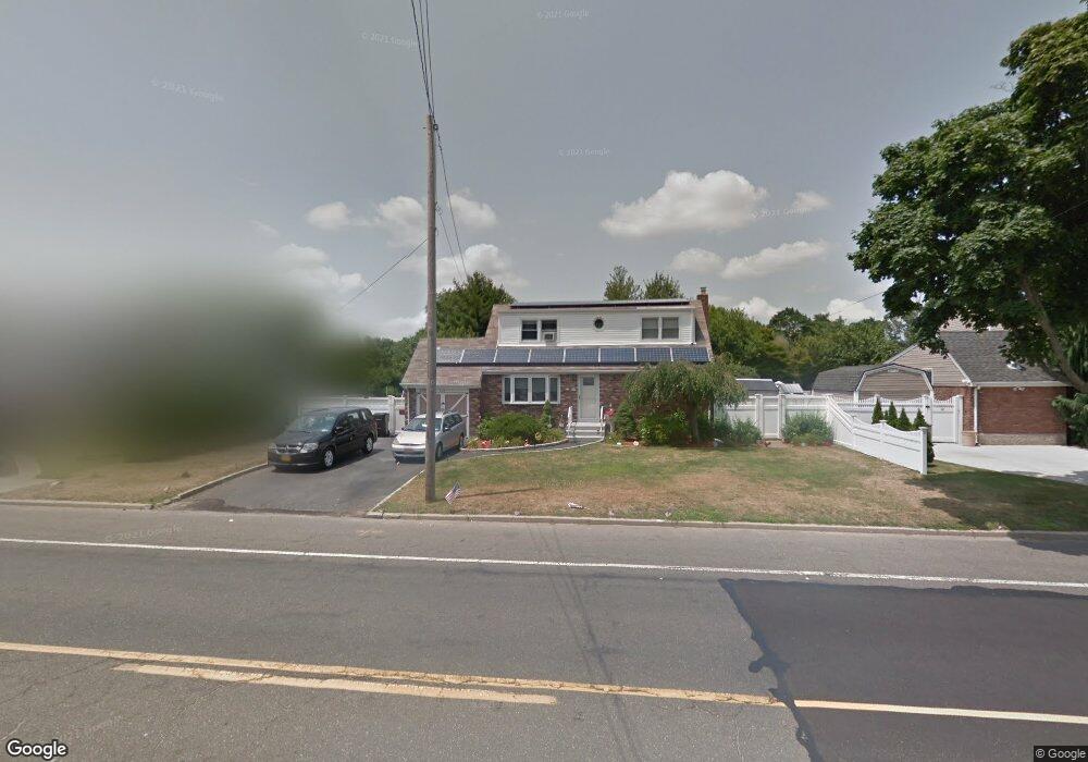
120 Udall Rd West Islip, NY 11795
Estimated Value: $589,000 - $845,000
4
Beds
3
Baths
--
Sq Ft
0.26
Acres
About This Home
This home is located at 120 Udall Rd, West Islip, NY 11795 and is currently estimated at $700,434. 120 Udall Rd is a home located in Suffolk County with nearby schools including Oquenock Elementary School, Udall Road Middle School, and West Islip Senior High School.
Ownership History
Date
Name
Owned For
Owner Type
Purchase Details
Closed on
Sep 10, 2014
Sold by
Quinn Keith B
Bought by
Rega Frank and Rega Frank
Current Estimated Value
Home Financials for this Owner
Home Financials are based on the most recent Mortgage that was taken out on this home.
Original Mortgage
$293,584
Outstanding Balance
$227,708
Interest Rate
4.5%
Mortgage Type
FHA
Estimated Equity
$472,726
Purchase Details
Closed on
May 16, 2000
Sold by
Winkler Jamie
Bought by
Quinn Keith B
Home Financials for this Owner
Home Financials are based on the most recent Mortgage that was taken out on this home.
Original Mortgage
$152,000
Interest Rate
8.1%
Purchase Details
Closed on
Aug 13, 1996
Sold by
Ford Gilbert and Ford Grace
Bought by
Ford Gilbert and Ford Grace
Create a Home Valuation Report for This Property
The Home Valuation Report is an in-depth analysis detailing your home's value as well as a comparison with similar homes in the area
Home Values in the Area
Average Home Value in this Area
Purchase History
| Date | Buyer | Sale Price | Title Company |
|---|---|---|---|
| Rega Frank | $299,000 | -- | |
| Quinn Keith B | $190,000 | -- | |
| Ford Gilbert | -- | -- |
Source: Public Records
Mortgage History
| Date | Status | Borrower | Loan Amount |
|---|---|---|---|
| Open | Rega Frank | $293,584 | |
| Previous Owner | Quinn Keith B | $152,000 |
Source: Public Records
Tax History Compared to Growth
Tax History
| Year | Tax Paid | Tax Assessment Tax Assessment Total Assessment is a certain percentage of the fair market value that is determined by local assessors to be the total taxable value of land and additions on the property. | Land | Improvement |
|---|---|---|---|---|
| 2024 | $10,855 | $40,000 | $8,900 | $31,100 |
| 2023 | $10,855 | $40,000 | $8,900 | $31,100 |
| 2022 | $9,976 | $40,000 | $8,900 | $31,100 |
| 2021 | $9,976 | $40,000 | $8,900 | $31,100 |
| 2020 | $10,223 | $40,000 | $8,900 | $31,100 |
| 2019 | $10,223 | $0 | $0 | $0 |
| 2018 | -- | $40,000 | $8,900 | $31,100 |
| 2017 | $9,721 | $40,000 | $8,900 | $31,100 |
| 2016 | $9,768 | $40,000 | $8,900 | $31,100 |
| 2015 | -- | $40,000 | $8,900 | $31,100 |
| 2014 | -- | $38,500 | $8,900 | $29,600 |
Source: Public Records
Map
Nearby Homes
- 14 Gerek Ave
- 15 Anthony Dr
- 47 Myson St
- 8 Gerek Ave
- 1280 Sunrise Hwy
- 409 Capri Rd
- 372 Hamilton Place
- 2011 Orinoco Dr
- 166 W 2nd St
- 1345 Madison Ave
- 1291 Minerva Ave
- 38 Beach St
- 170 Wickfield Ln
- 118 W 6th St
- 270 W 4th St
- 134 Veronica Ln
- 644 N Briarwood Ave
- 105 Graywood Ct
- 43 Hitherdell Ln
- 274 Edmunton Dr Unit K8