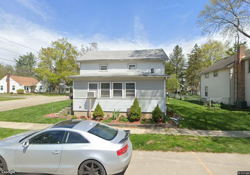
120 W 4th St Onsted, MI 49265
Estimated Value: $161,429 - $194,000
3
Beds
1
Bath
1,323
Sq Ft
$133/Sq Ft
Est. Value
About This Home
This home is located at 120 W 4th St, Onsted, MI 49265 and is currently estimated at $176,607, approximately $133 per square foot. 120 W 4th St is a home located in Lenawee County with nearby schools including Onsted Elementary School, Onsted Middle School, and Onsted Community High School.
Ownership History
Date
Name
Owned For
Owner Type
Purchase Details
Closed on
Nov 29, 2007
Sold by
Trott and Trott P
Bought by
Peake Jonathan L and Peake Janet
Current Estimated Value
Purchase Details
Closed on
Oct 23, 2007
Sold by
Mortgage Electronic Registration Systems
Bought by
Federal National Mortgage Association
Purchase Details
Closed on
Aug 23, 2007
Sold by
Bradley Johnny G and Bradley Margaret E
Bought by
Mortgage Electronic Registraction System
Purchase Details
Closed on
Jan 22, 2004
Bought by
Peake Jonathan L and Peake Janet
Create a Home Valuation Report for This Property
The Home Valuation Report is an in-depth analysis detailing your home's value as well as a comparison with similar homes in the area
Home Values in the Area
Average Home Value in this Area
Purchase History
| Date | Buyer | Sale Price | Title Company |
|---|---|---|---|
| Peake Jonathan L | $35,000 | Multiple | |
| Federal National Mortgage Association | -- | None Available | |
| Mortgage Electronic Registraction System | $100,161 | None Available | |
| Peake Jonathan L | $84,000 | -- |
Source: Public Records
Tax History Compared to Growth
Tax History
| Year | Tax Paid | Tax Assessment Tax Assessment Total Assessment is a certain percentage of the fair market value that is determined by local assessors to be the total taxable value of land and additions on the property. | Land | Improvement |
|---|---|---|---|---|
| 2025 | $2,048 | $63,500 | $0 | $0 |
| 2024 | $983 | $63,800 | $0 | $0 |
| 2022 | $3,689 | $50,600 | $0 | $0 |
| 2021 | $2,238 | $45,000 | $0 | $0 |
| 2020 | $2,177 | $43,500 | $0 | $0 |
| 2019 | $109,049 | $39,200 | $0 | $0 |
| 2018 | $2,017 | $39,210 | $0 | $0 |
| 2017 | $1,943 | $39,879 | $0 | $0 |
| 2016 | $1,928 | $37,657 | $0 | $0 |
| 2014 | -- | $35,620 | $0 | $0 |
Source: Public Records
Map
Nearby Homes
- 116 W Fourth St
- 212 S Maple St
- 409 Connor St
- Lot 8 Walsh Ct
- 8826 Irish Mist
- 0 Castlebar Ln Unit 25054904
- Lot 2 Walsh Ct
- 8810 W Stephenson Hwy
- 8000 Slee Rd
- 8812 Walsh Ct
- 8443 Stephenson Rd
- 7905 Wadding Dr
- 7831 Barron Ct
- 7604 Sherlock Dr
- 7966 Kingsley Dr
- 7596 Wadding Dr
- 10093 Shepherd Rd
- 7000 Surrey Dr
- 9160 Kingsley Dr
- 8861 Sussex Ct
- 116 W 4th St
- 116 S Maple St
- 112 W 4th St
- 112 W Fourth St
- 120 S Maple St
- 112 S Maple St
- 121 W Fourth St
- 108 S Maple St
- 117 W 4th St
- 115 W Fourth St Unit FOURTH
- 115 W Fourth St
- 121 W 4th St
- 121 W 4th St
- 115 W 4th St Unit FOURTH
- 115 W 4th St
- 104 S Maple St
- 111 W 3rd St
- 118 W Third St Unit 111 W
- 118 W Third St
- 118 W Third St Unit 111 W. Third St