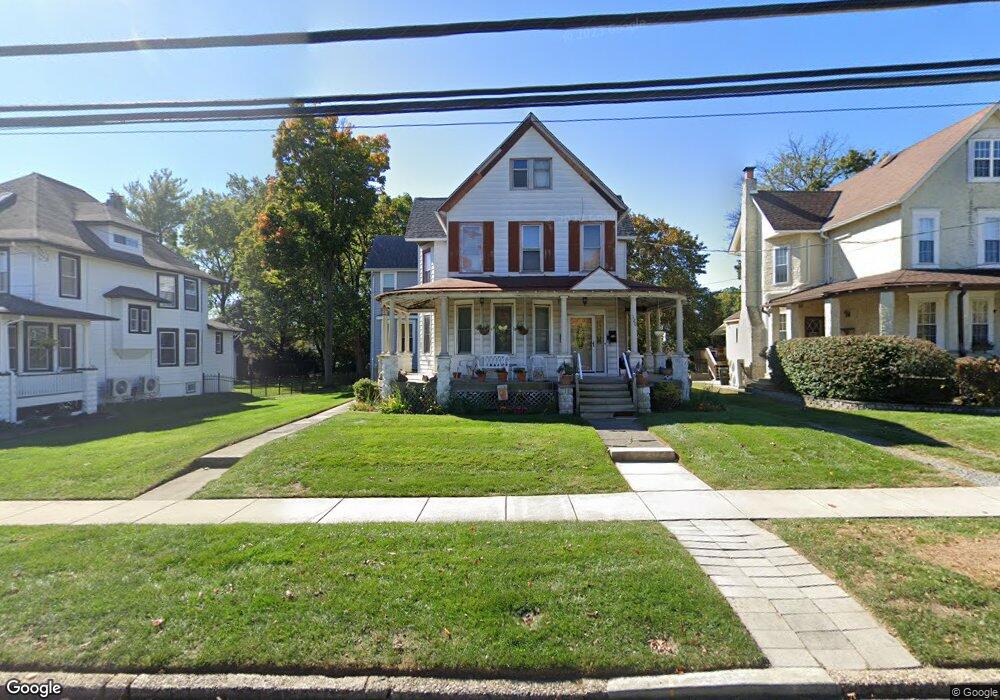
120 W Atlantic Ave Haddon Heights, NJ 08035
Estimated Value: $567,689 - $670,000
--
Bed
--
Bath
2,036
Sq Ft
$307/Sq Ft
Est. Value
About This Home
This home is located at 120 W Atlantic Ave, Haddon Heights, NJ 08035 and is currently estimated at $625,172, approximately $307 per square foot. 120 W Atlantic Ave is a home located in Camden County with nearby schools including Haddon Heights Jr Sr High School, Saint Rose of Lima Catholic School, and Brookfield Elementary School.
Ownership History
Date
Name
Owned For
Owner Type
Purchase Details
Closed on
Sep 29, 2000
Sold by
Newlon Nancy Alice
Bought by
Mcaleer Raymond J and Mcaleer Kathleen C
Current Estimated Value
Home Financials for this Owner
Home Financials are based on the most recent Mortgage that was taken out on this home.
Original Mortgage
$102,000
Outstanding Balance
$37,305
Interest Rate
7.96%
Estimated Equity
$587,867
Create a Home Valuation Report for This Property
The Home Valuation Report is an in-depth analysis detailing your home's value as well as a comparison with similar homes in the area
Home Values in the Area
Average Home Value in this Area
Purchase History
| Date | Buyer | Sale Price | Title Company |
|---|---|---|---|
| Mcaleer Raymond J | $127,500 | -- |
Source: Public Records
Mortgage History
| Date | Status | Borrower | Loan Amount |
|---|---|---|---|
| Open | Mcaleer Raymond J | $102,000 |
Source: Public Records
Tax History Compared to Growth
Tax History
| Year | Tax Paid | Tax Assessment Tax Assessment Total Assessment is a certain percentage of the fair market value that is determined by local assessors to be the total taxable value of land and additions on the property. | Land | Improvement |
|---|---|---|---|---|
| 2025 | $11,015 | $320,200 | $125,600 | $194,600 |
| 2024 | $10,900 | $320,200 | $125,600 | $194,600 |
| 2023 | $10,900 | $320,200 | $125,600 | $194,600 |
| 2022 | $10,871 | $320,200 | $125,600 | $194,600 |
| 2021 | $10,839 | $320,200 | $125,600 | $194,600 |
| 2020 | $10,663 | $320,200 | $125,600 | $194,600 |
| 2019 | $10,483 | $320,200 | $125,600 | $194,600 |
| 2018 | $10,317 | $320,200 | $125,600 | $194,600 |
| 2017 | $10,045 | $320,200 | $125,600 | $194,600 |
| 2016 | $9,888 | $320,200 | $125,600 | $194,600 |
| 2015 | $9,683 | $320,200 | $125,600 | $194,600 |
| 2014 | $9,375 | $320,200 | $125,600 | $194,600 |
Source: Public Records
Map
Nearby Homes
- 127 7th Ave
- 109 White Horse Pike
- 103 White Horse Pike
- 100 3rd Ave
- 47 E Kings Hwy
- 302 3rd Ave
- 425 White Horse Pike
- 114 Walnut St
- 233 E Kings Hwy
- 130 Walnut St
- 218 Walnut St
- 428 Mansfield Ave
- 2 Loucroft Ave
- 303 Highland Ave
- 1165 Fulling Mill Ln
- 210 Carlisle Rd
- 405 Austin Ave
- 325 Albany Ave
- 134 Kent Rd
- 256 S White Horse Pike
- 122 W Atlantic Ave
- 116 W Atlantic Ave
- 124 W Atlantic Ave
- 114 W Atlantic Ave
- 123 7th Ave
- 126 W Atlantic Ave
- 119 7th Ave
- 125 7th Ave
- 117 7th Ave
- 121 7th Ave Unit 2
- 121 7th Ave Unit 3
- 121 7th Ave Unit 2
- 121 7th Ave
- 112 W Atlantic Ave
- 115 7th Ave
- 129 7th Ave Unit 129 B
- 129 7th Ave
- 607 Station Ave
- 127 7th Ave Unit A
- 127 7th Ave Unit B