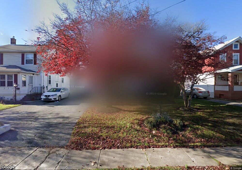
120 W Forrestview Rd Brookhaven, PA 19015
Estimated Value: $277,508 - $293,000
3
Beds
2
Baths
1,466
Sq Ft
$195/Sq Ft
Est. Value
About This Home
This home is located at 120 W Forrestview Rd, Brookhaven, PA 19015 and is currently estimated at $285,377, approximately $194 per square foot. 120 W Forrestview Rd is a home located in Delaware County with nearby schools including Widener Partnership Charter School and The Christian Academy.
Ownership History
Date
Name
Owned For
Owner Type
Purchase Details
Closed on
Dec 11, 2009
Sold by
Mcconnell Kathleen B
Bought by
Gianakis Allison N
Current Estimated Value
Home Financials for this Owner
Home Financials are based on the most recent Mortgage that was taken out on this home.
Original Mortgage
$123,400
Outstanding Balance
$80,901
Interest Rate
5%
Mortgage Type
New Conventional
Estimated Equity
$204,476
Purchase Details
Closed on
Mar 18, 2004
Sold by
Bailey Ervin E
Bought by
Bailey Ervin E and Mcconnell Kathleen B
Home Financials for this Owner
Home Financials are based on the most recent Mortgage that was taken out on this home.
Original Mortgage
$50,000
Interest Rate
5.6%
Mortgage Type
Stand Alone Refi Refinance Of Original Loan
Create a Home Valuation Report for This Property
The Home Valuation Report is an in-depth analysis detailing your home's value as well as a comparison with similar homes in the area
Home Values in the Area
Average Home Value in this Area
Purchase History
| Date | Buyer | Sale Price | Title Company |
|---|---|---|---|
| Gianakis Allison N | $155,000 | None Available | |
| Bailey Ervin E | -- | -- |
Source: Public Records
Mortgage History
| Date | Status | Borrower | Loan Amount |
|---|---|---|---|
| Open | Gianakis Allison N | $123,400 | |
| Previous Owner | Bailey Ervin E | $50,000 |
Source: Public Records
Tax History
| Year | Tax Paid | Tax Assessment Tax Assessment Total Assessment is a certain percentage of the fair market value that is determined by local assessors to be the total taxable value of land and additions on the property. | Land | Improvement |
|---|---|---|---|---|
| 2025 | $4,403 | $136,850 | $37,650 | $99,200 |
| 2024 | $4,403 | $136,850 | $37,650 | $99,200 |
| 2023 | $4,124 | $136,850 | $37,650 | $99,200 |
| 2022 | $3,895 | $136,850 | $37,650 | $99,200 |
| 2021 | $5,615 | $136,850 | $37,650 | $99,200 |
| 2020 | $4,203 | $90,120 | $29,170 | $60,950 |
| 2019 | $4,133 | $90,120 | $29,170 | $60,950 |
| 2018 | $4,070 | $90,120 | $0 | $0 |
| 2017 | $3,861 | $90,120 | $0 | $0 |
| 2016 | $495 | $90,120 | $0 | $0 |
| 2015 | $505 | $90,120 | $0 | $0 |
| 2014 | $505 | $90,120 | $0 | $0 |
Source: Public Records
Map
Nearby Homes
- 112 Upland Rd
- 125 E Avon Rd
- 114 E Parkway Ave
- 200 E Roland Rd
- 204 E Avon Rd
- 900 Main St
- 30 E Mowry St
- 2420 Edgmont Ave
- 104 School House Ln
- 23 E Mowry St
- 17 E Mowry St
- 600 Harvin Way Unit 612
- 1007 Woodside Ave
- 157 Meadowbrook Ln
- 1010 Mulberry St
- 34 E 23rd St
- 251 W 22nd St
- 200 W 21st St
- 212 W 21st St
- 113 Creekside Dr Unit 3
- 124 W Forrestview Rd
- 116 W Forrestview Rd
- 128 W Forrestview Rd
- 112 W Forrestview Rd
- 135 W Garrison Rd
- 139 W Garrison Rd
- 132 W Forrestview Rd
- 133 W Garrison Rd
- 141 W Garrison Rd
- 129 W Garrison Rd
- 145 W Garrison Rd
- 110 W Forrestview Rd
- 127 W Garrison Rd
- 147 W Garrison Rd
- 123 W Garrison Rd
- 111 W Forrestview Rd
- 113 W Forrestview Rd
- 134 W Forrestview Rd
- 109 W Forrestview Rd
- 121 W Garrison Rd
Your Personal Tour Guide
Ask me questions while you tour the home.