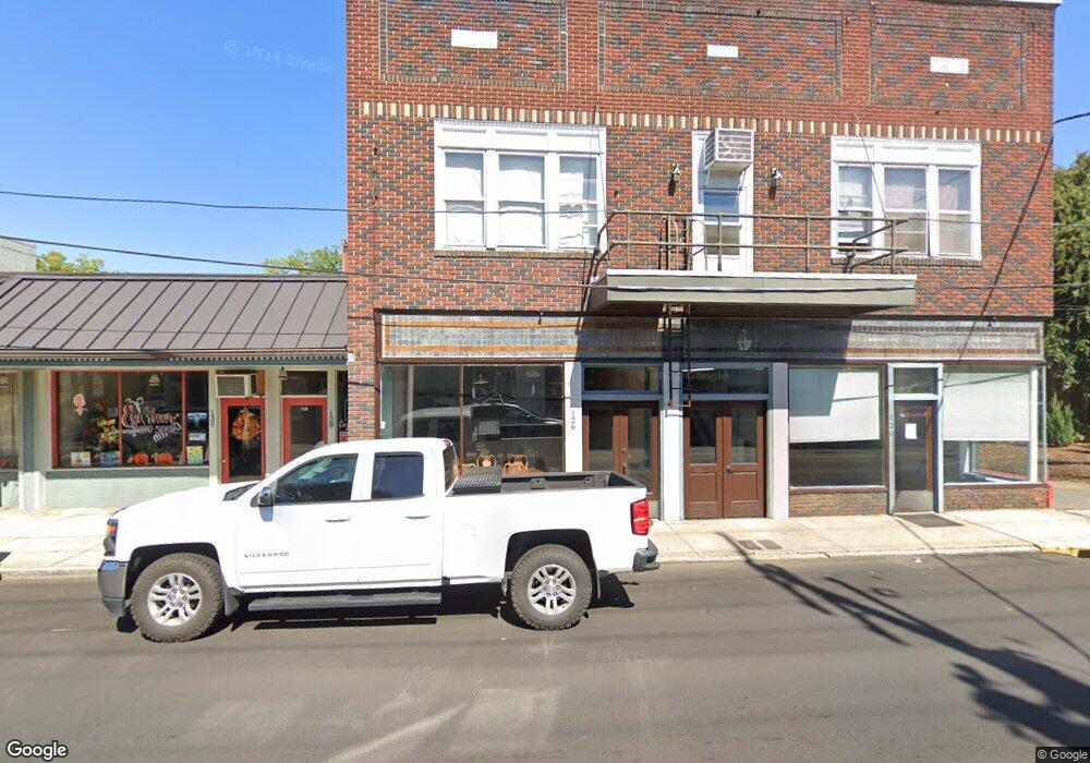
120 W Pine St Unit STW Mount Airy, NC 27030
--
Bed
2
Baths
15,142
Sq Ft
0.33
Acres
About This Home
This home is located at 120 W Pine St Unit STW, Mount Airy, NC 27030. 120 W Pine St Unit STW is a home located in Surry County with nearby schools including Bruce H. Tharrington Elementary School, Mount Airy Middle School, and Mount Airy High School.
Ownership History
Date
Name
Owned For
Owner Type
Purchase Details
Closed on
Nov 19, 2015
Sold by
Whitman Joy Davis and Whitman William Edwin
Bought by
Mctate Development Llc
Home Financials for this Owner
Home Financials are based on the most recent Mortgage that was taken out on this home.
Original Mortgage
$265,250
Outstanding Balance
$208,625
Interest Rate
3.87%
Mortgage Type
Commercial
Purchase Details
Closed on
Oct 1, 1954
Purchase Details
Closed on
Dec 1, 1943
Purchase Details
Closed on
Nov 1, 1942
Purchase Details
Closed on
Apr 1, 1930
Create a Home Valuation Report for This Property
The Home Valuation Report is an in-depth analysis detailing your home's value as well as a comparison with similar homes in the area
Home Values in the Area
Average Home Value in this Area
Purchase History
| Date | Buyer | Sale Price | Title Company |
|---|---|---|---|
| Mctate Development Llc | $265,000 | Attorney | |
| -- | -- | -- | |
| -- | -- | -- | |
| -- | -- | -- | |
| -- | -- | -- |
Source: Public Records
Mortgage History
| Date | Status | Borrower | Loan Amount |
|---|---|---|---|
| Open | Mctate Development Llc | $265,250 |
Source: Public Records
Tax History Compared to Growth
Tax History
| Year | Tax Paid | Tax Assessment Tax Assessment Total Assessment is a certain percentage of the fair market value that is determined by local assessors to be the total taxable value of land and additions on the property. | Land | Improvement |
|---|---|---|---|---|
| 2025 | $1,035 | $173,430 | $96,890 | $76,540 |
| 2024 | $1,062 | $161,400 | $87,760 | $73,640 |
| 2023 | $1,044 | $161,400 | $87,760 | $73,640 |
| 2022 | $1,044 | $161,400 | $87,760 | $73,640 |
| 2021 | $1,062 | $161,400 | $87,760 | $73,640 |
| 2020 | $1,169 | $168,910 | $87,760 | $81,150 |
| 2019 | $1,169 | $168,910 | $87,760 | $81,150 |
| 2018 | $1,149 | $168,910 | $0 | $0 |
| 2017 | $1,169 | $168,910 | $0 | $0 |
| 2016 | $1,152 | $168,910 | $0 | $0 |
| 2013 | -- | $168,910 | $0 | $0 |
Source: Public Records
Map
Nearby Homes
- 165 Virginia St Unit 309
- 165 Virginia St Unit 206
- 342 Moore Ave
- 455 Franklin St
- 220 Broad St
- 400 Cherry St
- 00 Carroll St
- 607 N Main St
- 411 Pippen St
- 415 Pippen St
- 643 Willow St
- 802 Spring St
- 1023 Spring St
- 311 E Lebanon St
- 1020 Frank St
- 226 Hamburg St
- 0 Woodruff St
- 921 N South St
- 00 Hillcrest Dr
- 212 Bluemont Rd
- 120 W Pine St
- 140 W Pine St
- 000 Mcbride Dr
- 000 Mcbride Dr Unit Parcel 3959 McBrid
- 174 W Pine St
- 152 N Main St
- 148 N Main St
- 127 Franklin St
- 197 Franklin St
- 118 Franklin St
- 201 N Main St
- 140 Franklin St
- 194 N Main St
- 228 Franklin St
- 200 N Main St
- 238 Market St
- 0000 Franklin
- 206 N Main St
- 304 Franklin St
- 313 Franklin St