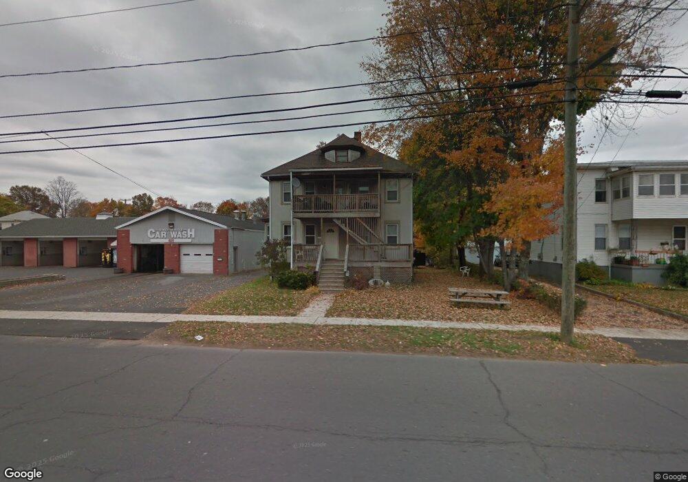
120 Whiting St Plainville, CT 06062
Estimated Value: $272,000 - $385,519
4
Beds
2
Baths
1,816
Sq Ft
$179/Sq Ft
Est. Value
About This Home
This home is located at 120 Whiting St, Plainville, CT 06062 and is currently estimated at $325,630, approximately $179 per square foot. 120 Whiting St is a home located in Hartford County with nearby schools including Middle School Of Plainville, Plainville High School, and Great Beginnings.
Ownership History
Date
Name
Owned For
Owner Type
Purchase Details
Closed on
Sep 6, 2005
Sold by
Lamont Mary S
Bought by
Florian Luke J and Florian Dewayne S
Current Estimated Value
Home Financials for this Owner
Home Financials are based on the most recent Mortgage that was taken out on this home.
Original Mortgage
$144,000
Interest Rate
7.77%
Purchase Details
Closed on
Aug 30, 1991
Sold by
Swenson Gail
Bought by
Lamont Mary
Create a Home Valuation Report for This Property
The Home Valuation Report is an in-depth analysis detailing your home's value as well as a comparison with similar homes in the area
Home Values in the Area
Average Home Value in this Area
Purchase History
| Date | Buyer | Sale Price | Title Company |
|---|---|---|---|
| Florian Luke J | $160,000 | -- | |
| Florian Luke J | $160,000 | -- | |
| Lamont Mary | $56,000 | -- |
Source: Public Records
Mortgage History
| Date | Status | Borrower | Loan Amount |
|---|---|---|---|
| Open | Lamont Mary | $127,500 | |
| Closed | Lamont Mary | $144,000 | |
| Previous Owner | Lamont Mary | $119,800 |
Source: Public Records
Tax History Compared to Growth
Tax History
| Year | Tax Paid | Tax Assessment Tax Assessment Total Assessment is a certain percentage of the fair market value that is determined by local assessors to be the total taxable value of land and additions on the property. | Land | Improvement |
|---|---|---|---|---|
| 2025 | $4,681 | $136,220 | $57,820 | $78,400 |
| 2024 | $4,446 | $136,220 | $57,820 | $78,400 |
| 2023 | $4,280 | $136,220 | $57,820 | $78,400 |
| 2022 | $4,174 | $136,220 | $57,820 | $78,400 |
| 2021 | $3,813 | $110,320 | $48,230 | $62,090 |
| 2020 | $3,819 | $110,320 | $48,230 | $62,090 |
| 2019 | $3,819 | $110,320 | $48,230 | $62,090 |
| 2018 | $3,733 | $110,320 | $48,230 | $62,090 |
| 2017 | $3,605 | $110,320 | $48,230 | $62,090 |
| 2016 | $3,901 | $121,940 | $53,550 | $68,390 |
| 2015 | $3,881 | $121,940 | $53,550 | $68,390 |
| 2014 | $4,266 | $135,940 | $53,550 | $82,390 |
Source: Public Records
Map
Nearby Homes
- 18 Homestead Ave
- 50 Pierce St Unit 65
- 50 Pierce St Unit 46
- 16 1/2 E Maple St
- 31 E Broad St
- 11 Oakwood Cir
- 25 Lincoln St
- 34 Willis Ave
- 180 S Washington St Unit 12
- 49 Lincoln St
- 3 Rosanne Ln
- 20 Macarthur Rd
- 452 East St
- 9 Pinecrest Dr
- 0 Lot 36 Unit 24121321
- 117 Hollyberry Ln
- 47 Orrin Ave
- 6 Bruce Ave
- 56 Bohemia St
- 4 Testa Dr
- 122 Whiting St
- 119 Whiting St
- 117 Whiting St Unit B
- 117 Whiting St
- 124/ 126 Whiting St
- 62 Newton Ave
- 97 Whiting St
- 97 Whiting St
- 65 Newton Ave Unit 2nd flr
- 65 Newton Ave
- 56 Newton Ave
- 71 Newton Ave
- 57 Hillside Ave
- 50 Newton Ave
- 48 Newton Ave
- 46 Newton Ave
- 130 Whiting St
- 130 Whiting St Unit 1
- 53 Hillside Ave
- 103 Whiting St