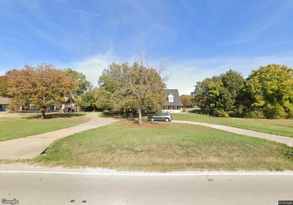
1200 Burney Ln Southlake, TX 76092
Estimated Value: $1,031,000 - $1,336,000
4
Beds
2
Baths
3,145
Sq Ft
$379/Sq Ft
Est. Value
About This Home
This home is located at 1200 Burney Ln, Southlake, TX 76092 and is currently estimated at $1,191,180, approximately $378 per square foot. 1200 Burney Ln is a home located in Tarrant County with nearby schools including Jack D. Johnson Elementary, Don T. Durham Intermediate School, and Carroll Middle School.
Ownership History
Date
Name
Owned For
Owner Type
Purchase Details
Closed on
Dec 14, 1998
Sold by
Sims William R and Sims Dorian S
Bought by
Jones Richard A and Jones Elsy P
Current Estimated Value
Home Financials for this Owner
Home Financials are based on the most recent Mortgage that was taken out on this home.
Original Mortgage
$226,800
Interest Rate
6.87%
Purchase Details
Closed on
Nov 30, 1993
Sold by
Pittman Jerry L
Bought by
Sims William R and Sims Dorian S
Home Financials for this Owner
Home Financials are based on the most recent Mortgage that was taken out on this home.
Original Mortgage
$25,000
Interest Rate
6.71%
Mortgage Type
Seller Take Back
Create a Home Valuation Report for This Property
The Home Valuation Report is an in-depth analysis detailing your home's value as well as a comparison with similar homes in the area
Home Values in the Area
Average Home Value in this Area
Purchase History
| Date | Buyer | Sale Price | Title Company |
|---|---|---|---|
| Jones Richard A | -- | Rattikin Title Co | |
| Sims William R | -- | Southwest Land Title |
Source: Public Records
Mortgage History
| Date | Status | Borrower | Loan Amount |
|---|---|---|---|
| Closed | Jones Richard A | $226,800 | |
| Previous Owner | Sims William R | $25,000 | |
| Closed | Jones Richard A | $28,350 |
Source: Public Records
Tax History Compared to Growth
Tax History
| Year | Tax Paid | Tax Assessment Tax Assessment Total Assessment is a certain percentage of the fair market value that is determined by local assessors to be the total taxable value of land and additions on the property. | Land | Improvement |
|---|---|---|---|---|
| 2025 | $6,626 | $1,289,508 | $643,200 | $646,308 |
| 2024 | $6,626 | $1,289,508 | $643,200 | $646,308 |
| 2023 | $12,624 | $1,206,322 | $643,200 | $563,122 |
| 2022 | $13,584 | $990,726 | $473,500 | $517,226 |
| 2021 | $13,051 | $911,864 | $473,500 | $438,364 |
| 2020 | $11,961 | $801,096 | $528,800 | $272,296 |
| 2019 | $11,455 | $803,112 | $528,800 | $274,312 |
| 2018 | $9,684 | $430,046 | $361,680 | $68,366 |
| 2017 | $9,690 | $640,000 | $328,800 | $311,200 |
| 2016 | $8,809 | $638,729 | $329,300 | $309,429 |
| 2015 | $7,583 | $323,100 | $104,550 | $218,550 |
| 2014 | $7,583 | $323,100 | $104,550 | $218,550 |
Source: Public Records
Map
Nearby Homes
- 1099 Burney Ln
- 1340 Burney Ln
- 1006 Quail Run Rd
- 2920 Burney Ln
- 1018 Quail Run Rd
- 3321 Ferguson Rd
- 3325 Ferguson Rd
- 3316 Ferguson Rd
- 3501 N Gravel Cir
- 3405 Witt Ct
- 3055 Midway Rd
- 3179 Southlake Park Rd
- 3300 Jackson Ct
- 3333 Southlake Park Rd
- 1013 Winfield Ct
- 1497 E Dove Rd
- 3240 Woodland Dr
- 136 Sweet St
- 1920 Fox Hollow Cir
- 415 Marshall Rd
- 1210 Burney Ln
- 1100 Burney Ln
- 1220 Burney Ln
- 2711 N Carroll Ave
- 1090 Burney Ln
- 1105 Harbor Retreat St
- 1214 Powder River Trail
- 1230 Burney Ln
- 1095 Harbor Retreat St
- 1216 Powder River Trail
- 2709 N Carroll Ave
- 1218 Powder River Trail
- 1212 Powder River Trail
- 1240 Burney Ln
- 1100 Harbor Retreat St
- 1115 Harbor Retreat St
- 1220 Powder River Trail
- 1213 Powder River Trail
- 1210 Powder River Trail
- 2707 N Carroll Ave