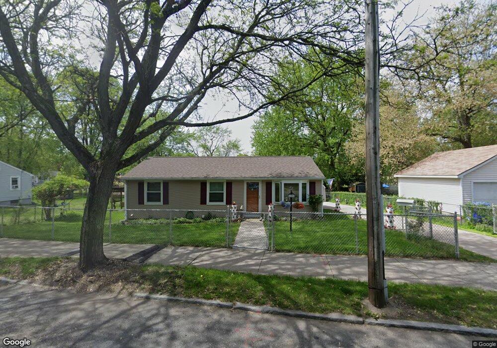
1200 Dwight St Springfield, MA 01107
Memorial Square NeighborhoodEstimated Value: $234,000 - $317,000
About This Home
This home is located at 1200 Dwight St, Springfield, MA 01107 and is currently estimated at $265,253, approximately $276 per square foot. 1200 Dwight St is a home located in Hampden County with nearby schools including German Gerena Community School, High School Of Commerce, and Springfield High School of Science and Technology.
Ownership History
We collect this data history from publicly available records. To have your information removed, we recommend requesting removal directly through your county’s website.
Purchase Details
Purchase Details
Home Values in the Area
Average Home Value in this Area
Purchase History
We collect this data history from publicly available records. To have your information removed, we recommend requesting removal directly through your county’s website.
| Date | Buyer | Sale Price | Title Company |
|---|---|---|---|
| -- | -- | ||
| $31,900 | -- |
Mortgage History
We collect this data history from publicly available records. To have your information removed, we recommend requesting removal directly through your county’s website.
| Date | Status | Borrower | Loan Amount |
|---|---|---|---|
| Previous Owner | $26,000 |
Tax History
We collect this data history from publicly available records. To have your information removed, we recommend requesting removal directly through your county’s website.
| Year | Tax Paid | Tax Assessment Tax Assessment Total Assessment is a certain percentage of the fair market value that is determined by local assessors to be the total taxable value of land and additions on the property. | Land | Improvement |
|---|---|---|---|---|
| 2025 | $3,123 | $199,200 | $31,900 | $167,300 |
| 2024 | $3,135 | $195,200 | $31,900 | $163,300 |
| 2023 | $2,950 | $173,000 | $23,200 | $149,800 |
| 2022 | $2,093 | $111,200 | $21,200 | $90,000 |
| 2021 | $2,266 | $119,900 | $19,200 | $100,700 |
| 2020 | $1,812 | $92,800 | $19,200 | $73,600 |
| 2019 | $1,637 | $83,200 | $19,200 | $64,000 |
| 2018 | $1,586 | $80,600 | $19,200 | $61,400 |
| 2017 | $1,830 | $93,100 | $18,500 | $74,600 |
| 2016 | $1,783 | $90,700 | $18,500 | $72,200 |
| 2015 | $1,595 | $81,100 | $18,500 | $62,600 |
Map
- 26 Hebron St
- 53-55 Allendale St
- 42 Ringgold St
- 116-118 Massasoit St
- 85 Narragansett St
- 45 Orchard St
- 33-35 Algonquin Place
- 14 Crane St
- 0 Liberty St (Ss)
- 127 Melha Ave
- 179 Knollwood St
- 540 Armory St
- 69 Winter St
- 585 Armory St
- 140 Chestnut St Unit 207
- 140 Chestnut St Unit 516
- 140 Chestnut St Unit 314
- 140 Chestnut St Unit 619
- 140 Chestnut St Unit M4
- 140 Chestnut St Unit 316
- 69 Osgood St
- 59 Osgood St
- 1218 Dwight St
- 64 Osgood St
- 64 Osgood St
- 64-68 Osgood St
- 54 Osgood St
- 10 Brookline Ave
- 1267 Dwight St
- 52 Osgood St Unit 1
- 52 Osgood St Unit 2
- 0 Brookline Ave (Ns) L: Unit 71157289
- 9 Brookline Ave
- 1180 Dwight St
- 0 Brookline Ave
- 48 Osgood St
- 15 Brookline Ave Unit 17
- 20 Hebron St
- 1293 Dwight St
- 19 Brookline Ave
Ask me questions while you tour the home.