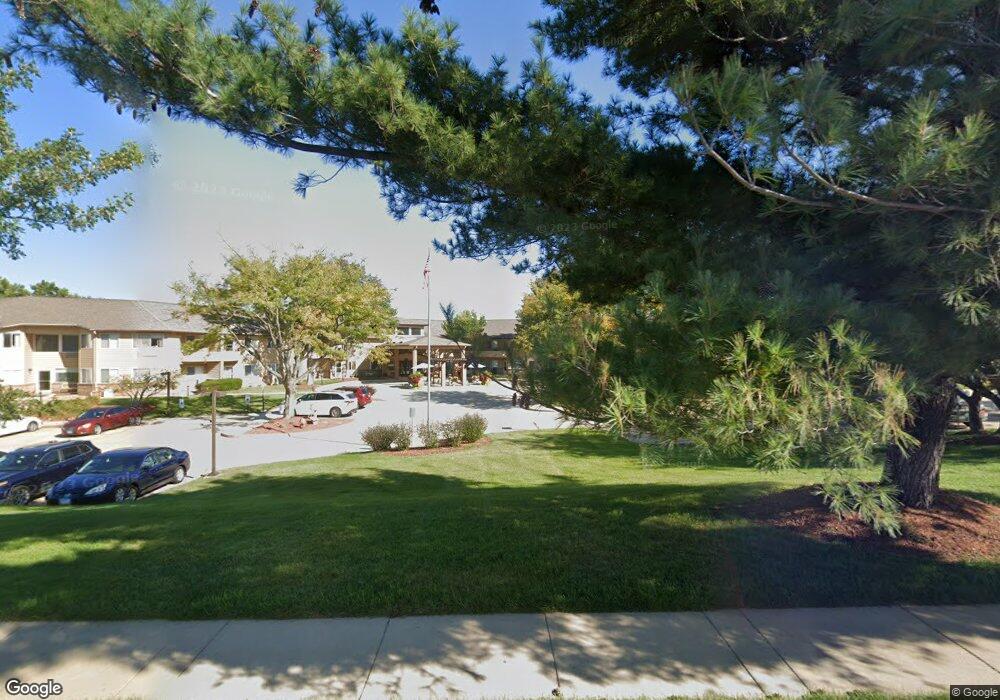
1200 E College Ave Unit 315 Normal, IL 61761
Windsor Hill-Sugar Creek NeighborhoodEstimated Value: $248,000 - $284,000
3
Beds
3
Baths
1,534
Sq Ft
$174/Sq Ft
Est. Value
About This Home
This home is located at 1200 E College Ave Unit 315, Normal, IL 61761 and is currently estimated at $266,231, approximately $173 per square foot. 1200 E College Ave Unit 315 is a home located in McLean County with nearby schools including Sugar Creek Elementary School, Kingsley Junior High School, and Normal Community High School.
Ownership History
Date
Name
Owned For
Owner Type
Purchase Details
Closed on
Jun 4, 2013
Sold by
Tiede Hans J
Bought by
Tiede Morcena R
Current Estimated Value
Purchase Details
Closed on
May 23, 2012
Sold by
Montgomerie Charles D
Bought by
Tiede Moreena R
Purchase Details
Closed on
Nov 20, 2009
Sold by
Rice Donald R
Bought by
Gifford Mary C
Purchase Details
Closed on
Jul 9, 2009
Sold by
Giffhorn Mary C
Bought by
Rice Donald R and Wayne Carmichael H
Purchase Details
Closed on
Sep 18, 2007
Sold by
Tate Mark S
Bought by
Giffhorn Mary C
Purchase Details
Closed on
Feb 22, 2007
Sold by
Neef Paul Lee and Neef Patricia A
Bought by
Giffhorn Mary C and Tate Mark S
Create a Home Valuation Report for This Property
The Home Valuation Report is an in-depth analysis detailing your home's value as well as a comparison with similar homes in the area
Home Values in the Area
Average Home Value in this Area
Purchase History
| Date | Buyer | Sale Price | Title Company |
|---|---|---|---|
| Tiede Morcena R | -- | None Available | |
| Tiede Moreena R | $148,000 | Mclean County Title | |
| Gifford Mary C | -- | None Available | |
| Rice Donald R | -- | None Available | |
| Giffhorn Mary C | -- | None Available | |
| Giffhorn Mary C | $160,000 | None Available |
Source: Public Records
Tax History
| Year | Tax Paid | Tax Assessment Tax Assessment Total Assessment is a certain percentage of the fair market value that is determined by local assessors to be the total taxable value of land and additions on the property. | Land | Improvement |
|---|---|---|---|---|
| 2024 | $5,721 | $76,454 | $14,157 | $62,297 |
| 2022 | $5,017 | $61,847 | $11,452 | $50,395 |
| 2021 | $4,815 | $58,352 | $10,805 | $47,547 |
| 2020 | $4,577 | $55,525 | $10,282 | $45,243 |
| 2019 | $4,419 | $55,227 | $10,227 | $45,000 |
| 2018 | $4,365 | $54,643 | $10,119 | $44,524 |
| 2017 | $4,209 | $54,643 | $10,119 | $44,524 |
| 2016 | $4,163 | $54,643 | $10,119 | $44,524 |
| 2015 | $4,038 | $53,362 | $9,882 | $43,480 |
| 2014 | $3,988 | $53,362 | $9,882 | $43,480 |
| 2013 | -- | $53,362 | $9,882 | $43,480 |
Source: Public Records
Map
Nearby Homes
- 1204 Westview Dr
- 1316 Hanson Dr
- 1211 Brentwood Ct
- 106 Doud Ct
- 1409 Hanson Dr
- 404 Grandview Dr
- 1302 E Vernon Ave
- 308 Columbia Dr
- 605 Pine St Unit 18
- 1003 Chippewa St
- 600 Sheridan Rd
- 15 Brookwood Dr
- 903 N Linden St Unit 108
- 1504 Estate Dr
- 1019 Sawgrass Dr
- 1015 Sawgrass Dr
- 907 S Fell Ave
- 805 Dresser Dr
- 102 W Virginia Ave
- 17 Sunset Rd
- 1200 E College Ave Unit 303
- 1200 E College Ave Unit 305
- 1206 Westview Dr
- 107 N Blair Dr Unit 17
- 107 N Blair Dr Unit 18
- 107 N Blair Dr Unit 19
- 107 N Blair Dr Unit 20
- 107 N Blair Dr Unit 21
- 107 N Blair Dr Unit 22
- 107 N Blair Dr Unit 23
- 107 N Blair Dr Unit 24
- 107 N Blair Dr Unit 25
- 107 N Blair Dr Unit 26
- 107 N Blair Dr Unit 27
- 107 N Blair Dr Unit 28
- 107 N Blair Dr Unit 15
- 107 N Blair Dr Unit 14
- 107 N Blair Dr Unit 13
- 107 N Blair Dr Unit 12
- 107 N Blair Dr Unit 11
Your Personal Tour Guide
Ask me questions while you tour the home.